Fort Ord
Monterey, California, US
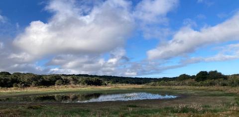
Fort Ord NM--eastern (Creekside Terrace, Boy Scout pond & Mudhen Lake)
150 species
Monterey, California, US
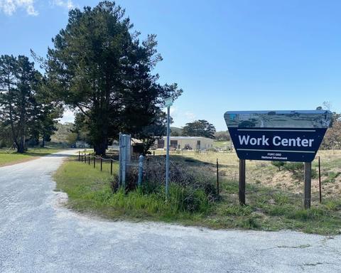
Fort Ord NM--BLM work center & southern impact zone (most off limits)
118 species
Fort Ord
About this Location
Fort Ord is a former United States Army post on Monterey Bay, California. During World War I, the United States purchased land as an artillery training field for the Army, called Gigling Reservation. In 1933, the artillery field became Camp Ord, named for Union Civil War Maj. Gen. Edward Ord. Initially, horse cavalry units trained here until the military modernized to tanks and movable artillery. By 1940, Camp Ord was expanded to 2,000 acres; in 1940, it became Fort Ord, and expanded again. It was considered an attractive locations for an Army posting, because of its proximity to the beach and California weather. Stilwell Hall was built in 1943, overlooking the Pacific, and named General "Vinegar Joe" Stilwell. The 7th Infantry Division was its main garrison for many years, and became important to Monterey's economy.
Fort Ord closed in 1994, along with various Army bases that were realigned or closed. Even before the closure, litigation by the local Native Plant Society forced the Army to set aside reserves for endangered species, including Smith's blue butterfly and various plants that were endemic to the maritime chaparral habitat that made up the western half of the base.
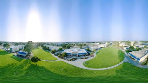
A base closure authority undertook to divide Fort Ord ffor a decade after closure. Each of the adjacent cities — Seaside, Marina, Del Rey Oaks— received land to develop. While many old military buildings remain abandoned, others have been torn down for development. Various subdivisions now exist on prior Army land. California State University, Monterey Bay (CSUMB) and a Veterans' Cemetery have been created.
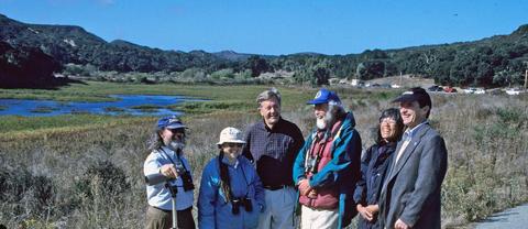
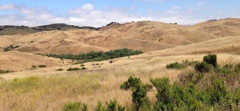
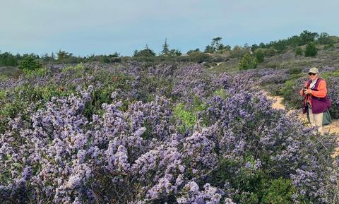
The local environmental community lobbied hard to preserve the prime habitats on Fort Ord: coastal dunes, maritime chaparral, live-oak woods, native grasslands with vernal pools, and all the Army-designated endangered species reserves. The local Audubon Society worked to survey birds and determine the areas most important for birds.
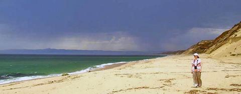
In the end, most of the Fort's land was retained as nature reserves. Most of the coastal dunes west became Fort Ord Dunes State Park. It remains mostly undeveloped but is open for beach-goers, hikers, and bikers. The cliff next to Stillwell Hall, though, eroded so dramatically that it became unsafe and was demolished. The primary parking lot for Fort Ord Dunes State Park is now adjacent to where Stilwell Hall once stood. In addition, some land once considered for development has become a research reserve for CSUMB. A large area of maritime chaparral was included within a 6,560-acre "Impact Area" that was contaminated by munitions. The Army conducted remedial work (grading and fires) within the Impact Area, but this land remains fenced and posted, and is off-limits to the public.
On April 20, 2012, President Obama designating 14,651 acres as Fort Ord National Monument, and assigned to the Bureau of Land Management (BLM)for its preservation. Work continues to restore land damaged by Army use, and to remove hazardous materials. The Impact Area remains off-limits. Access to the rest of the National Monument, and to the CSUMB reserve, is on foot or by bicycle. Authorized BLM vehicles use the major former-Army roads: Eucalyptus Road, Parker Flats Cutoff, Barloy Canyon Road, and others, all of which are locked and gated. During the annual Christmas Bird Count, counters are permitted to use the roads for bird surveys.
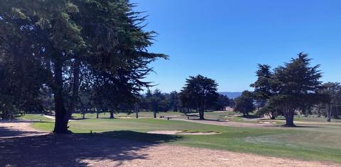
There are nine Hotspots carved out of what was once Fort Ord. The Fort Ord "residential area/gold course" is developed land like any local town or city; the CSUMB hotspot is embedded within the larger "residential" hotspot.
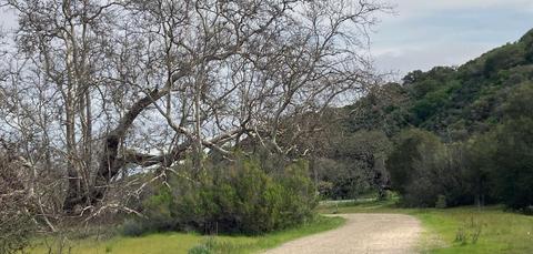
A paved road leads to the Fort Ord Dunes SP parking area next to the old Stilwell Hall site; one may hike or bike from there. The remaining six Hotspots that are entirely or partially within Fort Ord National Monument are enjoyed by hiking or biking. There are parking areas scattered around the perimeter of the Hotspots east of Highway 1. In addition, paved Eucalyptus Road, beginning at General Jim Moore Blvd., is now open during the day, and straddles two Hotspots towards the interior of old Fort Ord for almost a mile, bringing the observer much closer to the center of Fort Ord National Monument than before. There are many trails within all these Hotspots; see a trail map on each of Hotspots within Fort Ord National Monument.
Content from Wikipedia and Don Roberson