Fort Ord Dunes SP
Tips for Birding
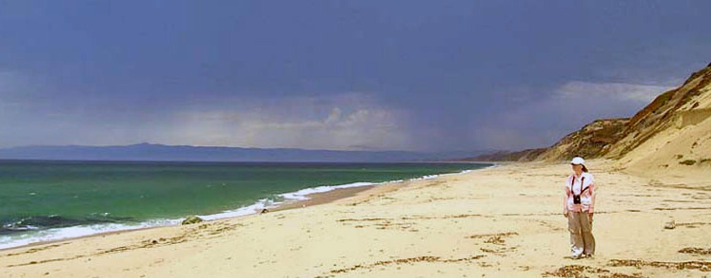
Take the boardwalk from the parking lot (driving directions are below) to the ocean overlook. From November into April, a large flock of Surf Scoters winter here. Bring a scope to look for rarer species among the scoter flock or on the sea.
In June-July, the endangered Smith's Blue Butterfly may be found near the southern end of the dunes; this is quite a long hike from the parking area, but can be accessed on trails heading north behind the Costco shopping center in Sand City. A bicycle would be useful to reach the dunes. See the link (above) to a web page about Smith's Blue Butterfly at Fort Ord Dunes SP. As an Endangered species, one must not molest, touch, nor catch this rare insect. When the small reserve in the dunes was created by the Army while it was still a military base, it was the first Nationally-maintained reserve for an insect.
Birds of Interest
White-winged and Black Scoter probably occur annually, in small numbers, and an occasional Long-tailed Duck or Harlequin Duck may winter with the scoter flock. Search the ocean for grebes, loons, gulls, and alcids. Watch for Osprey, Northern Harrier, or White-tailed Kite overhead anywhere in the State Park.
From 2008 to 2012, a small colony of Bank Swallows dug holes and fledged you from a sandy cliff-face over the beach about a mile south of the parking area. As it take a longish walk on sand to reach the location, it has not been checked in most recent years. It is possible that the sandy cliff eroded after 2012 and the colony never returned.
About this Location
Driving Directions to Fort Ord Dunes SP
From Highway 1, exit Light Fighter Drive (bear right).
Turn left onto 2nd Avenue.
Turn left onto Divarty Street.
Turn right onto 1st Avenue.
Signs posted will direct you to the park entrance at the 8th Street overcrossing of Hwy 1.
These directions will take you to a large parking lot, from which there are trails to the beach, paved roads for hiking and biking in back of the dunes, and a boardwalk to an ocean overlook, with signs explaining the now-gone Stilwell Hall, which was once adjacent to the parking area.
Currently there are no facilities in this State Park beyond the roads and bunkers left over from the military, and various endangered species reserves in the dunes also established before the State Park was created. Their web site reads, as to the future: Fort Ord Dunes State Park’s 2004 General Plan provides for the development of a new campground and beach access facilities, and identifies the area immediately adjacent to the old military bunkers as the location for the campground. The project site lies largely outside the Highway 1 viewshed and consists of approximately 130 acres of which 16.79 acres will be developed with visitor improvements.
About Fort Ord
See all hotspots at Fort Ord
Fort Ord is a former United States Army post on Monterey Bay, California. During World War I, the United States purchased land as an artillery training field for the Army, called Gigling Reservation. In 1933, the artillery field became Camp Ord, named for Union Civil War Maj. Gen. Edward Ord. Initially, horse cavalry units trained here until the military modernized to tanks and movable artillery. By 1940, Camp Ord was expanded to 2,000 acres; in 1940, it became Fort Ord, and expanded again. It was considered an attractive locations for an Army posting, because of its proximity to the beach and California weather. Stilwell Hall was built in 1943, overlooking the Pacific, and named General "Vinegar Joe" Stilwell. The 7th Infantry Division was its main garrison for many years, and became important to Monterey's economy.
Fort Ord closed in 1994, along with various Army bases that were realigned or closed. Even before the closure, litigation by the local Native Plant Society forced the Army to set aside reserves for endangered species, including Smith's blue butterfly and various plants that were endemic to the maritime chaparral habitat that made up the western half of the base.
A base closure authority undertook to divide Fort Ord ffor a decade after closure. Each of the adjacent cities — Seaside, Marina, Del Rey Oaks— received land to develop. While many old military buildings remain abandoned, others have been torn down for development. Various subdivisions now exist on prior Army land. California State University, Monterey Bay (CSUMB) and a Veterans' Cemetery have been created.
The local environmental community lobbied hard to preserve the prime habitats on Fort Ord: coastal dunes, maritime chaparral, live-oak woods, native grasslands with vernal pools, and all the Army-designated endangered species reserves. The local Audubon Society worked to survey birds and determine the areas most important for birds.
In the end, most of the Fort's land was retained as nature reserves. Most of the coastal dunes west became Fort Ord Dunes State Park. It remains mostly undeveloped but is open for beach-goers, hikers, and bikers. The cliff next to Stillwell Hall, though, eroded so dramatically that it became unsafe and was demolished. The primary parking lot for Fort Ord Dunes State Park is now adjacent to where Stilwell Hall once stood. In addition, some land once considered for development has become a research reserve for CSUMB. A large area of maritime chaparral was included within a 6,560-acre "Impact Area" that was contaminated by munitions. The Army conducted remedial work (grading and fires) within the Impact Area, but this land remains fenced and posted, and is off-limits to the public.
On April 20, 2012, President Obama designating 14,651 acres as Fort Ord National Monument, and assigned to the Bureau of Land Management (BLM)for its preservation. Work continues to restore land damaged by Army use, and to remove hazardous materials. The Impact Area remains off-limits. Access to the rest of the National Monument, and to the CSUMB reserve, is on foot or by bicycle. Authorized BLM vehicles use the major former-Army roads: Eucalyptus Road, Parker Flats Cutoff, Barloy Canyon Road, and others, all of which are locked and gated. During the annual Christmas Bird Count, counters are permitted to use the roads for bird surveys.
There are nine Hotspots carved out of what was once Fort Ord. The Fort Ord "residential area/gold course" is developed land like any local town or city; the CSUMB hotspot is embedded within the larger "residential" hotspot.
A paved road leads to the Fort Ord Dunes SP parking area next to the old Stilwell Hall site; one may hike or bike from there. The remaining six Hotspots that are entirely or partially within Fort Ord National Monument are enjoyed by hiking or biking. There are parking areas scattered around the perimeter of the Hotspots east of Highway 1. In addition, paved Eucalyptus Road, beginning at General Jim Moore Blvd., is now open during the day, and straddles two Hotspots towards the interior of old Fort Ord for almost a mile, bringing the observer much closer to the center of Fort Ord National Monument than before. There are many trails within all these Hotspots; see a trail map on each of Hotspots within Fort Ord National Monument.
Features
Restrooms on site
Wheelchair accessible trail
Roadside viewing
Entrance fee
Content from California State Parks, Don Roberson, Wikipedia, and Don Roberson
Last updated April 3, 2023