Bosque del Apache NWR--Chupadera Trail
Bosque del Apache NWR--Chupadera Trail
San Antonio, New Mexico 87832
Official WebsiteBosque del Apache National Wildlife Refuge website
Friends of Bosque del Apache NWR website
Bosque del Apache NWR Important Bird Area (Audubon) website
Habitat! Guide to Bosque del Apache NWR booklet
Bosque del Apache National Wildlife Refuge map
Tips for Birding
Take some time to examine the scrub around the parking area, especially to the south where a shallow ditch often collects water. Gambel’s Quail, Northern Flicker, House Finch, and White-crowned Sparrow appear commonly during winter and early spring. Lesser Nighthawk and Cassin’s Sparrow have been seen during early summer. Lesser Goldfinch are more likely during fall.
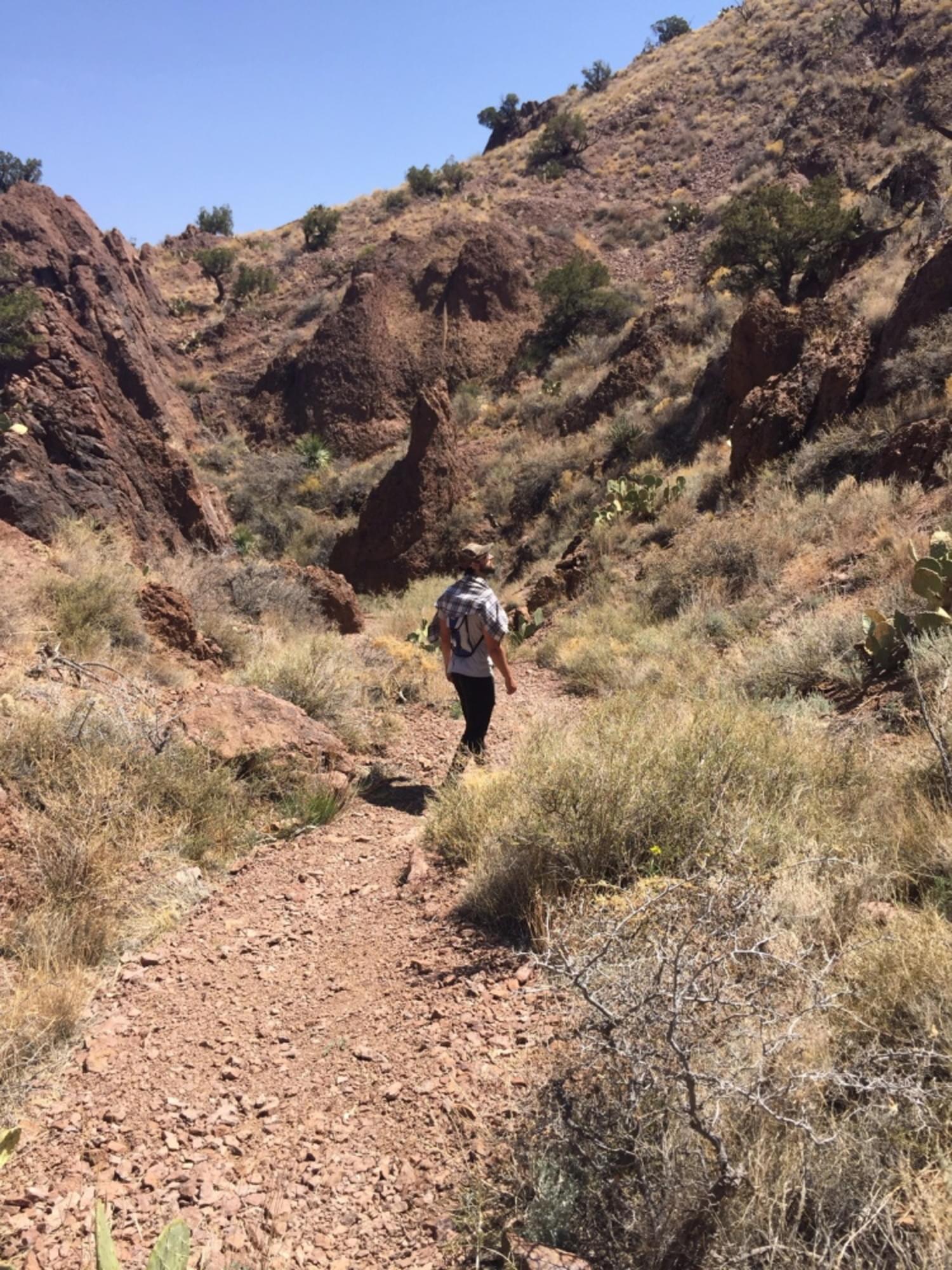
After passing under the trestle, the trail has the appearance of a dirt road, with grassland extending on both the north and south sides. White-crowned Sparrows abound here during winter, and other sparrow species, along with Western Meadowlark, have been sighted as well.
At the western end of this road-like portion of the trail, where there are a few dead cottonwoods, the hiker has the option of continuing west over a small berm and ditch, or turning north along the eastern side of this berm; this is the eastern end of what is called the Bajada Loop portion of the trail. Those unfamiliar with the trail should take the north fork; it is by far easier to follow. Whereas the westward path takes the hiker immediately into the public hunting area and essentially becomes washes through mesquite and other scrub, the northern path follows the eastern edge of the ditch berm, which, with the path itself, separates a zone of four-wing saltbush on its upper or western side from the grassland to the east.
This path soon turns west, crossing the berm and ditch into the public hunting area, here dominated by saltbush. White-crowned Sparrows are common here in winter, as are flyovers of Northern Harrier and Red-tailed Hawk. If instead of continuing on the path, at the base of the hills you turn directly south into the mix of grasses, four-wing saltbush, mesquite, chamisa, and creosote, you are likely to be rewarded with a variety of species (at least during winter) such as Morning Dove, Gambel’s Quail, Loggerhead Shrike, American Kestrel, Ladder-backed Woodpecker, Dark-eyed Junco, White-crowned Sparrow, Black-throated Sparrow, Brewer’s Sparrow, and Spotted Towhee. This is not easy hiking, being off the path, and finding the southern side of the Bajada Loop portion of the trail can be challenging. Especially if wandering off the path, it is prudent to wear brightly colored clothing during mule deer, javelina, dove, and quail hunting seasons.
Hikers staying on the path, following the Bajada Loop counterclockwise up the low hills, will find at the top a bench with a nice eastward view of the Refuge lowlands. Many birders simply turn south here, hiking down to finish the Bajada Loop and return to the parking area, having traveled roughly a mile.
From the bench, the trail west is easy to follow along the creosote-covered ridge top. The eastern wilderness boundary is marked just west of the large utility poles, but the creosote monotony will, for miles, offer few birds. Opuntia cactus becomes more frequently mixed with the creosote as you approach the culvert under I-25, with a few more birds, most likely Black-throated Sparrows.
Beyond the culvert (in which you may find rattlesnakes taking a break from the summer sun), vegetation changes markedly, grasses, desert broom, cacti, and juniper being added to the still-present creosote, with the trail largely following washes, sloping upward to a greater and greater degree. Look for Curve-billed Thrasher, Cactus Wren, Sagebrush Sparrow, and Canyon Towhee along this portion of the trail, especially during winter and early spring, with Northern Mockingbird and Scaled Quail observed later in the year. This is one of the better areas of the Refuge to see Golden Eagles.
Once you reach a reddish-brown volcanic-ash rock face, the trail begins a steep climb clockwise around to the top of Chupadera Peak. Rock Wren and Canyon Wren may be seen in this trail stretch.
Unless you hike just the Bajada Loop, the Chupadera is an “in-and-out” trail. A slightly longer loop can be formed by hiking the north side of the Bajada Loop to the bench, taking the main trail to the utility poles, then going down the old power-line maintenance road to the wash at the south base of the ridge, and following that wash to where it joins the southern portion of the Bajada Loop; those familiar with the trail can, of course, do this in reverse. Overall, the Chupadera Trail is moderately strenuous to strenuous, partly due to its length and partly due to the elevation change (from about 4500 feet to over 6200 feet), especially over the steeper last mile. Take plenty of water and sunscreen during all seasons.
The Chupadera Wilderness National Recreation Trail is open daily from one hour before sunrise until one hour after sunset. The trail is 9.5 miles roundtrip (level of difficulty: strenuous, though that is mostly the final ascent).
Trek through interesting geological formations as you gain altitude from the valley floor to the peak. The habitat is Chihuahuan desert scrub dominated by fourwing saltbush, creosote bush, and mesquite.
Seasonally, search for Scaled Quail, Cactus Wren, Rufous-crowned Sparrow, Canyon Wren, Green-tailed Towhee, Black-tailed Jackrabbit, and Banded Rock Rattlesnake.
The trailhead and parking lot are located along the west side of nm-1, 1 mile north of the Visitor Center.
Birders can learn when hunting is permitted in this area by visiting the New Mexico Department Fish and Game Hunting Calendar.
Birds of Interest
Broad-tailed hummingbird (April and July, occasional)
Cactus Wren (May-July, occasionally observed at other times)
Cassin's Sparrow (June-July)
Pyrrhuloxia (March-July, occasional)
About this Location
The Chupadera Wilderness National Recreation Trail runs west from NM-1 for 4.75 miles. About a mile north of the Refuge Visitor Center (approximately 4 miles south of the north Refuge boundary), a one-lane dirt road runs for maybe 100 yards to a trailhead parking area directly west of a railway trestle. Signage on NM-1 announcing the trail gives the briefest of alerts, standing only about 10 yards on either side of this road, so first-time visitors, in particular, will need to approach the turn-in slowly.
About Bosque del Apache National Wildlife Refuge
See all hotspots at Bosque del Apache National Wildlife Refuge
Established in 1939 to provide a critical stopover for migrating waterfowl, the refuge is well known for the thousands of sandhill cranes, geese, and other waterfowl that winter here each year.
Situated between the Chupadera Mountains to the west and the San Pascual Mountains to the east, the 57,331-acre refuge harbors a wild stretch of the Rio Grande, a ribbon of cottonwood and willow trees visible on the landscape from distant mesas.
Petroglyphs tell the story of ancient people who lived and hunted here. The river and its diversity of wildlife have drawn humans to this area for at least 11,000 years when humans migrated along this corridor, sometimes settling to hunt, fish, and farm. Artifacts and stone tools found nearby tell us that nomadic Paleo-Indian hunters pursued herds of mammoth and bison in the valley.
Today, Bosque del Apache is part of the National Wildlife Refuge System, a national network of lands and waters set aside and managed for the benefit of wildlife, habitat, and you.
Notable Trails
The refuge website has a trail map and description of the hike on the Chupadera Trail.
Features
Restrooms on site
Wheelchair accessible trail
Entrance fee
Content from Bosque del Apache National Wildlife Refuge website, Birding in New Mexico (National Audubon Society), and John Montgomery
Last updated March 26, 2024
