Camels Hump State Park--Monroe Trail
Camels Hump State Park--Monroe Trail
Huntington, Vermont 05462
Camels Hump State Park (TrailFinder) webpageCamels Hump State Park Official Website
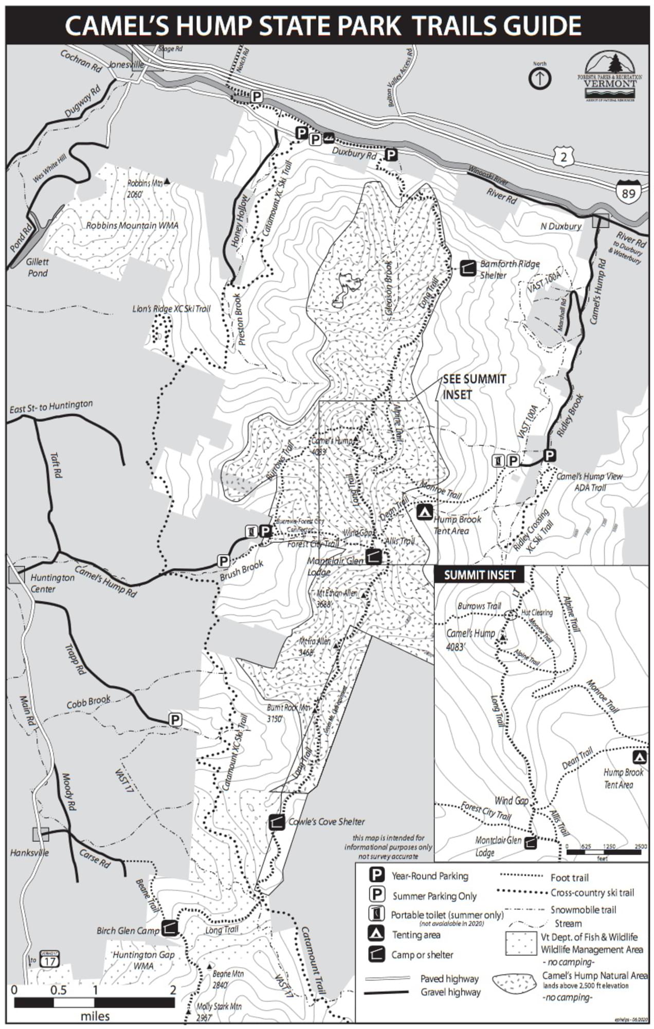
Camels Hump State Park map
Tips for Birding
Birdwatching in Vermont, p. 102.
About this Location
Starts out from parking lots at the end of Camel’s Hump Road in North Duxbury on the eastern flank of the mountain. There is a seasonally staffed caretaker’s quarters and a cemetery adjacent to the upper lot. Winter trail access is provided 0.3 miles below the main lots. Will Monroe and his sister Catherine and several of Will’s dogs are buried in the cemetery; there is also a plaque commemorating the crew of a B-24 Liberator bomber that crashed on the mountain in 1944. This trail is one of the most popular on Camel’s Hump. The Monroe Trail joins the Dean Trail at 1.3 miles and the Alpine Trail at 2.5 miles. The Monroe Trail ends at Hut Clearing where it joins the Long Trail. It is 0.3 miles to the left, uphill, to the summit, on the Long Trail.
About Camels Hump State Park
See all hotspots at Camels Hump State Park
Camels Hump State Park is an undeveloped, free-entry, state park with no phone or visitor facilities.
Waubanaukee Indians first named it “Tah-wak-be-dee-ee-wadso” or Saddle Mountain. Samuel de Champlain’s explorers in the 1600s called it “lion couchant” or resting lion. The name “Camel’s Rump” was used on a historical map by Ira Allen in 1798, and this became “Camel’s Hump” in 1830.
The park came about as an original gift of 1000 acres including the summit from Colonel Joseph Battell, who originally bought Camel’s Hump to preserve the wooded mountainous view from his home. In 1911, care of the mountain was entrusted to the State Forester who managed intending to keep it in a primitive state according to Battell’s wish.
The State of Vermont eventually adopted a policy of development regulation on all state forest lands to preserve aesthetic values. It fought proposed intrusions by communications towers and ski resorts until the summit’s Natural Area was set aside; then special legislation was passed in 1969 to create a Forest Reserve whose state-owned acres (about 20,000 by 1991) form Camel’s Hump State Park.
There are designated parking areas at trailheads on Camel’s Hump Road on both sides of the mountain. Also, there are parking areas along River Road in Duxbury for the Long Trail.
Notable Trails
Monroe Trail – 3.4 miles (6.8 round-trip), Moderately Difficult.
Features
Restrooms on site
Wheelchair accessible trail
Entrance fee
Content from Camels Hump State Park (TrailFinder) webpage and Camels Hump State Park Official Website
Last updated December 20, 2023