Sugar River Rail Trail--Rt. 103 (Kelleyville) to Pier Covered Bridge, Newport
Sugar River Rail Trail--Rt. 103 (Kelleyville) to Pier Covered Bridge, Newport
Newport, New Hampshire 03773
Official WebsiteSugar River Rail Trail map
Sugar River Rail Trail Official Website
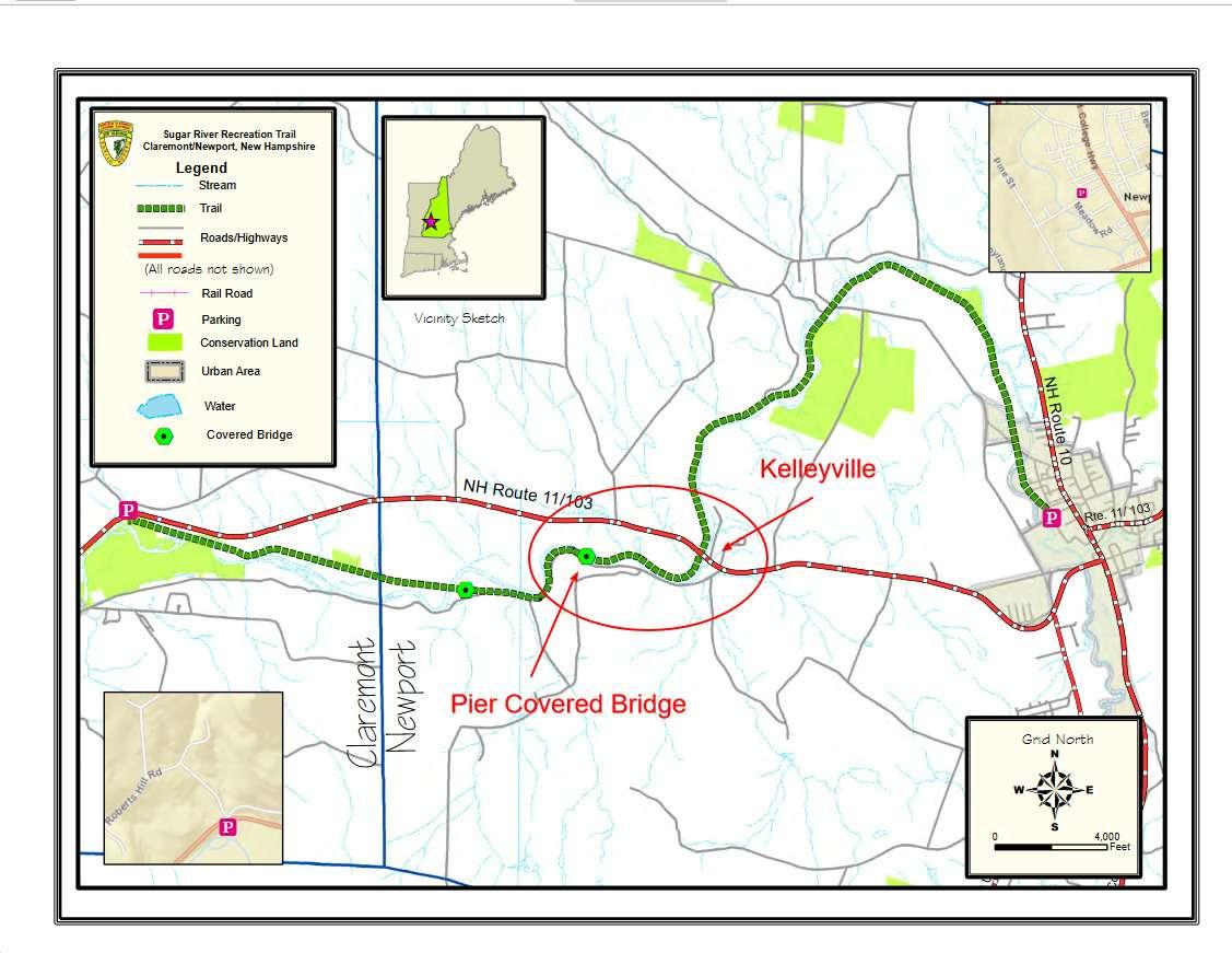
Sugar River Rail Trail map
About this Location
This section of the Sugar River Rail Trail goes west from NH-103/NH-11 to the Pier Covered Bridge.
About Sugar River Rail Trail
See all hotspots at Sugar River Rail Trail
The 9-mile Sugar River Rail Trail begins at the Newport Recreation Department on Belknap Avenue in Newport and ends at Washington Street in Claremont. The trail boasts two historic covered bridges and meanders along the Sugar River.
Parking Areas
Claremont: OHRV trailhead on the south side of NH-103. 398-394 Washington Street, Claremont. View Map Google Maps has “Sugar River Trail, ORV Trailhead” on the map for this parking lot.
Newport: Green Crow parking at 601-613 John Stark Highway off NH-11/NH-103. Sign with the “green crow” marks where to turn. Park alongside the highway as you go down under the bridge. There is not much parking here, could not have a trailer to load/unload. View Map
Newport: Limited parking on the side of the road on Oak Street, Newport. View Map Not enough room for trailers.
Newport: Newport Trailhead is next to Newport Recreation Department at 65 Belknap Avenue, Newport. Limited parking on the side of the building. Go behind the building to access the dirt lot near the gate. View MapThere is a propane truck fill-up station next to the lot that has to be shared.
Features
Restrooms on site
Wheelchair accessible trail
Entrance fee
Content from Official Website and Sugar River Rail Trail Official Website
Last updated January 11, 2024