Sugar River Rail Trail
Tips for Birding
Note that this tip is for a location that is not yet an eBird hotspot. Please suggest it if you create a checklist here.
A good place to visit is the parking area for the Sugar River Rail Trail in Newport: where Oak Street crosses the Sugar River. Just past this spot, there are some parking places and a short walk through the brush to an old factory filled with very interesting graffiti. "When I park at this place I rarely walk far. I have found many birds within 25 yards of my car."
From Jim Block
About this Location
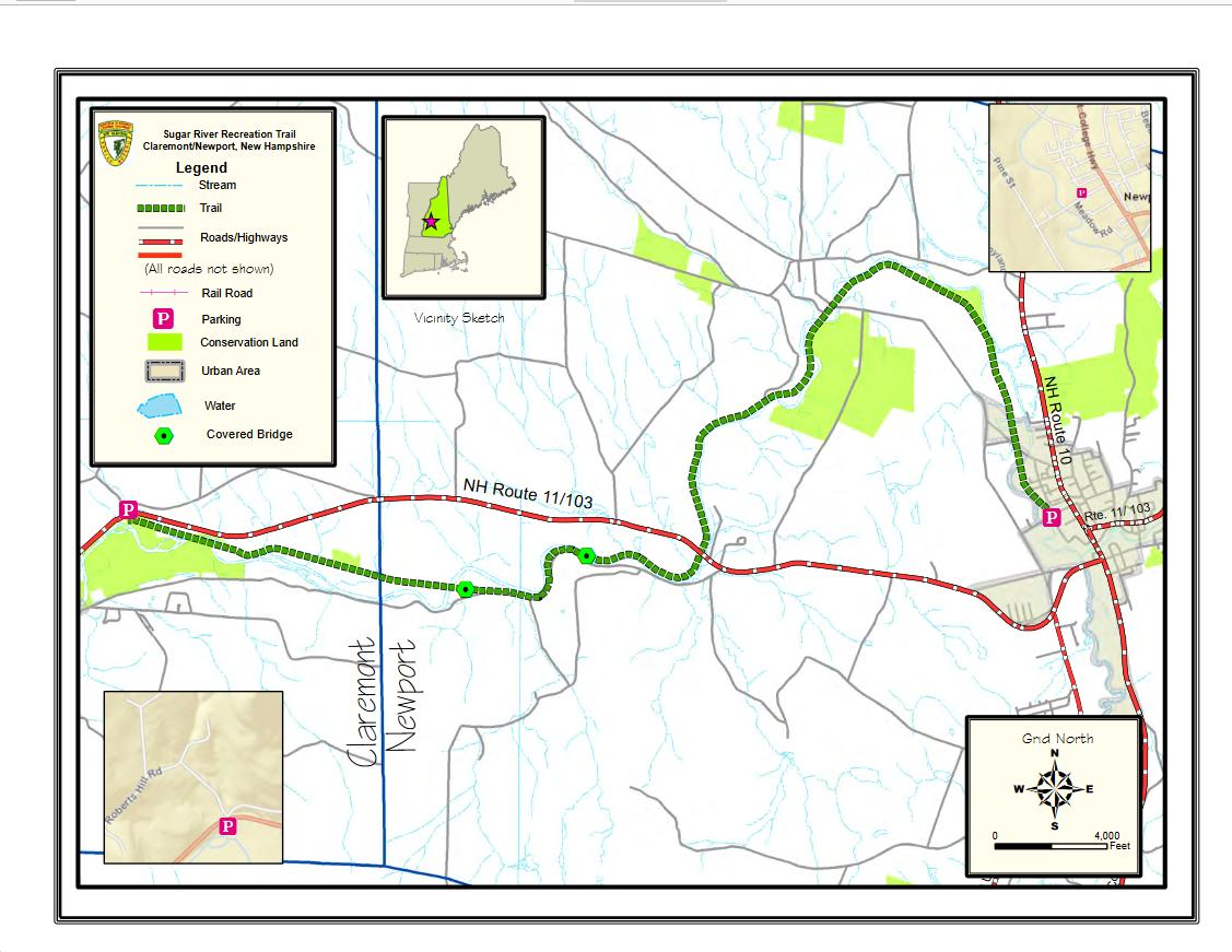
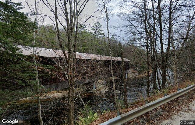
The 9-mile Sugar River Rail Trail begins at the Newport Recreation Department on Belknap Avenue in Newport and ends at Washington Street in Claremont. The trail boasts two historic covered bridges and meanders along the Sugar River.
Parking Areas
Claremont: OHRV trailhead on the south side of NH-103. 398-394 Washington Street, Claremont. View Map Google Maps has “Sugar River Trail, ORV Trailhead” on the map for this parking lot.
Newport: Green Crow parking at 601-613 John Stark Highway off NH-11/NH-103. Sign with the “green crow” marks where to turn. Park alongside the highway as you go down under the bridge. There is not much parking here, could not have a trailer to load/unload. View Map
Newport: Limited parking on the side of the road on Oak Street, Newport. View Map Not enough room for trailers.
Newport: Newport Trailhead is next to Newport Recreation Department at 65 Belknap Avenue, Newport. Limited parking on the side of the building. Go behind the building to access the dirt lot near the gate. View MapThere is a propane truck fill-up station next to the lot that has to be shared.
Notable Trails
The TrailFinder website has a description and map of a hike on the Sugar River Trail.
Content from Official Website
Last updated January 11, 2024