Merrimack River Conservation Area (SPNHF)--Floodplain, Concord
Merrimack River Conservation Area (SPNHF)--Floodplain, Concord
Society for the Protection of New Hampshire Forests Concord, New Hampshire 03301
Merrimack River Outdoor Education and Conservation Area webpageMerrimack River Conservation Area Official Website
Merrimack River Conservation Area map
Merrimack River Watershed Association website
Merrimack River (National Park Service) wepage
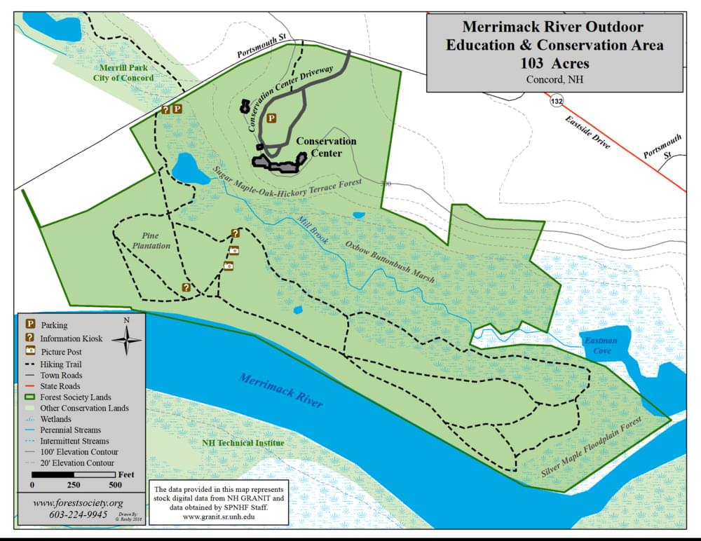
About this Location
The dramatic floodplain landscape includes oxbows, back channels, and high terraces that host a dynamic collection of overlapping natural communities. A walk down the Les Clark Nature Trail will take you past a pine forest planted in the 1960s, a wooded swamp, and beaver-influenced wetlands, a maple-oak-hickory terrace community, and a native silver maple floodplain forest. The silver maple forest is unusual in New Hampshire; it has specifically adapted to life among the shifting sand and silt that line the state’s largest rivers. No other tree species can survive in this challenging environment, so the silver maples end up winning by default.
The floodplain offers a natural sanctuary for not only people, but for wildlife, including turtles, beaver, migratory waterfowl and other birds, such as the cardinal, oriole, bald eagle, osprey, pileated woodpecker, and rose-breasted grosbeak.
About Merrimack River Conservation Area
See all hotspots at Merrimack River Conservation Area
Several types of floodplain forest natural communities may be seen along the trail system below the Forest Society’s headquarters, including one near the river’s edge that is dominated by tall silver maples leaning over the river (this is a portion of an exemplary silver maple – false nettle – sensitive fern floodplain forest that occurs in patches along the banks of this stretch of the river). Other natural communities found here include a hardwood terrace forest dominated by sugar maples, oaks, and hickories, as well as marshes, ponds, and streams.
About Merrimack River
See all hotspots at Merrimack River
The Merrimack River is a 117-mile-long river in the northeastern United States. It rises at the confluence of the Pemigewasset and Winnipesaukee rivers in Franklin, New Hampshire, flows southward into Massachusetts, and then flows northeast until it empties into the Atlantic Ocean at Newburyport. From the point where the Merrimack turns northeast in Lowell, Massachusetts onward, the Massachusetts–New Hampshire border is roughly calculated as the line three miles north of the river.
Features
Restrooms on site
Wheelchair accessible trail
Entrance fee
Content from Merrimack River Outdoor Education and Conservation Area webpage and Merrimack River Conservation Area Official Website
Last updated October 31, 2023