Pine Trailhead
About this Location
Only a short portion of this trail is on the Coconino National Forest, proceeding over the edge of the Mogollon Rim, with the longest portion on the Tonto National Forest. This trail offers a scenic view of Pine, Arizona, and the surrounding area. Ferns grow along the banks of Pine Creek. The trailhead sign also presents distances to other trails nearby.
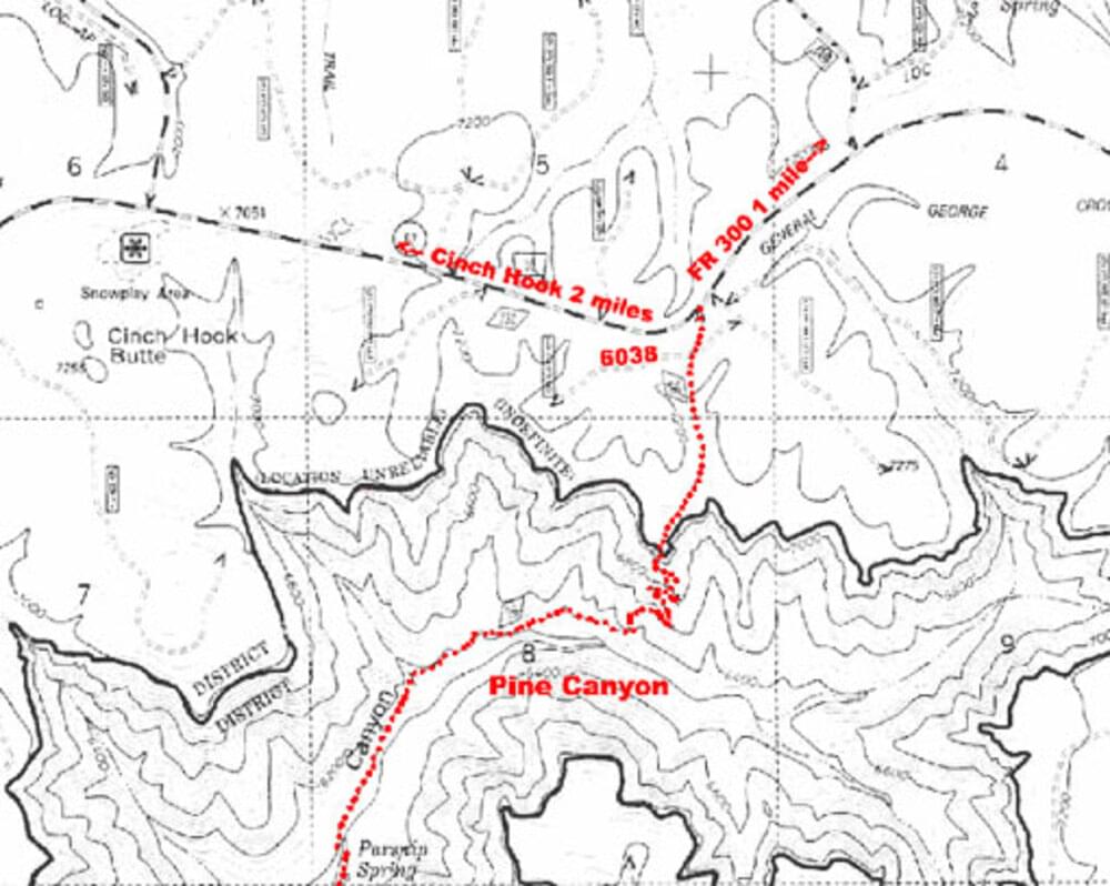
From Clints Well go south on AZ-87 approximately 10.8 miles, to FR-6038. This road is approximately 1 mile southwest of FR-300 and about 2 miles northeast of the Cinch Hook Snowplay area. Turn left. The road is gated with poles and barbed wire. Please reclose the gate. Trailhead is 0.1 mile on the left. Follow the signs to Dripping Springs then on to Pine Trailhead.
Content from Official Website