Nantucket--Massasoit Bridge
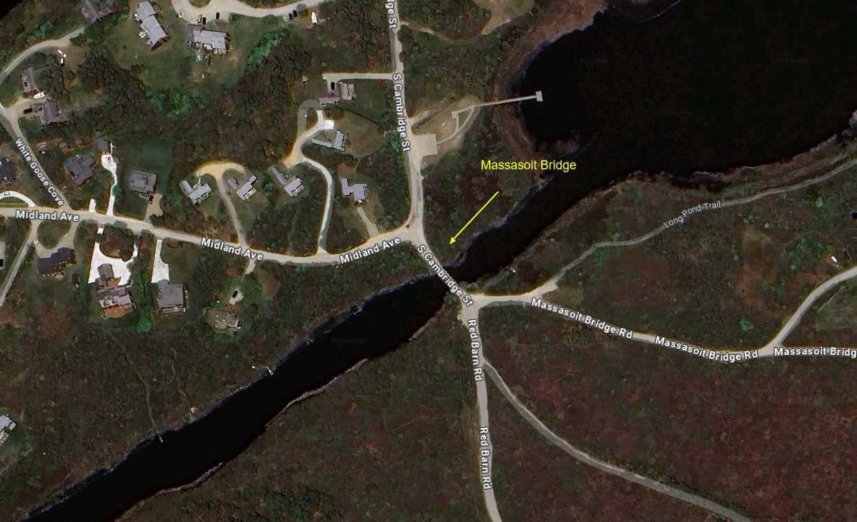
Nantucket--Massasoit Bridge
Nantucket, Massachusetts 02554
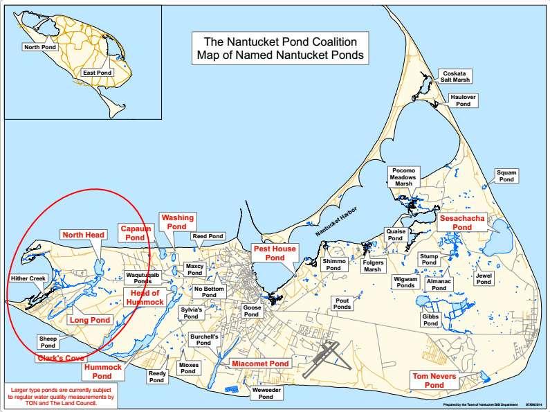
Long Pond, Nantucket Official WebsiteNantucket Ponds map
About this Location
Massasoit Bridge is located on the west end of Nantucket Island at the junction of Massasoit Bridge Road, Red Barn Road, Midland Avenue, and South Cambridge Street.
About Long Pond, Nantucket
See all hotspots at Long Pond, Nantucket
Long Pond connects to Hither Creek and Madaket Harbor by a ditch dug in 1665 through a cooperative agreement between the island’s early European settlers and the Wampanoag Indians also living on the island who sought an efficient method of harvesting Blueback herring and American eels spawning and living in the pond, respectively.
Sadly, though, tidal exchange between Madaket Harbor and Long Pond via the ditch through the salt marsh isn’t robust enough to keep up with the number of nutrients entering this pond from nearby houses, all of which have septic systems, and from the Nantucket Landfill, which sits right on the eastern edge of Long Pond. This southern portion of Long Pond has several coves and then drops down to within 200 feet of the ocean before hooking back northward to form White Goose Cove, making it impossible for total twice-daily tidal flushing. As it is, it takes 76 days for this pond to turnover completely.
Long Pond, which early Nantucketers and their Native American neighbors had opened early on, hasn’t been opened in at least two centuries, but it remains brackish because of the Madaket Ditch.
Access to this pond is via the First and Second bridges along Madaket Road and the beach at the end of Starbuck Road.
Features
Roadside viewing
Restrooms on site
Wheelchair accessible trail
Entrance fee
Content from Long Pond, Nantucket Official Website
Last updated March 25, 2024