Fort Cavazos--East Range South (Restricted Access)
Fort Cavazos--East Range South (Restricted Access)
Tips for Birding
A pass is required - See "About this location" for details
There are extensive Ashe Juniper forests that Golden-cheeked Warblers utilize for breeding habitat from late March through late May. Black-capped Vireos are less abundant than other regions of the installation, but can still be found in some areas of this hotspot region from late March through late September. Do NOT pin specific locations for these sensitive species or use any audio playback from March through September.
Multiple large lakes in the region host many species of waterfowl in the winter months. The riparian habitat surrounding the various lakes in this region is especially inviting to many winter species like Brown Thrasher, Winter Wren, and Red-breasted Nuthatch. During spring migration, flocks of warblers will utilize the rich habitat as a stopover site.
The rest of this region is comprised of mixed Juniper hardwood, Post Oak savannah, herbaceous grassland, and shrubland habitats, attracting a diverse variety of species.
Birds of Interest
Golden-cheeked Warbler
Black-capped Vireo
About this Location
This is an active-duty military installation with a law enforcement team patrolling the training areas. It is imperative that visitors follow all regulations exactly. Regulations can be found at cavazos.isportsman.net.
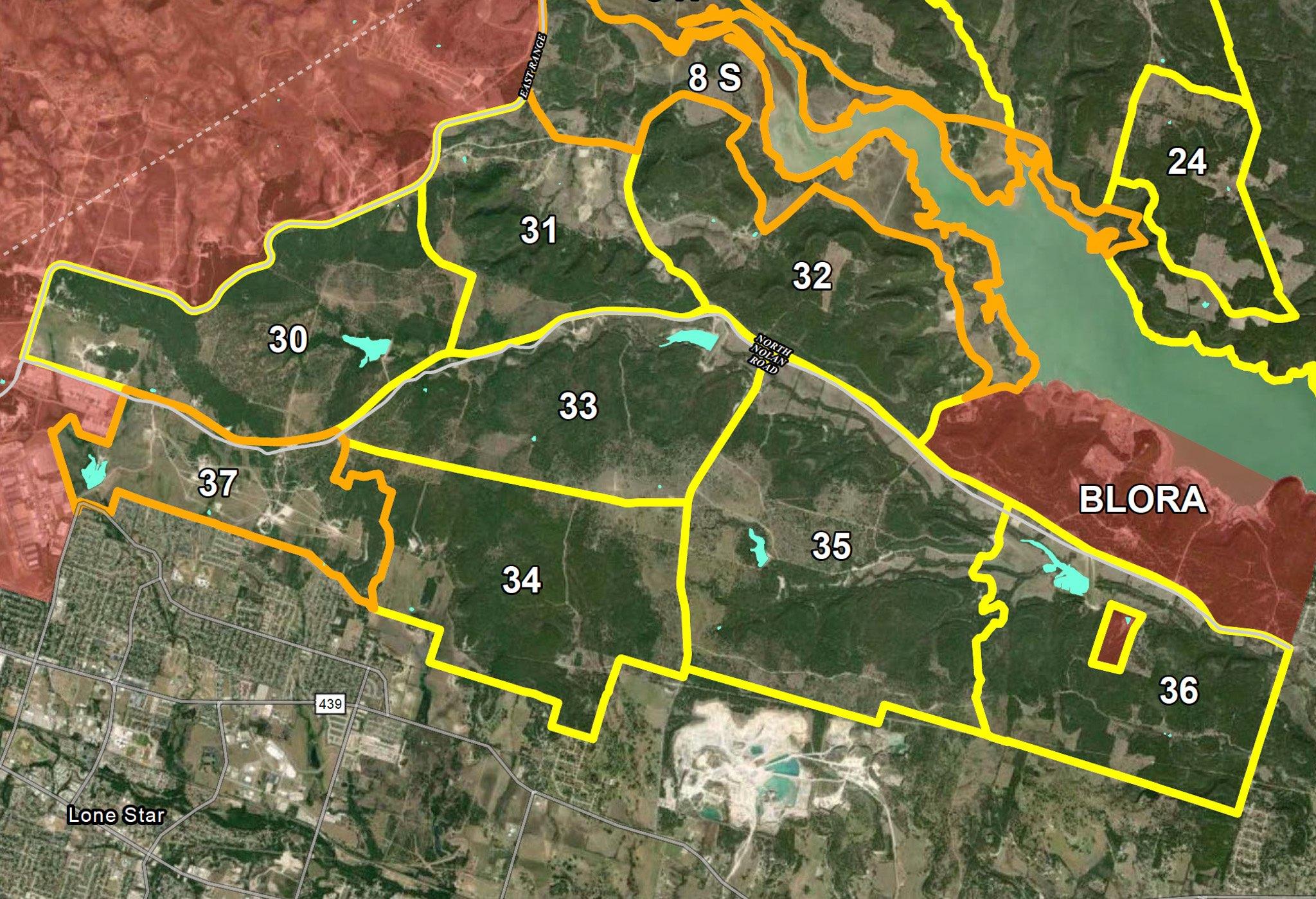
For security reasons, Fort Cavazos hotspots are designed as regions covering large areas rather than specific locations. This hotspot should be used when birding in Training Areas 30 through 37 and the western portion of 8 South.
- A general recreation permit is required, and may be purchased for $5 from the iSportsman web portal.
- A vehicle range pass must be displayed in the windshield/dash.
- An installation pass is required, and may be obtained at the Visitor Welcome Center.
- Each Training Area must be checked in and out of via the iSporstman web portal.
- Road birding is ONLY allowed with the appropriate passes and if the birder is checked in to the relevant TA.
- Training areas are only open to birders under limited circumstances, and may close on very short notice.
- General recreation option is not available from September 30, 2023- January 31, 2024.
Notable Trails
No officially designated recreation trails, but many trails made by Army maneuvering may be used by recreators. Vehicles may only be driven on permanent roads and vehicle trails. Off-roading is prohibited. There are many trails or sections of trails which may be legally accessed but are impassable for most vehicles and drivers. Extra care should be taken when using trails due to unpredictable road conditions caused by military use. Foot travel has few restrictions within the designated Training Areas.
TA 37 – A tank trail entrance off of North Nolan Road https://maps.app.goo.gl/c2Kx5WZcQEqh6Rnp6 Eastward to https://maps.app.goo.gl/jMD6c1GxMwpHM1Km6. This trail splits into 4 separate trails that run through grassland habitat and reconverge in a shrubby woodland area. A 5th trail also leads to Airfield Lake that is very attractive to waterbird species.
TA 30 – A tank trail entrance off of East Range Road https://maps.app.goo.gl/FBjEYhvv8V1fniaw8 Eastward to https://maps.app.goo.gl/4StSTHQURGDQHXDe8 with multiple exit points along the way. This route traverses through a mix of Post Oak savannahs, hardwood forests, and herbaceous grasslands while also passing by multiple small lakes.
TA 32 – Follow Liberty Hill Road https://maps.app.goo.gl/vfdJozKF9Yg3URv8A westward where it eventually turns into Nolan Creek Road, intersecting with Brookhaven Road and ending at East Range Road https://maps.app.goo.gl/r9g2JLPKrfTB1PMKA . Passes through multiple grassland and Prairie Flameleaf Sumac shrublands. Note: If birding closer to the lake along this route, it is recommended you use the hotspot for Fort Cavazos South Lake Shore off Nolan Creek rd.
Features
Entrance fee
Roadside viewing
Restrooms on site
Wheelchair accessible trail
Content from Charlie Plimpton
Last updated December 4, 2023