Whiton Woods
Whiton Woods
Duxbury, Massachusetts 02332
Whiton Woods (North and South Rivers Watershed Association) webpageWhiton Woods map
About this Location
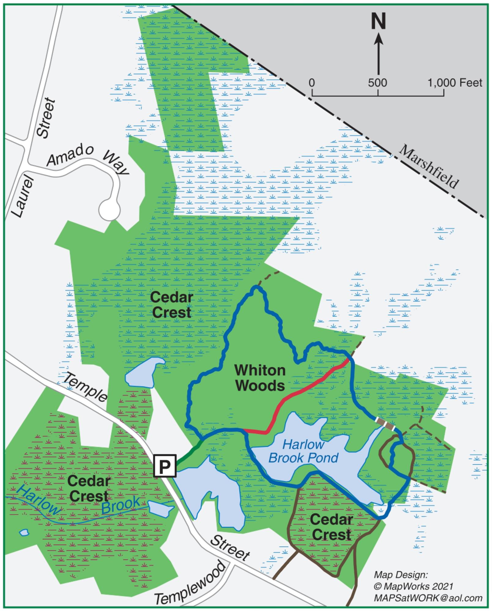
Whiton Woods, 37 acres, is located on Temple Street. Next door is Cedar Crest. Together they provide 154 acres of conservation land, with a 2.2-mile network of cart paths and trails that extend through the woods and around cranberry bogs, ponds, vernal pools, and wetlands. Harlow Brook flows through the property and eventually into the South River.
Whiton Woods features old stone walls, bubbling streams, at least one wooden footbridge, large outcroppings of rocks, swampy lowlands, and even a vernal pool or two. It was purchased by the Town of Duxbury in 1970 from Harry Hunt Whiton, a long-time summer resident (1950s+).
Whiton Woods is located in North Duxbury, a village sometimes known as the Crooked Lane neighborhood, because of the winding road that once connected each of the homes there. Settlers, often the sons and grandsons of Duxbury’s original grantees, began to arrive in 1685. Samuel Delano received an early land grant at Temple Hill, between Enterprise and Temple Streets. Isaac Simmons built a home farther north on Temple, just before Laurel Street, and Joseph Peterson’s farm was even farther north.
Additional settlers arrived in North Duxbury around 1700, with several 30-acre grants at the intersections of Lincoln, Franklin, and Temple Streets. But even though well-established paths led to other parts of Duxbury, settlers in this area tended to be more connected to Marshfield. They attended church there, and also did their milling, and patronized Marshfield’s stores. North Duxbury once petitioned the General Court to be annexed to Marshfield, but the petition failed.
North Duxbury was largely a farming community. While in other parts of town, dams were constructed on brooks to power mills and factories, the village’s primary waterway, Harlow Brook, remained a quiet stream flowing west through lowlands and eventually into the South River. Some of those swamps and shallow ponds produced bog iron ore, which could be raked up and forged into functional metal.
Before European contact, the Mattakeeset band of the Massachuseuk (or Massachusett) Native American tribe lived for thousands of years in the North River watershed. Their village included most of today’s Pembroke and Hanson as well as parts of Duxbury. Meanwhile, the Patuxet band of the Wampanoag tribe inhabited the Jones River watershed, and the area now known as Kingston, Plymouth, and Duxbury. This property lies within the upper portion of the South River watershed — right between those two territories. It’s possible that both tribes utilized the area.
There is an abundance of white pine on the property, as well as some oak and holly. Because of a brutal storm in 2019, many of the pines are now either snapped in half or lying flat on the forest floor. Harlow Brook flows through this property and eventually into the South River.
Notable Trails
A large cedar tree marks the trailhead. Follow the entrance trail a short distance, and you will arrive at the start of the Whiton Woods loop trail (to the left), which extends for 1.2 miles altogether. Or continue on the entrance trail to the next intersection. Turning right will bring you into another conservation property, Cedar Crest, where you’ll find two additional loop trails. The entrance trail eventually ends at the property’s boundary. Please respect private property.
Features
Restrooms on site
Wheelchair accessible trail
Entrance fee
Last updated March 3, 2024