Havasu NWR--Pintail Slough/North Dike
Havasu NWR--Pintail Slough/North Dike
Mohave Valley, Arizona 86440
Havasu National Wildlife Refuge Official WebsiteHavasu National Wildlife Refuge map
Havasu National Wildlife Refuge IBA webpage
About this Location
Pintail Slough an excellent area to view many species of birds that utilize the wetland habitat. Visitors might catch a glimpse of a coyote following a refuge road or a jackrabbit darting into the bushes. Extremely lucky guests may spot a bobcat walking along the edge of a field. Starting a wildlife watching trip early in the morning or in the evening hours will increase your chances of viewing the variety of wildlife at Pintail Slough.
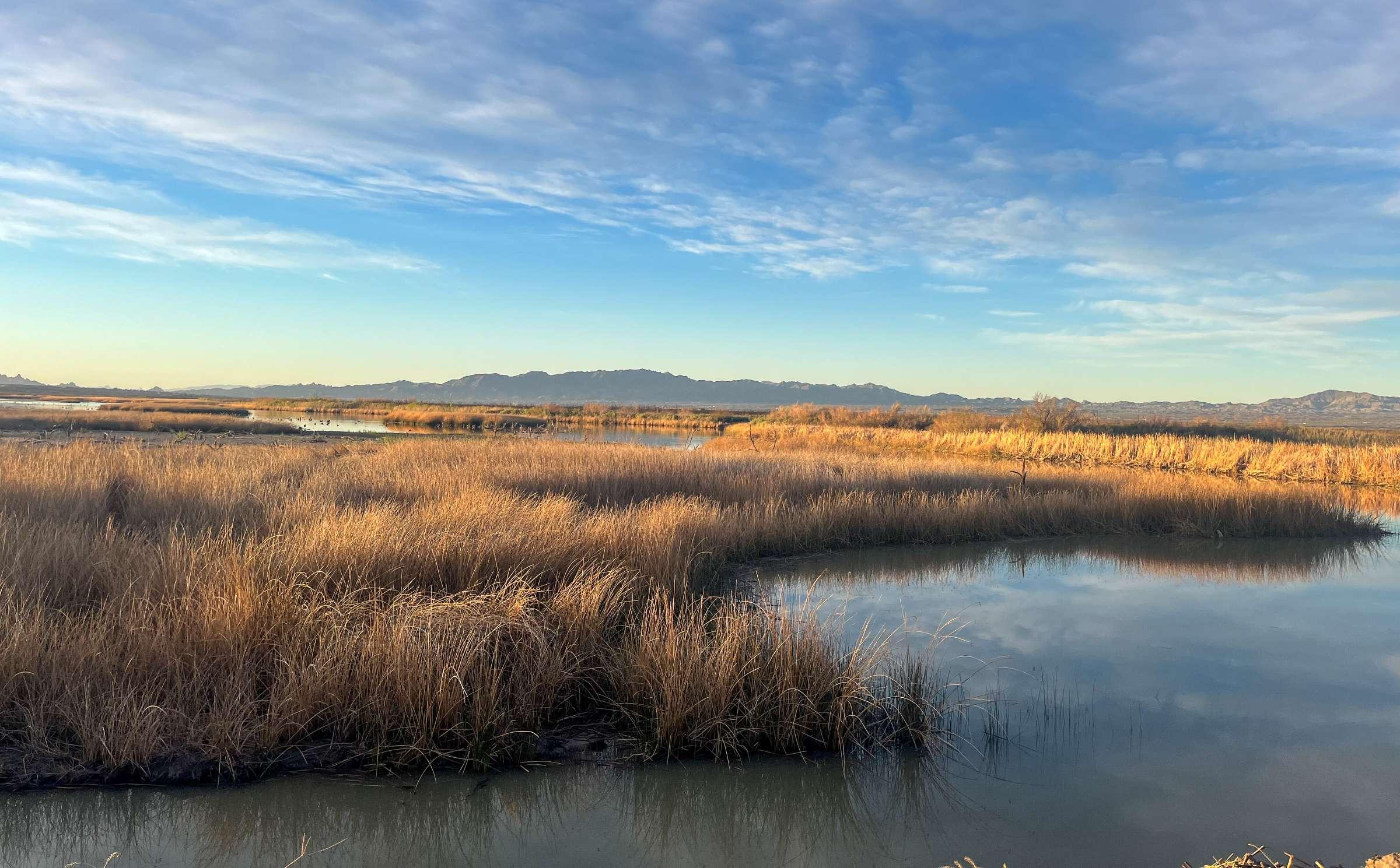
Pintail Slough is an extensively managed area at the northern end of Havasu National Wildlife Refuge. It consists of eight moist soil units, four agricultural fields and several riparian areas with cottonwoods and mesquite trees. Refuge staff manages water levels and vegetation within the moist soil units to provide ample habitat for migrating birds winging over the desert landscape. The agricultural fields are planted with an assortment of vegetation to provide food for quail and doves. Although there is no access by vehicle or amenities, guests can walk over eight miles of quiet roads surrounding the moist soil units and the fields.
The view from North Dike offers glimpses of a wide variety of active wildlife, including foraging white-faced Ibis, ospreys hunting overhead, swooping cliff swallows, swimming beaver and resting rattlesnakes. Although there are no facilities, visitors to North Dike can park in the lot and walk down the access road along the northern end of Topock Marsh. If guests arrive early enough, a rousing chorus of red-winged blackbirds will bring the quiet morning hours to life. Binoculars or a spotting scope and a camera are recommended equipment.
About Havasu National Wildlife Refuge
See all hotspots at Havasu National Wildlife Refuge
Havasu National Wildlife Refuge, originally named Havasu Lake National Wildlife Refuge, was established by Executive Order by President Franklin D. Roosevelt in 1941 for the primary purpose of providing migratory bird habitat. The refuge is comprised of 37,515 acres along the lower Colorado River in Arizona and California. The refuge protects 30 river miles and encompasses 300 miles of shoreline from Needles, California, to Lake Havasu City, Arizona. One of the last remaining natural stretches of the lower Colorado River flows through the 20-mile-long Topock Gorge.
Havasu National Wildlife Refuge is within the Pacific Flyway, a major north-south migratory route along the western coast of the United States. Hundreds of birds stop here to rest and refuel during their long journey. Many species also breed and overwinter here. Because of its importance to birds, the refuge is considered an Important Bird Area in the state of Arizona.
Historically, the Lower Colorado River wound its way through desert valleys and canyons surrounded by a dense riparian forest. Periodic flooding rejuvenated the landscape into a mosaic of willow and cottonwood trees and brought the dry desert to life. Wildlife thrived in the backwaters and forested habitat supported by the mighty river. However, with the construction of the Hoover Dam in 1936 and several other dams along the lower Colorado River, the natural restoration of the desert riparian habitat ceased.
Havasu National Wildlife Refuge protects the remaining native riparian area and the surrounding desert upland and manages the landscape to provide habitat for endangered species and neotropical migrants.
Content from Havasu National Wildlife Refuge webpage, recreation.gov website, and Lake Havasu National Wildlife Refuge webpage
 Map adapted from © OpenStreetMap contributors