Quabbin Reservoir--Gate 35
Quabbin Reservoir--Gate 35
New Salem, Massachusetts 01355
Quabbin Reservoir Official WebsiteQuabbin Reservoir Important Bird Area webpage
Quabbin Park and Reservoir brochure
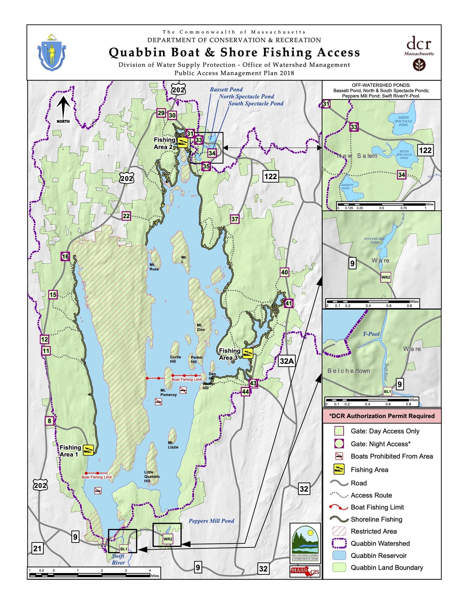
Quabbin Reservoir map
About this Location
Gate 35, one of the access points to the Quabbin Reservoir, leads to a hiking trail that offers scenic views of the water and the surrounding forest. Along the trail, visitors can see remnants of the former towns, such as cellar holes, stone walls, and cemeteries. The trail is open year-round, but some sections may be closed during hunting season or due to weather conditions.
About Quabbin Reservoir
See all hotspots at Quabbin Reservoir
The Quabbin Reservoir is a remarkable engineering feat that provides water to millions of people in Massachusetts. It was constructed in the 1930s by damming the Swift River and flooding four towns in the process. The reservoir covers an area of 39 square miles and has a capacity of 412 billion gallons. The Quabbin Reservoir is a popular destination for fishing, hiking, and wildlife viewing. The reservoir is surrounded by a protected forest that hosts a variety of plants and animals, some of which are rare or endangered.
Quabbin Reservoir is one of the largest unfiltered water supplies in the United States. Along with the Wachusett Reservoir and Ware River, it is the source of high-quality water for the Massachusetts Water Resources Authority water supply system. Recreational activities are regulated and limited to protect 3 million people’s drinking water.
Notable Trails
The MyHikes website has a description and map of a hike from Gate 35.
Features
Restrooms on site
Wheelchair accessible trail
Entrance fee
Content from Quabbin Reservoir Official Website
Last updated December 6, 2023
 Quabbin Reservoir showing county lines