Fort Cavazos--West Range Central (Limited access)
Fort Cavazos--West Range Central (Limited access)
Fort Cavazos, Texas 76544
Official WebsiteInstallation pass information
Tips for Birding
A pass is required - See "About this location" for details
Black-capped Vireos are common throughout this hotspot region from late March through late September. Golden-cheeked Warblers breed abundantly in the extensive Ashe Juniper forests. Do NOT pin specific locations for these sensitive species, or use any audio playback from March through September.
There are few reliable water sources in this region, but the relatively strong topographic gradient is attractive to some migrants and dispersing birds at the edges of their expected ranges. Some notable examples include Bushtit, Hutton's Vireo, Red-headed Woodpecker, and Gray-cheeked Thrush.
Birds of Interest
- Golden-cheeked Warbler
- Black-capped Vireo
About this Location
This is an active-duty military installation with a law enforcement team patrolling the training areas. It is absolutely imperative that visitors follow all regulations exactly. Regulations can be found at cavazos.isportsman.net.
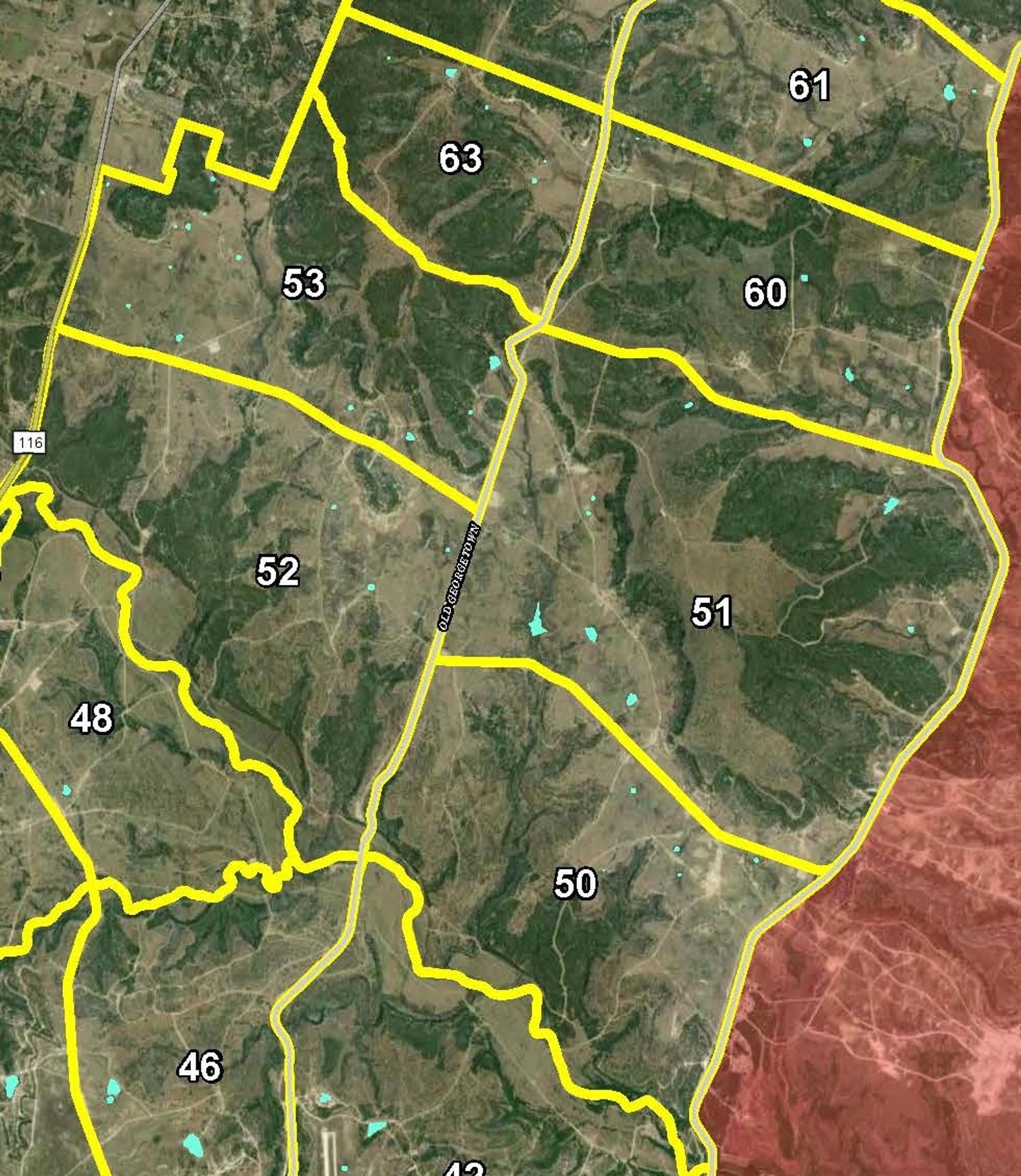
For security reasons, Fort Cavazos hotspots are designed as regions covering large areas rather than specific locations. This hotspot should be used when birding in Training Areas 50 through 53, 60, and 63. Training Areas 47 and 48 may be included on this hotspot or Fort Cavazos--Four Corners area (Limited access).
- A general recreation permit is required, and may be purchased for $5 from the iSportsman web portal.
- A vehicle range pass must be displayed in the windshield/dash.
- An installation pass is required, and may be obtained at the Visitor Welcome Center.
- Each Training Area must be checked in and out of via the iSporstman web portal.
- Road birding is ONLY allowed with the appropriate passes and if the birder is checked in to the relevant TA.
- Training areas are only open to birders under limited circumstances, and may close on very short notice.
- General recreation option is not available from September 30, 2023- January 31, 2024.
Notable Trails
No officially designated recreation trails, but many trails made by Army maneuvering may be used by recreators. Vehicles may only be driven on permanent roads and vehicle trails. Off-roading is prohibited. There are many trails or sections of trails which may be legally accessed but are impassable for most vehicles and drivers. Foot travel has few restrictions within the designated Training Areas.
Some notable drivable trails are:
- TA 50 - A tank trail following Cowhouse Creek from Georgetown Rd View Map eastward to about View Map. This trail goes through numerous patches of deciduous riparian forest and meadows. Several small canyons can be accessed from here.
- TA 51 - From Georgetown Rd View Map to Manning Mountain Rd View Map. Passes near some of the more reliably-full livestock tanks and through some very productive prairie.
- TA 52 - The trail following Cowhouse Creek from TA 50 continues across Georgetown Rd View Mapand ends at the western edge of base View Map.
- TAs 53 & 63 - A series of trails criss-cross the Shell "Mountains" through these 2 areas, giving great access to the varied habitats on and around that mesa.
Features
Wheelchair accessible trail
Entrance fee
Roadside viewing
Restrooms on site
Last updated November 2, 2023