Boston Lot Lake Trail--Powerline Corridor, Lebanon
Boston Lot Lake Trail--Powerline Corridor, Lebanon
Lebanon, New Hampshire 03784
Boston Lot Lake Official WebsiteBoston Lot Lake map
Tips for Birding
The trail into Boston Lot and to the lake begins from the more northern parking area along NH 10 across from the Wilder Dam.
There are several excellent birding spots along the trail to the lake, especially the powerline area and a small meadow on the left shortly before the lake.
From Jim Block
About this Location
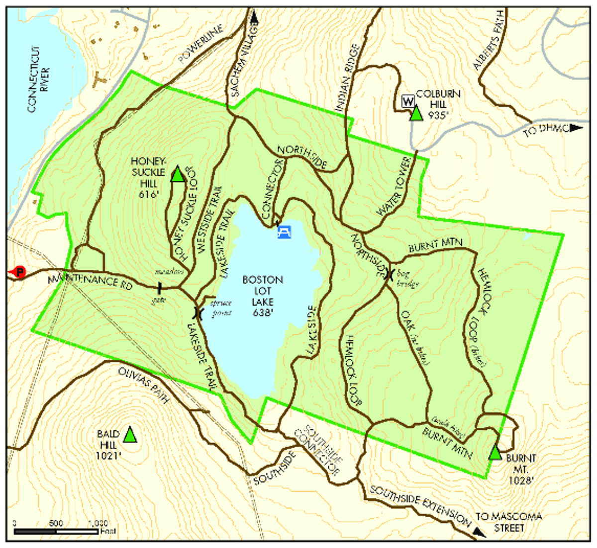
The power line corridor is on the west side of Boston Lot Lake between the lake and North Main Street (NH-10).
About Boston Lot Lake
See all hotspots at Boston Lot Lake
Boston Lot offers 7+ miles of trails, rated 3-4 Moderate Difficulty. Parking is available at the picnic area on the east side of NH 10 just north of Wilder Dam.
Trails on 439 acres circle Boston Lot Lake, climb Burnt Mountain, loop around Honeysuckle Hill, and connect to the power lines.
Boston Lot is a forested upland area.
The Boston Lot Reservoir, (elevation 638 feet) is ringed by ridges. Several small streams flow into the reservoir, and one stream flows from the dam spillway to the Connecticut River. The bedrock is primarily Lebanon Granite, a medium- to coarse-grained pink rock. Near the western boundary, the Lebanon Granite is a border gneiss. The soils are shallow, so outcrop0s of bedrock are common and easily observed along the shore of the reservoir. Glacial boulders are common, especially on the slopes east of the reservoir where large boulders are found. Steep ledges are prominent on the southeast slope of Burnt Mountain.
Features
Restrooms on site
Wheelchair accessible trail
Entrance fee
Last updated January 10, 2024