Hoosac Range Trail (BNRC)
Hoosac Range Trail (BNRC)
Berkshire Natural Resources Council MA-2 North Adams, Massachusetts 01247
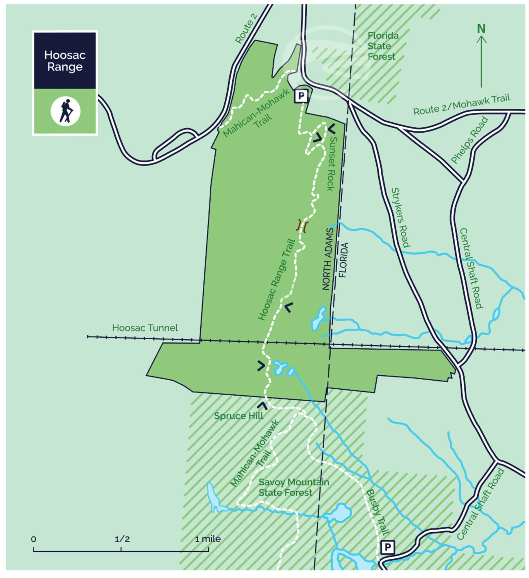
Official WebsiteHoosac Range Trail map
About this Location
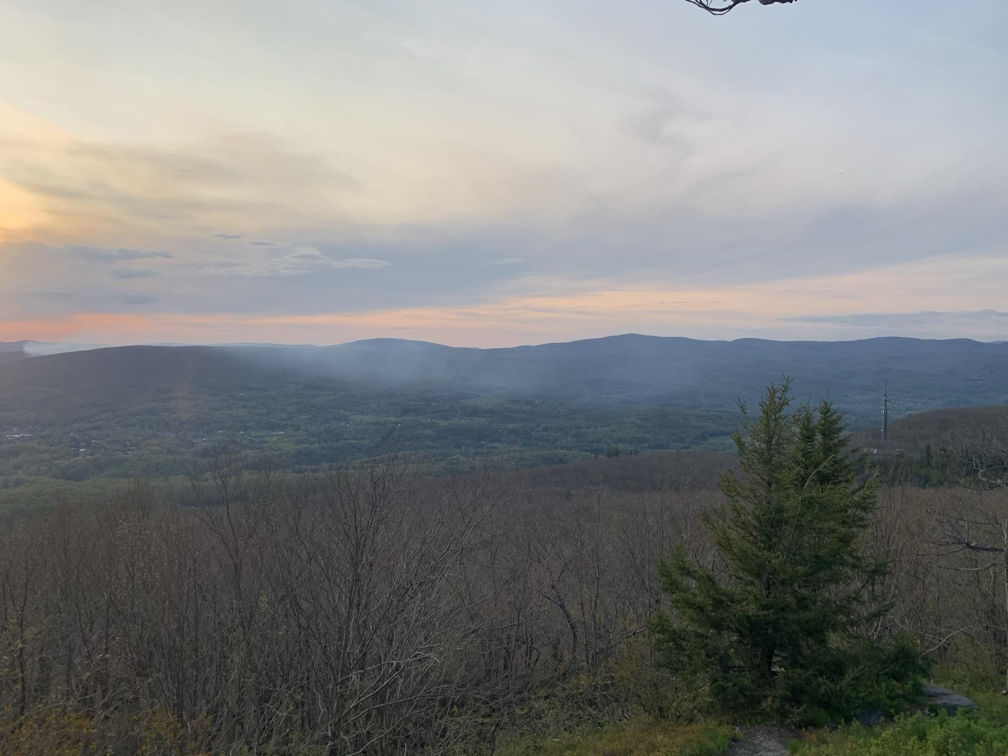
A three-mile-long ridge trail along the Berkshires’ northeastern wall, Hoosac Range includes several dramatic vistas, including the one to the west at the trail’s Spruce Hill destination. A much shorter hike, 1.6 miles roundtrip, leads to Sunset Rock, which also has spectacular views to the west.
This land, and all of the present-day Berkshires, are the ancestral homeland of the Mohican people, who were forcefully displaced to Wisconsin by European colonization. These lands continue to be of great significance to the Stockbridge-Munsee Mohican Nation today.
The 944 acres of the Hoosac Range property connect with the Massachusetts Department of Conservation and Recreation’s 11,118-acre Savoy Mountain State Forest. The sheer size of the protected area provides abundant habitat for a range of wildlife, from bears to beavers.
Designed by Peter Jensen, the Hoosac Range trails take hikers past several outcroppings of the range’s characteristic Hoosac schist, a sedimentary rock that first began forming under the warm oceans of the Southern Hemisphere 550 million years ago, before traveling north via plate tectonics. The schist remained after the softer marble and limestone that surrounded it eroded under the constant melt-flow of glaciers.
Notable Trails
The Hoosac Range Trail is also part of the Mahican Mohawk Trail, envisioned as a 100-mile foot trail from the Hudson River, over the intervening mountain ranges, and back down to the Connecticut River. Heading east from here, the Mahican Mohawk Trail travels to Savoy Mountain State Forest, and then on to Mohawk Trail State Forest, where it traverses an original section of the historic native American path between the two great rivers.
From the trailhead, hike three miles along a ridgeline to Spruce Hill, with its 180-degree views including Mount Greylock to the west. Hikers can return or descend to trailheads in Savoy Mountain State Forest by the Busby or continue on the Mahican Mohawk Trail. An out-and-back trip on the Hoosac Range Trail is about six miles and takes three to four hours. Far beneath the trail is the Hoosac Tunnel, a rail connection between Northern Berkshire and Boston that opened in 1876.
The shorter inner-loop hike to Sunset Rock provides views to the west and north, overlooking North Adams. A round trip is 1.6 miles.
The AllTrails website has a description and map of a hike at Hoosac Range.
Features
Restrooms on site
Wheelchair accessible trail
Entrance fee
Content from Official Website
Last updated November 24, 2023
 Berkshire Natural Resources Council