Sweet Pond and State Park - Guilford (20 acres)
Sweet Pond and State Park - Guilford (20 acres)
2763 Sweet Pond Road Guilford, Vermont 05301
Official WebsiteSweet Pond State Park guide and map
About this Location
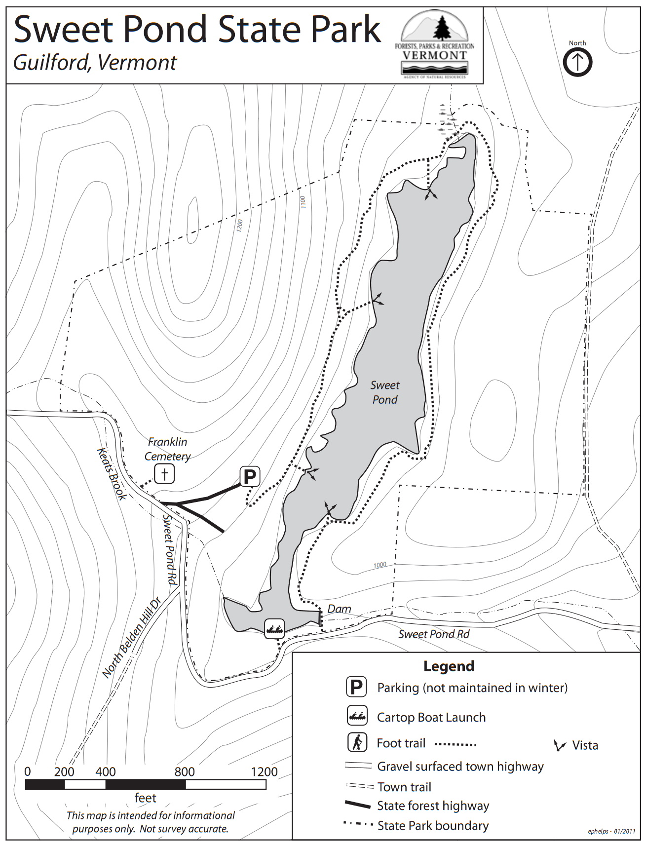
Sweet Pond State Park was established in 1976. The park is named after Dr. Charles and Susan Sweet, who maintained a summer home on the property for a time prior to the State acquisition.
Located in the southeastern Vermont town of Guilford, the park is less than one-half mile from the Massachusetts border and is nine miles southwest of Brattleboro. The park includes all of the shoreline of the 18-acre Sweet Pond. The pond is an artificial impoundment on Keats Brook; a dam was first established here in the mid-19th century to power a mill. The land was originally settled by the Franklin family, who farmed the land for more than 150 years beginning in 1777. The Franklin Cemetery lies within the park.
The park is undeveloped, except for the Sweet family home (privately rented), a public parking area, and a foot trail. There are traces visible of historic farmsteads and roads on the property. It is a popular place for the easy hike and for paddling and swimming.
Sweet Pond (20 acres) is a site for the Vermont LoonWatch annual survey. Birders are encouraged to volunteer as often and whenever they are able. See Join LoonWatch for details.
Notable Trails
The 1.3 miles Sweet Pond Trail circumnavigates the pond.
Features
Restrooms on site
Wheelchair accessible trail
Entrance fee
Content from Official Website
Last updated October 6, 2023