Mount Toby State Reservation
Mount Toby State Reservation
Sunderland, Massachusetts 01375
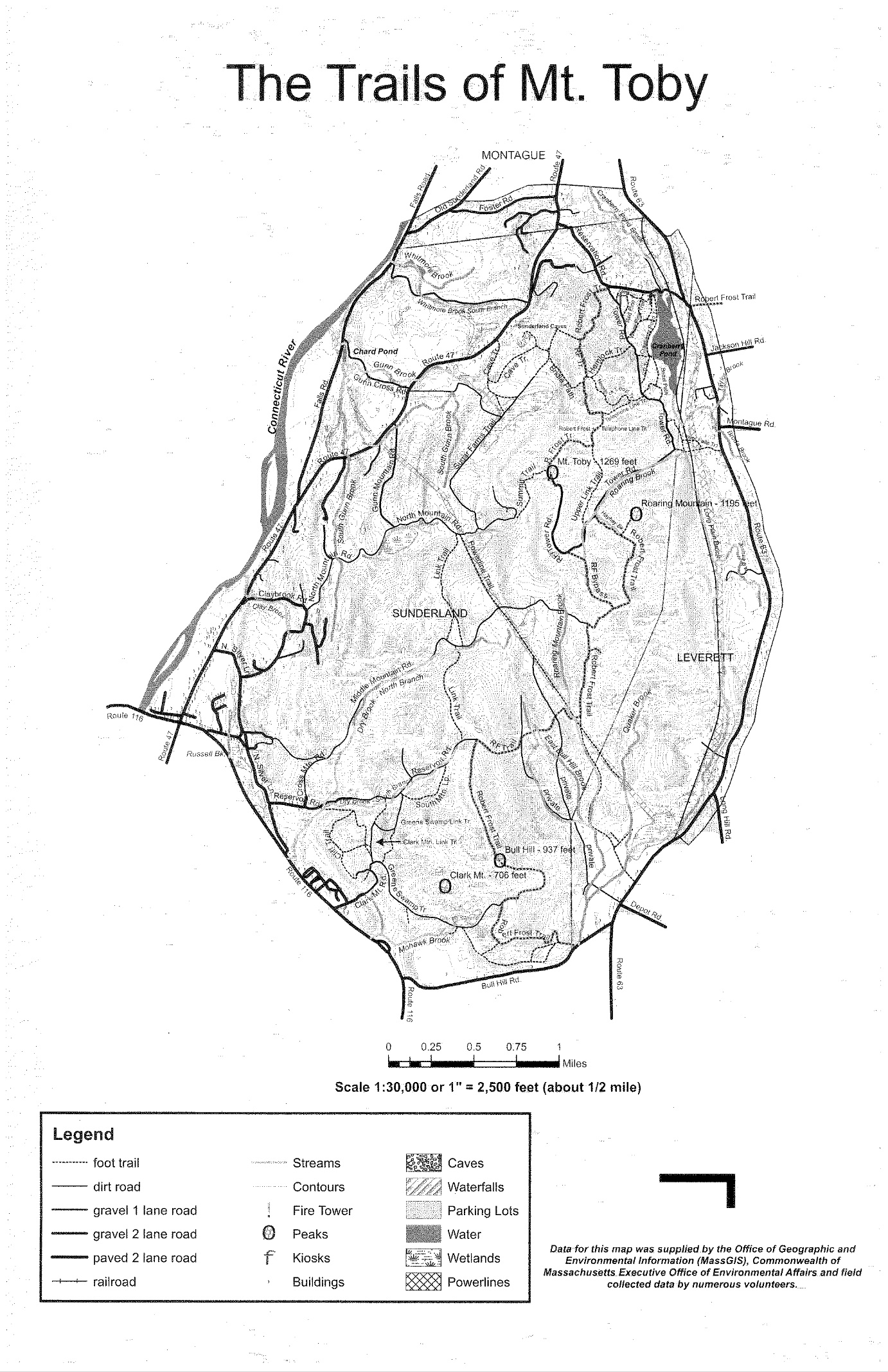
Official WebsiteMount Toby State Reservation map
About this Location
The Department of Natural Resources Conservation at the University of Massachusetts Amherst has responsibility for managing the 755-acre Mount Toby Demonstration forest for teaching, research, and demonstration. We also try to coordinate with recreational users of the Forest, the Massachusetts Department of Conservation and Recreation who operate the fire tower at the summit, and other organizations.
The Forest is topographically diverse. To the south are three hills, the highest being Mount Toby (1269 feet). Slopes are steep with small cliffs and ledges to the east and west. There is a deep valley between two of the hills, Roaring Mountain to the south and Ox Hill to the north, with a brook that drops into a waterfall near the eastern border of the Forest. Most, but not all of it has been logged more than once, but some areas are so inaccessible that they were never logged.
University of Massachusetts students and faculty use the forest for teaching, field exercises, and forestry research activities. Mount Toby is used heavily by the general public for recreational activities. These are allowed as long as they conform with the University Trustees’ guidelines for using the Forest and do not interfere with teaching and research activities.
Notable Trails
The AllTrails website has a description and map of a hike at Mount Toby State Reservation.
Features
Restrooms on site
Wheelchair accessible trail
Entrance fee
Content from Official Website
Last updated December 5, 2023