Rockcastle Rec. Area DBNF
Rockcastle Rec. Area DBNF
London, Kentucky 40744
Official WebsiteLake Cumberland Official Website
Lake Cumberland (US Army Corps of Engineers Nashville District) website
Lake Cumberland (Lakes online) lake level
About this Location
From I-75, take exit 38 and travel west on KY 192 for 13.9 miles. Veer left on KY 3497 and travel straight ahead until the road terminates at Cumberland River, approximately 6 miles.
Amenities include a boat ramp and trails. Rockcastle Campground is temporarily closed due to the hazardous road conditions and deteriorating campsite conditions. The February 2019 Rockcastle River flooding further increased the damage to the area. In 2018, the ash trees that were infected with the Emerald Ash Borer were eliminated. Because of the extensive amount of work needed, and the lack of funding available, the campground will remain closed until further notice.
About Lake Cumberland
See all hotspots at Lake Cumberland
Lake Cumberland is the second largest lake in the Cumberland River System. The lake provides varied outdoor recreational opportunities for millions of visitors each year.
Lake Cumberland is located in Wayne, Russell, Pulaski, Clinton, McCreary, Laurel, and Whitley counties in Southeastern Kentucky on the Cumberland River. The damsite is at river mile 460.9 or about 10 miles southwest of Jamestown, Kentucky.
The Wolf Creek Project was authorized by the Flood Control Act of 1938 and the Rivers and Harbor Act of 1946. Construction of the project, designed and supervised by the U.S. Army Corps of Engineers, began in August 1941. After a three-year delay caused by World War II, the project was completed for full beneficial use in August 1952.
The dam was completed for flood control operation in 1950. Three of the six hydroelectric generating units were placed in operation in 1951 and the remaining three in 1952. Operation of the lake is for the primary purposes of flood control and the production of hydroelectric power. The cost of the project was approximately $80.4 million.
Notable Trails
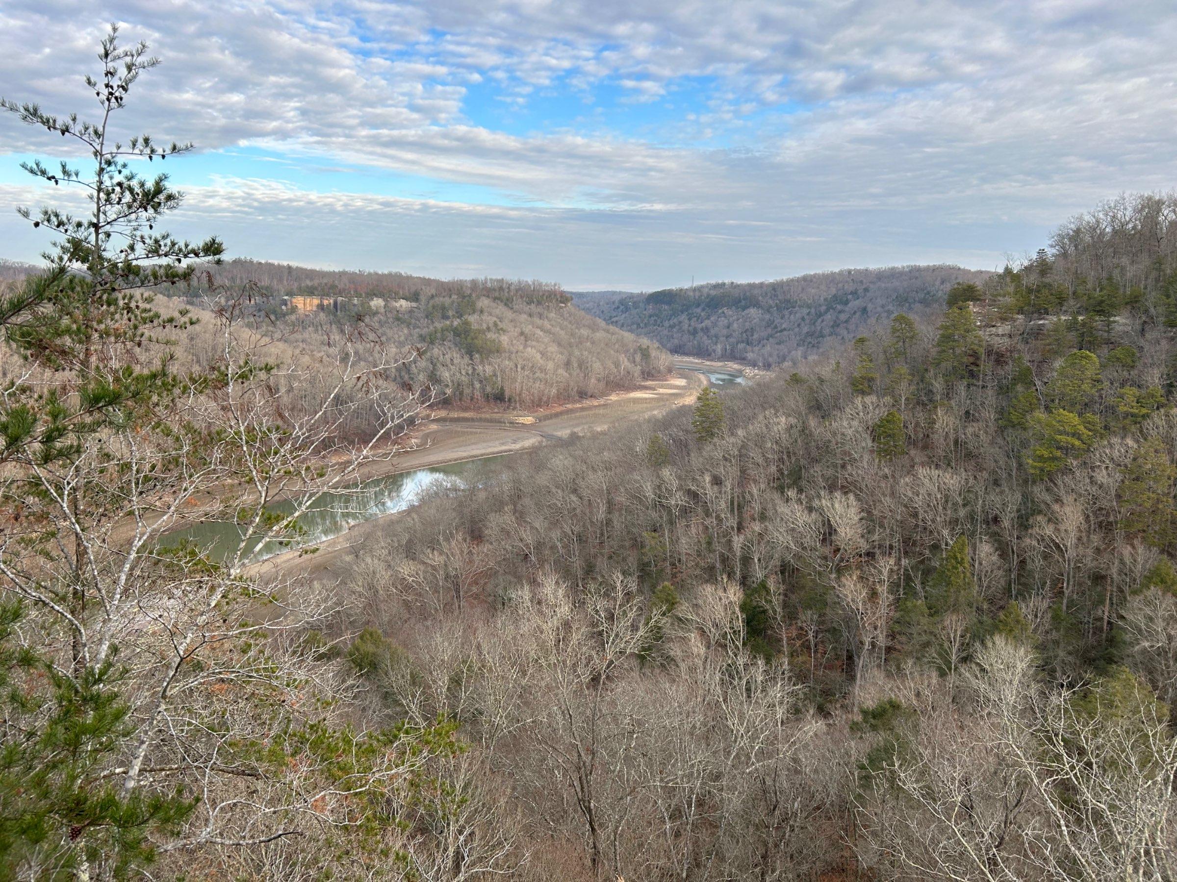
Some of the most popular hiking trails on the London Ranger District lead from the closed campground. Dutch Branch Trail #404B leads hikers through a rich cove forest of mostly beech and hemlock. Scuttle Hole Trail #404 climbs through a crack in the cliffs to reach overlooks of the lake. Lakeside South Trail #412 follows the shore of the lake and connects with Twin Branch Trail #406 and Ned Branch Trail #405 to form an 8.5 mile loop around the campground.
Features
Restrooms on site
Roadside viewing
Wheelchair accessible trail
Entrance fee
Content from Official Website and Lake Cumberland (Lakes online) lake level
Last updated December 25, 2023
 Lake Cumberland