Cuttyhunk Island
About this Location
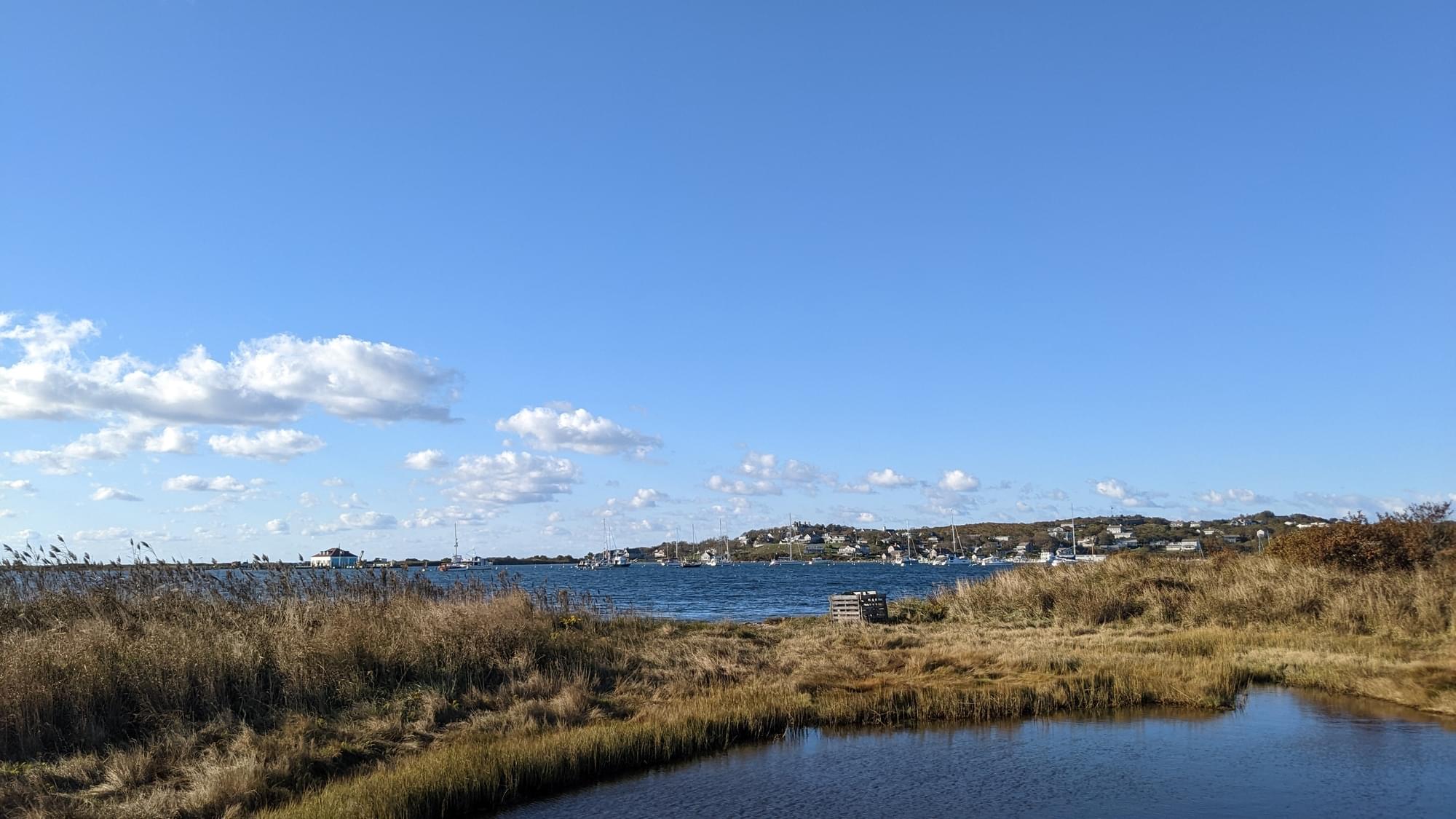
Cuttyhunk Island is the outermost of the Elizabeth Islands in Massachusetts. A small outpost for the harvesting of sassafras was occupied for a few weeks in 1602, arguably making it the first English settlement in New England. Cuttyhunk is located between Buzzards Bay to the north and Vineyard Sound to the south. Penikese Island and Nashawena Island are located to the north and east respectively.
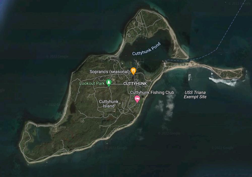
The island has a land area of 580 acres and a population of 52 persons as of the 2000 census. It is the fourth largest area of the Elizabeth Islands and home to the village of Cuttyhunk. It lies entirely within the town of Gosnold.[2]
Cuttyhunk is about a mile and a half long, and three-quarters of a mile wide, with a large natural harbor at the eastern end of the island. Fully half of the main part of the island is set apart as a nature preserve. It is home to a wide variety of birds such as piping plovers, least terns, and Massachusetts' American oystercatchers,[3] as well as White-tailed deer, White-footed mice, and Eastern cottontails. It also has a small population of coyotes. Cuttyhunk has the most varieties of New England's wildflowers, as well as bayberry, sweet peas, and a host of other plant life.
Two large peninsular arms extend from the main body of the island, named Canapitsit (the southern arm) and Copicut Neck (the northern arm). The shore is made up largely of rocks, testimony to Cuttyhunk's glacial origins. Cuttyhunk is covered with rocks and stones that are elsewhere found only in the mountains of Vermont and New Hampshire.
There are three stretches of sandy beach: along the channel that leads to the harbor (Channel Beach), around the sunken barges that connect Canapitsit to the main body of land (Barges Beach), and at "Church's beach," which connects Copicut to the main island. Much of Cuttyhunk's rocky shore is bounded by cliffs made of rock, sand, and clay. The western end of the island is taken up by the West End Pond, much of which is currently used for shellfish farming. A monument to Bartholomew Gosnold's 1602 landing stands on a small island in the Pond.
The highest point on the island is Lookout Hill, standing at 154 feet above sea level. The Lookout is home to one of the six (one now buried) defensive bunkers built by the United States Coast Guard in 1941 to watch the surrounding ocean for Nazi U-boats. Stripped of their observation equipment and weaponry at the end of World War II, the bunkers are now picnic areas. They offer views of the island and its surrounding waters. The Coast Guard station has not been active since 1964.
Features
Restrooms on site
Wheelchair accessible trail
Entrance fee
Content from Wikipedia
Last updated March 21, 2024
 © Google Maps