Great Herring Pond
Tips for Birding
If you carefully keep your bird records by county, be sure to use the specific hotspots at Great Herring Pond so that the birds will be assigned to the proper county. Most of the pond is in Plymouth County. The south end of the pond is in Barnstable County.
About Great Herring Pond
See all hotspots at Great Herring Pond
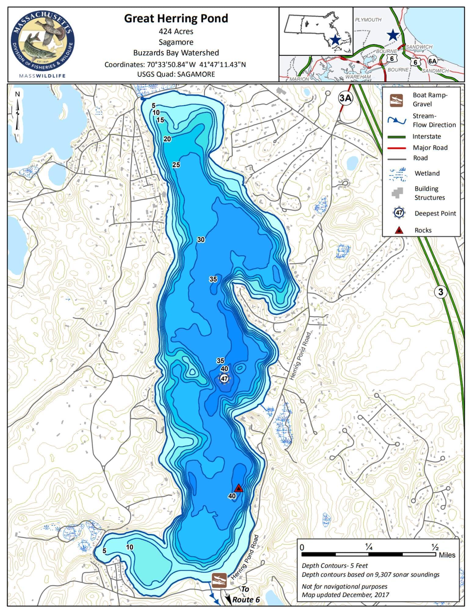
Great Herring Pond, historically known as Lake Manomet, is a 424-acre Great Pond with an average depth of 21 feet and a maximum depth of 47 feet. Its outlet is the Herring River, formerly known as Monument River, which used to flow into Buzzards Bay. This river now enters the Cape Cod Canal at the Bournedale Herring Run. The pond’s water supply is an inlet from Little Herring Pond, cranberry bogs, and groundwater. The water color is generally clear and transparency is about 8 feet. Due to its windswept nature, the pond does not stratify during the summer months. The pond’s 5.3 miles of shoreline is moderately developed with houses, roads, cranberry bogs, and a summer camp (Camp Bournedale). The bottom is primarily sand and rubble with mud in deeper and more sheltered areas.
Access is provided by a gravel boat ramp suitable for trailered boats and an associated parking area with space for approximately 6 cars. The ramp and parking area are located off Little Sandy Pond Road adjacent to the intersection with Herring Pond Road. The ramp is shallow, sandy, and unimproved; four-wheel drive vehicles are recommended if trying to launch trailered craft.
Features
Restrooms on site
Wheelchair accessible trail
Entrance fee
Content from Great Herring Pond information page and map
Last updated February 23, 2024
 Massachusetts Department of Fish and Wildlife
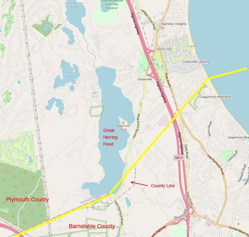 Map adapted from © OpenStreetMap contributors