Meramec CA
About this Location
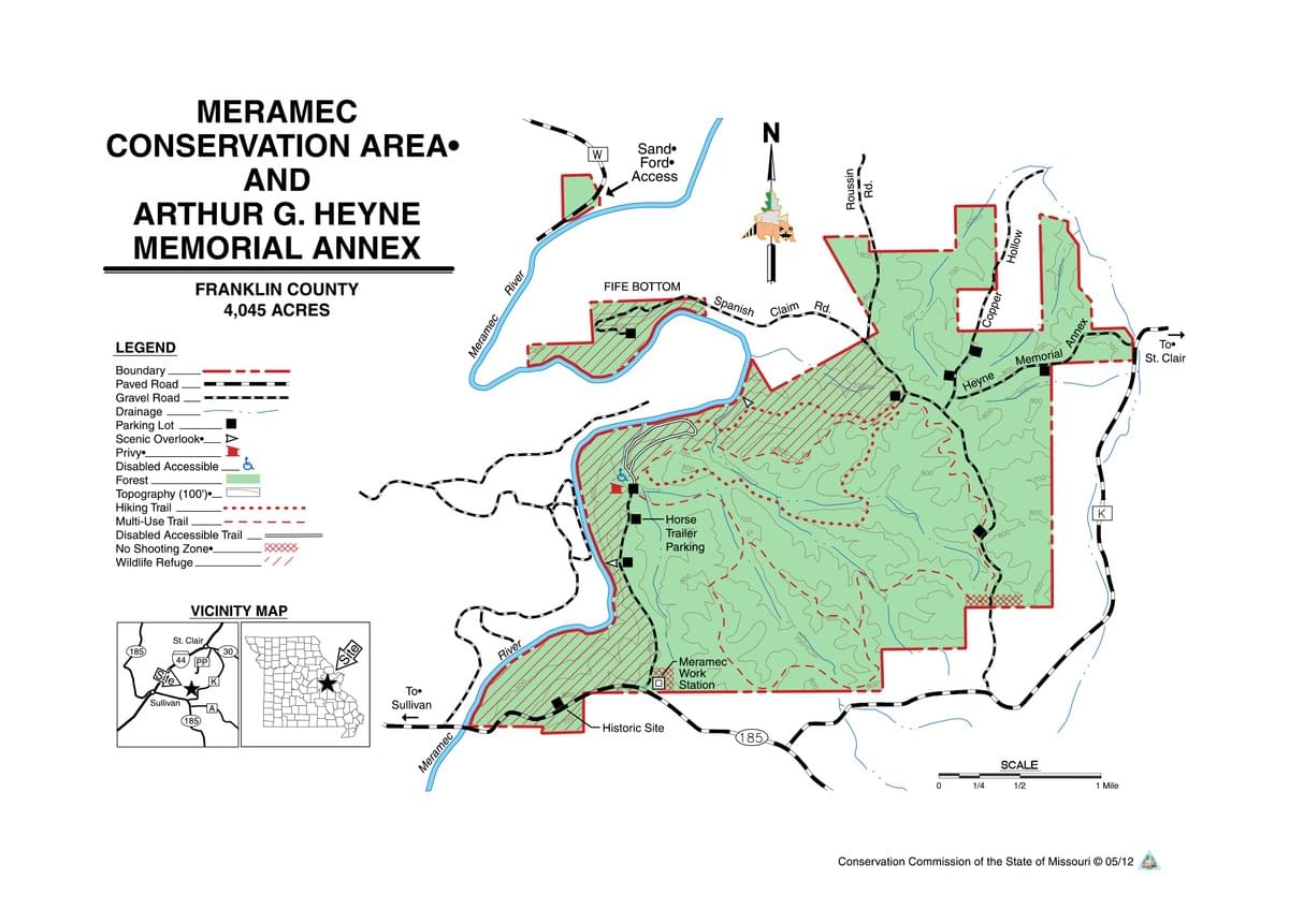
Directions: From I-44 exit 226 near Sullivan, go south on MO 185 about 4 miles, crossing the Meramec River. The first parking area, on the left, is less than a mile after the river crossing, and easily missed. The main entrance is about a mile further south on MO 185, at the Meramec Work Station. To reach the third entrance, continue on MO 185 past the work station, turn left onto Rt. K. and follow it for 1.4 miles to a left onto Spanish Claim Rd. Conservation area land begins about .5 miles north.
Anytime can be good birding, but fall and spring passerine migrations can be particularly exciting here. Blue-headed Vireo and Bewick’s Wren, Veery and Swainson’s Thrush have been seen. Migrant warbler sightings include Blue-winged, Nashville, Cerulean, Black-and-white, Tennessee, Chestnut-sided, Blackpoll, Canada, and Wilson’s. The area is mainly wooded; much of it is oak-hickory upland. There are numerous stands of shortleaf pine that could yield additional interesting migrants.
The first parking area a little less than a mile east of the river has no sign, so watch on the left for the gap in roadside trees. This is the site of the former CCC camp. An informative display describes the camp, and a small network of pathways of about .1 mile leads to parts of the ruins (foundations and chimneys) with access into this woods/scrub ecotone.
From the main entrance at the Meramec Work Station, the road leads through pines to a horse trailer parking area on the right. This is a trailhead for the moderate-rated 10.5-mile J. Avery Ruble Memorial Trail, an extensive network of multi-use trails that can be reached from most of the 10 parking lots. These trails are mostly quite wide and well-maintained.
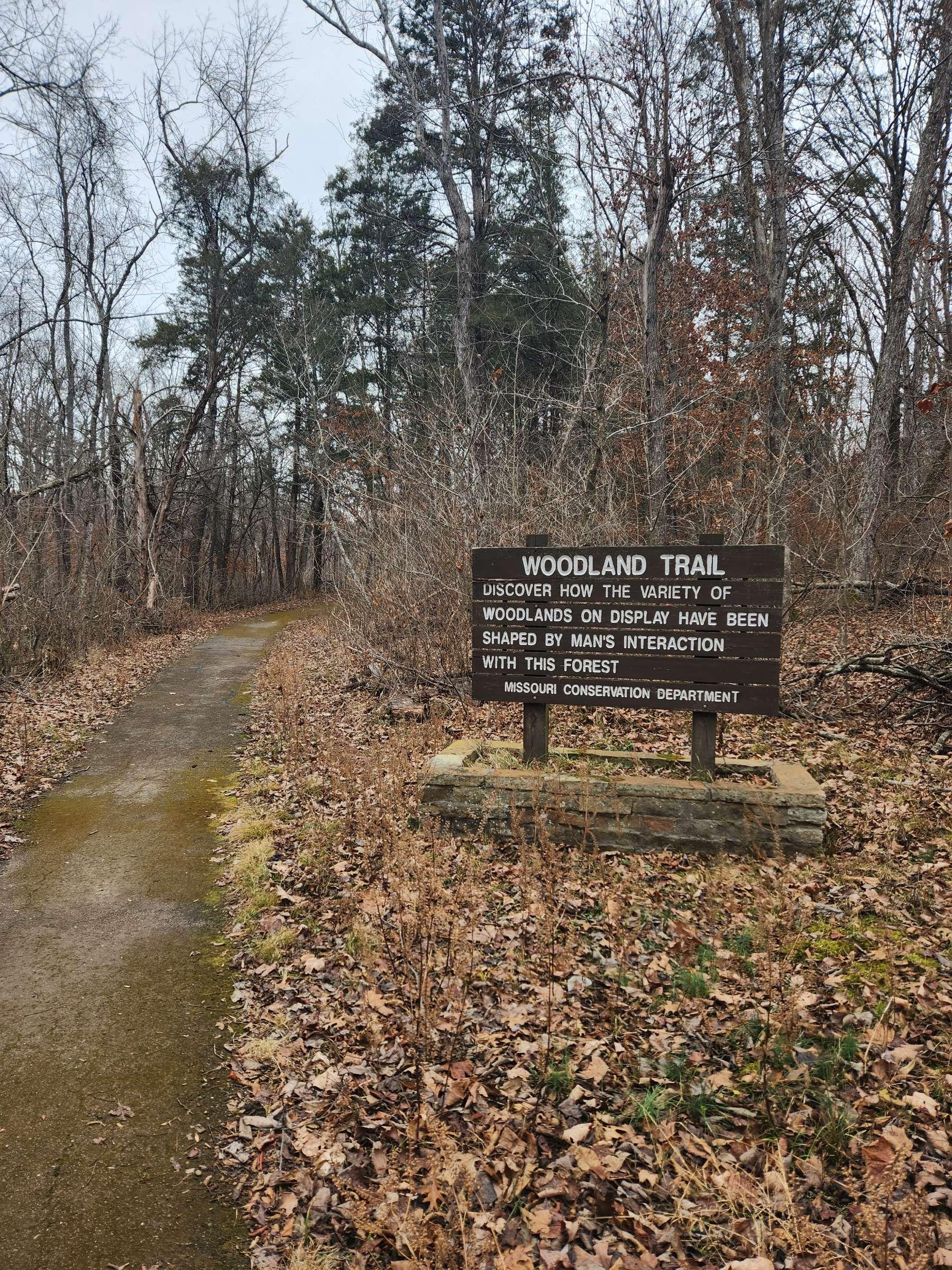
Beyond the horse trailer parking area, the road ends at the head of the accessible nature trail. This 1.3-mile asphalt paved, almost entirely level loop trail goes through mixed hardwood forest with some areas of shortleaf pine.
There are several turnouts on the west branch of the loop with views of the Meramec River, and frequent benches to rest (or do a Small Sit). The north end of the loop crosses a small creek, with a boardwalk overlooking the creek bed and a cave entrance (All caves in the area are now closed to visitors). The cave overlook and creek area is good for resident warblers such as Ovenbird and Kentucky in the summer, and should be excellent for migrating passerines. A poorly maintained trail leads east from the end of the loop along the riverbank, eventually joining the multi-use trail system.
The other entrance to Meramec Conservation Area is via the gravel Spanish Claim Road, extending north from Rt. K. Part of the 10.5-mile multi-use trail parallels the road for most of its distance, giving access to upland hardwood and shortleaf pine forests.
From Spanish Claim Road, Heyne Memorial Annex Road leads northeast into steep wooded country that is good habitat for Worm-Eating Warbler. The last parking area on Spanish Claim Road inside the main part of the conservation area is at the head of the 6.1-mile multi-use Old Reedville School Trail. It traverses hardwood upland forest past a historical marker at the site of the Reedville log school, and eventually joins the asphalt loop trail.
Spanish Claim Rd. continues northwest to a non-contiguous part of the area called Fife Bottom. The road dead-ends about 4.5 miles from highway K at a parking area, and an easy trail leads 200 yards through the woods to a very picturesque gravel bar on the Meramec River. Waders, swallows, swifts, and other riparian species can be expected here. Watch and listen for Prothonotary and Yellow-throated Warblers, Acadian Flycatchers and Pileated Woodpeckers.
Notable Trails
A 1.3-mile, nearly level asphalt paved loop trail wends through forestland with spurs to Meramec River viewpoints.
Features
Restrooms on site
Wheelchair accessible trail
Roadside viewing
Entrance fee
Content from A Birders' Guide to Meramec CA
Last updated September 14, 2023
 Meramec CA Map
Missouri Dept. of Conservation