Black Island CA--Stephen C. Bradford Unit
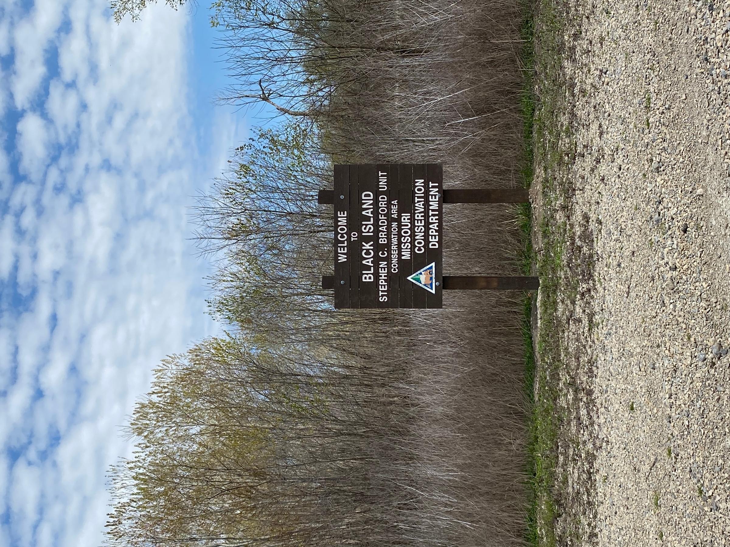
Black Island CA--Stephen C. Bradford Unit
Concord, Missouri 63851
A Birders' Guide to Black Island CA Stephen C. Bradford UnitWolf Bayou Unit Website
Stephen C. Bradford Unit Website
Gayoso Bend Unit Website
DeSoto Unit Website
Tips for Birding
About 400 feet after entering the area on CR 338, there is a parking lot to the left. From this lot it is possible to walk along a ditch northward about 300 yards. The trees and shrubs along the ditch often harbor warblers and tanagers, while the fields to the east are good for grassland species. This is also a good location to watch for flyovers.
A half mile further east on CR 338 there is a parking area with a gravel boat launch on the right. This spot offers a good view of a slough where there may be some waterfowl, and of more woodland species in the trees around the parking lot, as well as across the slough on the edge of the Gayoso Bend Unit.
One-third mile beyond the boat ramp parking area, CR338 reaches the eastern boundary of the Bradford Unit. If you stop here it is possible to walk north along the edge of the conservation area for some distance. To the west there are trees and brush that are good for passerines, and depending on conditions, there should be some marsh or shallow pond areas spanning the boundary. This marshy area has produced shorebirds and waders, including American Bitterns on one occasion.
Continuing one-half mile further east on CR338 (1.4 miles from the point where the road first entered the conservation area), CR339 branches off to the left (unmarked). The slightly raised roadbed provides another opportunity to view the marsh and shallow pond areas to the west and open fields to the east.
CR339 reaches a strip of conservation area at a tree line in 0.4 mile, and follows the area boundary north one-fourth mile to another tree line. At the second tree line, turn west to a parking area between fields. This area is mostly good for grassland species. It is marked as a primitive camping area on the MDC map. After this parking area, the road continues west and north by half-mile zig-zags to another parking lot (about 2 miles from the camping area in total). From here it is usually possible to walk west along a small ditch and tree line. There is excellent grassland habitat north of this line, and the trees have been good for warblers and orioles. There is a large shallow pond (marked “Big Lake” on the MDC map) southwest of this line that has been good for waders, gulls, and waterfowl, sometimes in large numbers. Depending on conditions it may be possible to walk to the levee about one-third mile west of the parking area.
If you return to the campground, you can follow CR339 one-half mile north to CR336. Continue a half mile east on CR336 to a junction with CR333. From here, go three-quarters of a mile north on CR333 to a parking area with a gate to the right. Walking in to the east about 1/3 mile you reach an extensive newly developed pond and wetland area and Robinson Lake, all of which should provide waders, shorebirds and waterfowl.
Birds of Interest
Waterfowl and waders abound in season. Grassland, agricultural fields, and forested areas produce characteristic passerines.
About this Location
From Hayti I-55 exit, take Highway 84 east, then County Road 337 north, and County Road 338 east to the area.
The Stephen C. Bradford Unit consists of a recently abandoned river channel of the Mississippi River. Two wetland pools were created, and are managed for waterfowl, wading birds and shorebirds. The remaining portion of the area is agriculture fields that are being converted to riverfront forest.
About Black Island Conservation Area
See all hotspots at Black Island Conservation Area
The area provides opportunities for outdoor recreation and is managed to maintain unique forest cover and aquatic resources. Forest cover in the Bootheel region is less than two percent of the land area. The forest is a remnant of the once extensive bottomland hardwood forest that covered more than two million acres of the Missouri Bootheel.
Notable Trails
There are no formally marked trails; opportunities for walking into various habitats are detailed above.
Features
Roadside viewing
Restrooms on site
Wheelchair accessible trail
Entrance fee
Content from A Birders' Guide to Black Island CA Stephen C. Bradford Unit and Wolf Bayou Unit Website
Last updated June 6, 2023
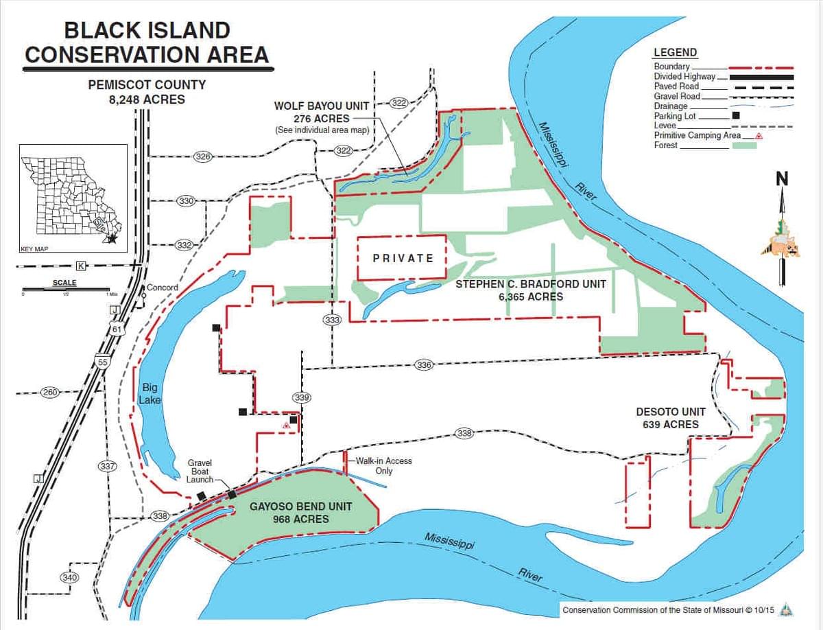 Black Island map
Missouri Department of Conservation
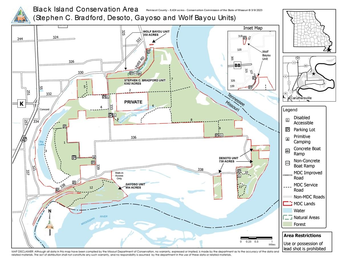 Black Island Conservation Area Map
Missouri Dept. of Conservation