Tonto NF--Miles Ranch (Pinal Co)
Tonto NF--Miles Ranch (Pinal Co)
Top-of-the-World, Arizona 85539
Official WebsiteWest Pinto Trail webpage
Tonto National Forest Official Website
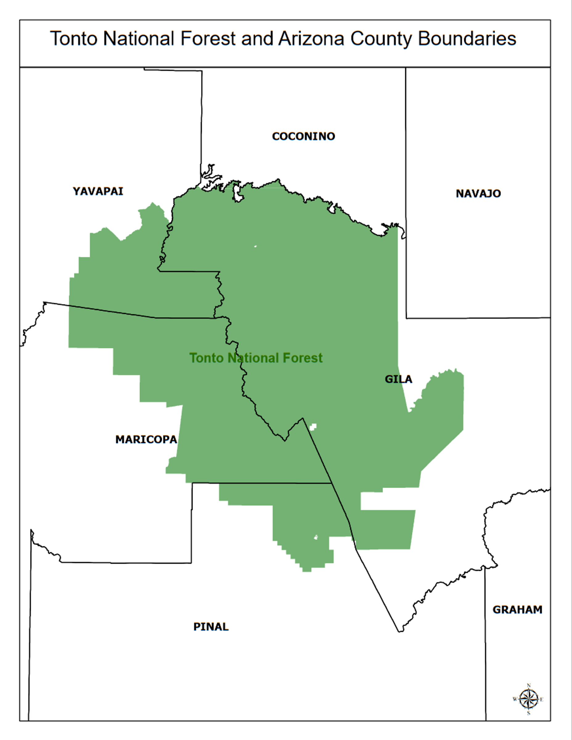
Tonto National Forest maps
About this Location
Miles Ranch Trailhead is a trailhead on West Fork Pinto Creek.
About Tonto National Forest
See all hotspots at Tonto National Forest
The Tonto National Forest features some of the country's most rugged and inherently beautiful lands. With nearly 600,000 acres of wilderness, there's a place for you to escape the rigors of modern society.
Sonoran Desert cacti and flat lands slowly give way to the highlands of the Mogollon Rim. This variety in vegetation and range in altitude, from 1,300 to 7,900 feet, offers outstanding recreational opportunities throughout the year, whether it's lake beaches or cool pine forests.
Eight lush wilderness areas, scenic flowing rivers, the Mogollon Rim's 200 miles of beauty, and some of the best trails in the country.
Notable Trails
Miles Ranch Trailhead
High-clearance vehicles are needed. Not recommended for horse trailers. Drive northeast from Superior on US-60 approximately 4 miles past “Top-of-the-World.” Turn left on the paved Pinto Valley Mine Road 287 (east of the Pinto Creek Bridge). This road is through a mining area and is often confusing. Follow this road approximately 6.5 miles to the Miles Ranch Road 287A turn-off. Turn left on this road for approximately 5.6 miles to the trailhead. Trails Accessed: West Pinto Trail 212, Rock Creek Trail 195.
West Pinto Trail
9 miles long. A scenic trail mostly located on the west fork of Pinto Creek. Steep grades on portions near Iron Mountain. The east section is in the canyon bottom, is subject to flooding, and may be difficult to follow. Elevation: 3,440 - 5,500 feet. Termini: Miles Ranch Trailhead (Forest Road 287A), and Trail 109 near Rogers Through Trailhead.
Content from Official Website, West Pinto Trail webpage, and Tonto National Forest Official Website
Last updated July 12, 2023