Bell's Neck Conservation Area--Bell's Neck Rd. Bridge
Bell's Neck Conservation Area--Bell's Neck Rd. Bridge
Bells Neck Road Harwich, Massachusetts 02645
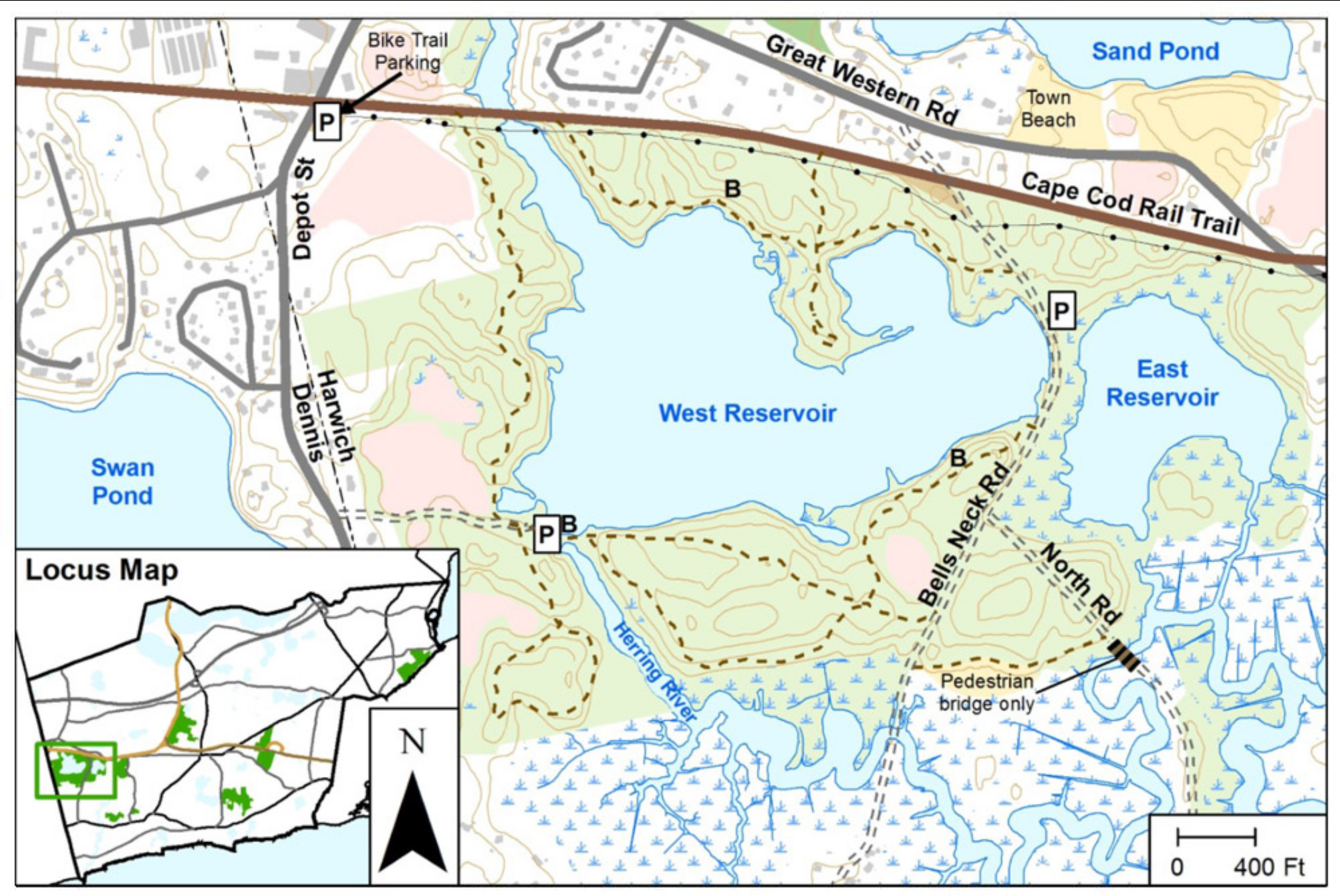
Bell's Neck Conservation Area Official WebsiteBells Neck Conservation Area map
About this Location
Bell's Neck Road Bridge is a historic structure that spans the Herring River in Harwich. The bridge provides access to the Bell's Neck Conservation Area.
About Bell's Neck Conservation Area
See all hotspots at Bell's Neck Conservation Area
Bells Neck Conservation is 259 acres with a total trail length of 2.75 miles.
In 1668, settler John Bell is believed to have acquired much of this land from the Saquatucket Native Americans. The land passed through multiple owners until nearly 300 years later, the town purchased it to protect the Herring River, West Reservoir, and buffering woodlands. Additional acreage was added over the years. The land surrounds the West Reservoir (freshwater) and East Reservoir (brackish). Trails offer views of wind-ruffled water and sweeping salt marsh. Watch for ospreys and the secretive black-crowned night heron in spring and summer. Each April, herring swim upstream along a herring ladder at the west trailhead. Canoeists and kayakers can launch near each trailhead.
Features
Roadside viewing
Restrooms on site
Wheelchair accessible trail
Entrance fee
Content from Bell's Neck Conservation Area Official Website
Last updated March 3, 2024