Mount Tom State Reservation--Lake Bray and Loop Trail
Mount Tom State Reservation--Lake Bray and Loop Trail
Easthampton, Massachusetts 01027
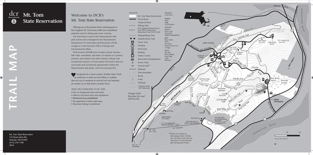
Mount Tom State Reservation Official WebsiteMount Tom State Reservation map
About this Location
The 2.1-mile Bray Lake Loop Trail circles Bray Lake, where there is fishing or canoeing in the warmer months. The trail goes through some rocky and steep sections, along Bray Brook, and crosses some wooden footbridges. The hike's highlight is the vantage point that offers stunning views of the Connecticut Valley and the Berkshires.
About Mount Tom State Reservation
See all hotspots at Mount Tom State Reservation
Mount Tom State Reservation covers more than 2,000 acres of land. The park is located in the Connecticut River Valley, just north of Springfield. The park offers 20 miles of hiking trails for all levels of experience, as well as fishing, canoeing, and cross-country skiing on Lake Bray. The park has views of the Pioneer Valley, the Berkshire Mountains, and the Pelham Hills.
The area is also a great place to bird watch, especially for hawks in the fall.
Notable Trails
The AllTrails website has a description and map of a hike on the Bray Loop Trail.
Features
Entrance fee
Restrooms on site
Wheelchair accessible trail
Content from Mount Tom State Reservation Official Website
Last updated January 6, 2024
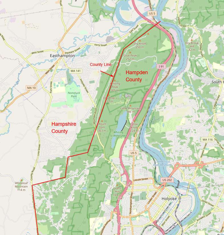 Map adapted from © OpenStreetMap contributors