Topping Farm Conservation Area
Topping Farm Conservation Area
Belchertown, Massachusetts 01007
Official WebsiteTopping Farm Conservation Area (Kestrel Land Trust) webpage
Topping Farm Conservation Area map
About this Location
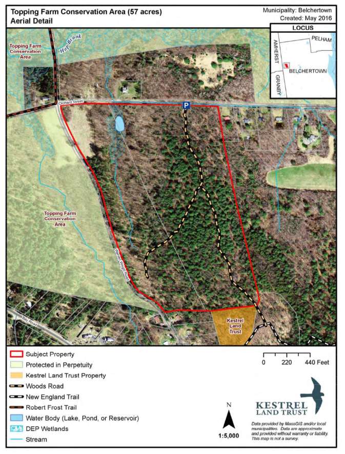
This 220-acre property is located in the northwest section of the town. It was purchased primarily because of its significance as aquifer protection land, benefiting the towns of Amherst, Pelham, and Belchertown. Hop Brook and its adjacent wetland bisect a major portion of the property. They recharge a major aquifer that underlies Lawrence Swamp and serves as a public water source for Belchertown and Amherst. The Topping Farm parcel is BioMap Supporting Landscape, buffering and almost connecting two large BioMap core habitats for the Lawrence swamp and the Holyoke Mt. Range. The Massachusetts Natural Heritage Program's list of endangered and rare species documents numerous species to be found on the site. Two small parking lots are located on Goodell St. and Orchard Rd. for public access and old logging roads traverse the property for hiking.
Encompassing forested slopes, open fields, Hop Brook, and expansive wetlands, the land nearly connects Lawrence Swamp and the Mt. Holyoke Range and provides scenic roadside views of a varied rural landscape.
Parking areas give access to exploring old logging roads on the upland portions of the conservation area. There are three parking areas: one off Goodell Street and two off Orchard Road (east and west of Warren Wright Road).
Features
Restrooms on site
Wheelchair accessible trail
Entrance fee
Content from Official Website and Topping Farm Conservation Area (Kestrel Land Trust) webpage
Last updated December 2, 2023