Westboro Reservoir
Westboro Reservoir
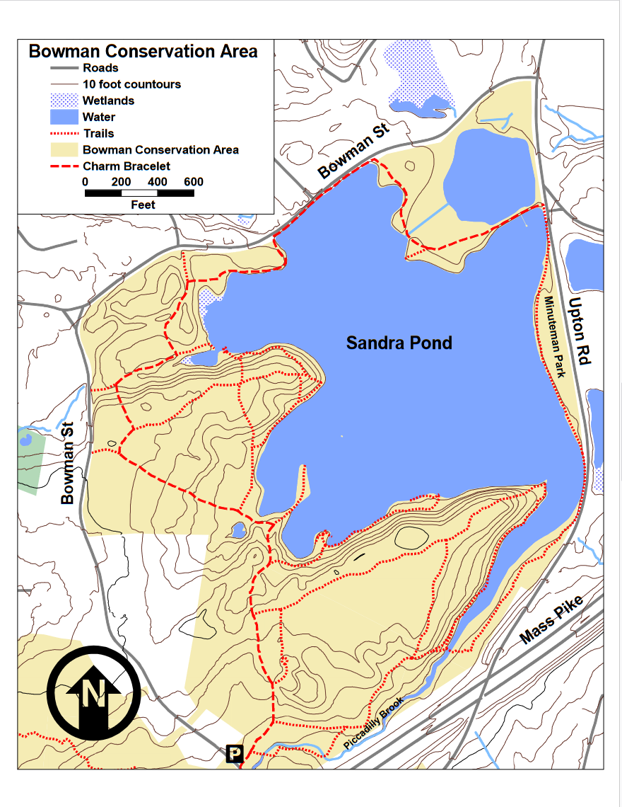
Bowman Conservation Area Westborough, Massachusetts 01581
Bowman Conservation Area trail map and guideAbout this Location
The Bowman Conservation Area was purchased by the town in the late 1960s to protect Sandra Pond, also known as Westboro Reservoir, then the town’s water supply. The woods of the conservation area are a mixture of hardwoods and red pines planted after the 1953 tornado devastated the area. Most walkers know of the limited trails displayed on the sign at the entrance to the area, but a much wider range of trails are available, including routes that circle the pond.
For a short walk head out to the peninsula on the Charm Bracelet and return this round trip is about 0.7 miles. A popular walk is to follow Piccadilly Brook as it flows into the cove in Sandra Pond. At 0.3 mile you will pass the rail crossing over the cove leading to Upton Road. In another 0.2 miles, you reach the main body of Sandra Pond from there climb the hill to reach the Charm Bracelet in another 0.3 miles. Turning left at this point will return you to the parking lot in 0.2 miles for a total walk of a mile. This walk can be extended another 0.4 miles, by turning right on the Charm Bracelet and heading to the peninsula, and returning to the parking lot.
Notable Trails
The AllTrails website has a description and map of a hike at Westboro Reservoir.
Features
Roadside viewing
Restrooms on site
Wheelchair accessible trail
Entrance fee
Content from Bowman Conservation Area trail map and guide
Last updated December 19, 2023