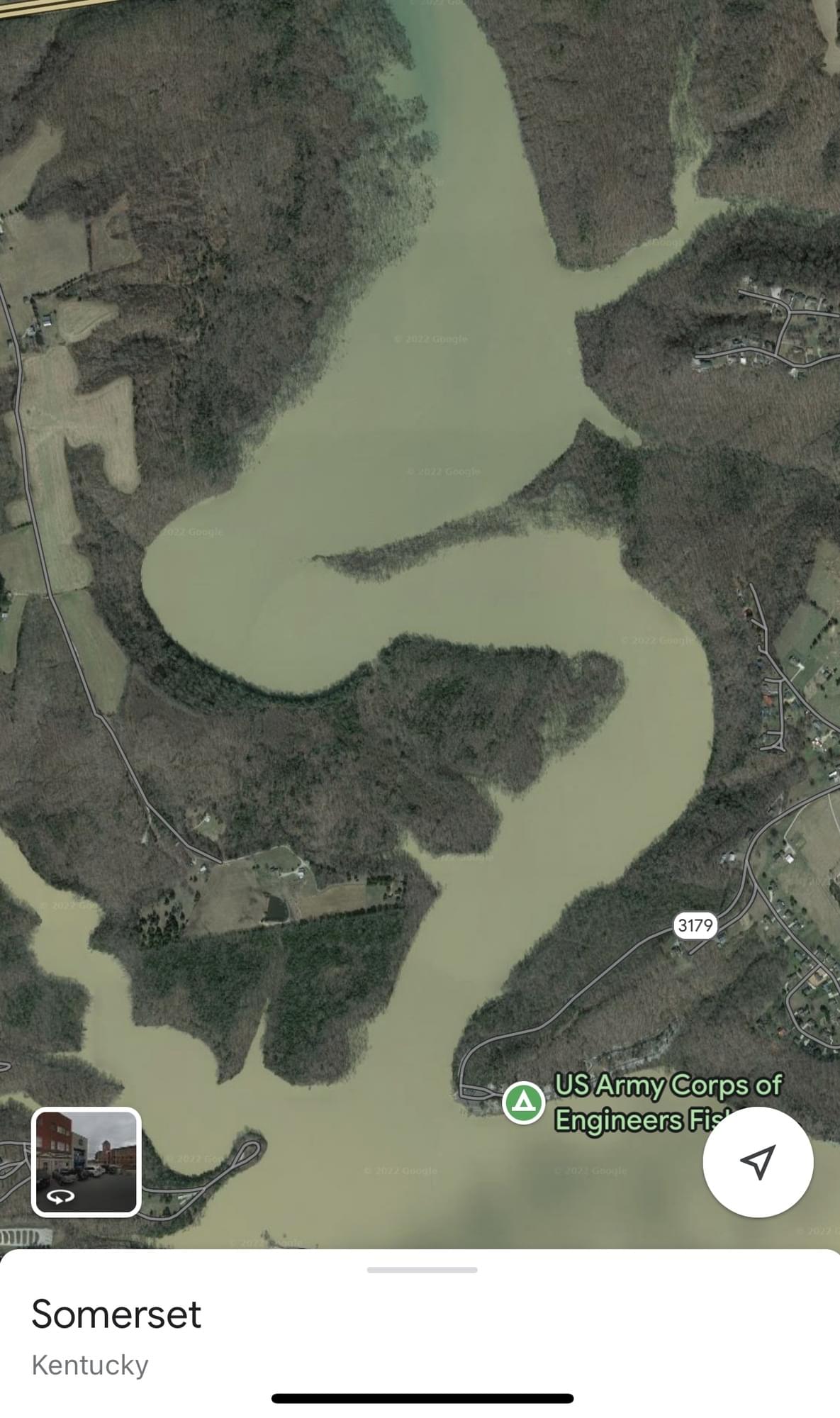
Fishing Creek Embayment, Horseshoe Bend Area (access via water)

Fishing Creek Embayment, Horseshoe Bend Area (access via water)
Lake Cumberland Nancy, Kentucky 42544
Lake Cumberland Official WebsiteLake Cumberland (US Army Corps of Engineers Nashville District) website
Lake Cumberland (Lakes online) lake level
Tips for Birding
Kayak, canoe, or boat needed to access.
Birds of Interest
Shorebirds, herons, Osprey, and Bald Eagle
About this Location
This hotspot must be accessed via the water. Put in at the Fishing Creek Recreation Area boat ramp or the Pulaski County Park boat ramp and head upstream. It is about 2 miles to the mudflats, which will be on the west side after rounding the bend. For shorebirds, go from late summer into fall. The summer pool for Lake Cumberland is 723 feet in elevation. The lake needs to be around 715 feet for a habitat to develop for shorebirds. As they drop the lake further the mudflat dries out and becomes unsuitable for shorebirds at around 700 feet elevation.
Link to check lake elevation: https://cumberland.uslakes.info/Level/
About Lake Cumberland
See all hotspots at Lake Cumberland
Lake Cumberland is the second largest lake in the Cumberland River System. The lake provides varied outdoor recreational opportunities for millions of visitors each year.
Lake Cumberland is located in Wayne, Russell, Pulaski, Clinton, McCreary, Laurel, and Whitley counties in Southeastern Kentucky on the Cumberland River. The damsite is at river mile 460.9 or about 10 miles southwest of Jamestown, Kentucky.
The Wolf Creek Project was authorized by the Flood Control Act of 1938 and the Rivers and Harbor Act of 1946. Construction of the project, designed and supervised by the U.S. Army Corps of Engineers, began in August 1941. After a three-year delay caused by World War II, the project was completed for full beneficial use in August 1952.
The dam was completed for flood control operation in 1950. Three of the six hydroelectric generating units were placed in operation in 1951 and the remaining three in 1952. Operation of the lake is for the primary purposes of flood control and the production of hydroelectric power. The cost of the project was approximately $80.4 million.
Features
Restrooms on site
Wheelchair accessible trail
Roadside viewing
Content from Lake Cumberland (Lakes online) lake level and Roseanna Denton
 Lake Cumberland