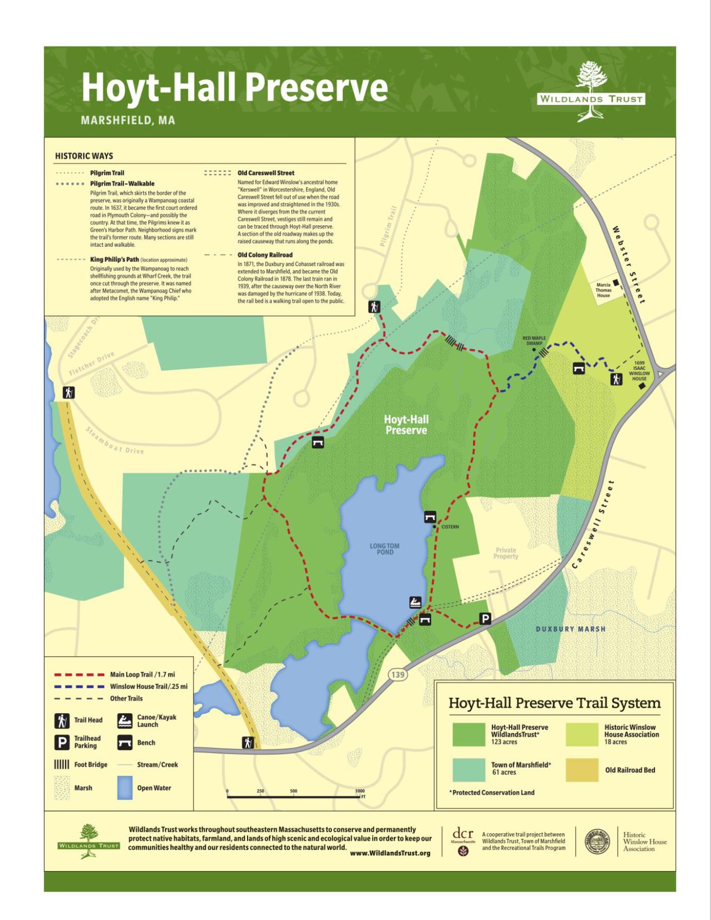
Hoyt-Hall Preserve
About this Location
Hoyt-Hall Preserve was created in 2000 when Wildlands Trust purchased this expansive open space to protect it from development. In partnership with the Town of Marshfield and the Historic Winslow House Association, Wildlands utilized DCR Recreational Trail Program funding to put in place a trail system that connects these adjacent conservation lands for your use and enjoyment.
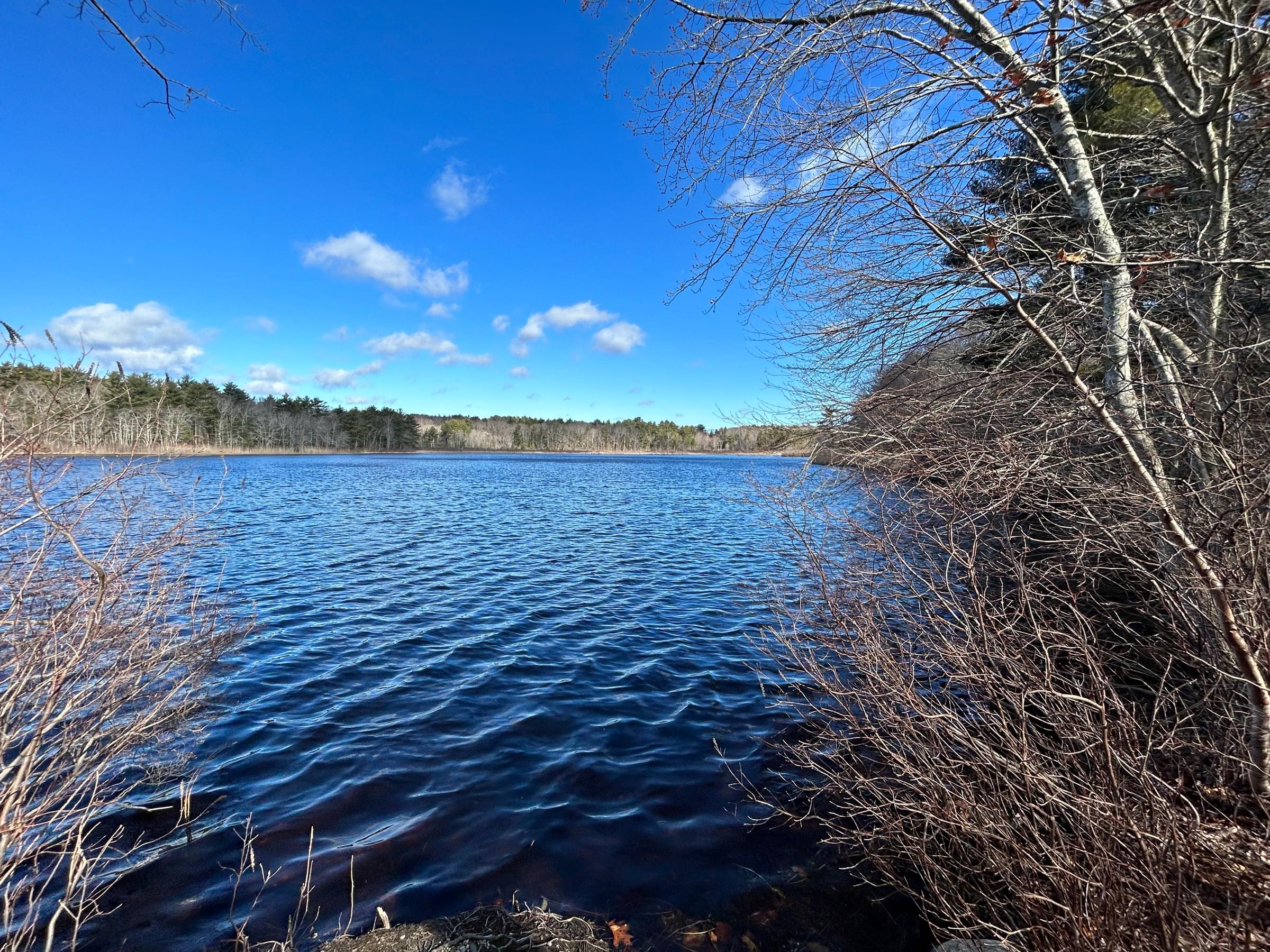
The varied topography of the preserve was shaped by the same retreating glacier that carved out the Cape and Islands some 14,000 years ago, creating dramatic eskers, lowlands, uplands, and depressions. Swamps, ponds, forests, and the former tidal marshes characterize the landscape.
The freshwater pond and marsh ecosystem supports a wide array of both aquatic and avian plant and animal species—possibly including the rare American bittern.
A young forest of white pine and mixed deciduous trees (mostly oak & maple) blankets the uplands, replacing old-growth trees cleared in the colonial era. Small and large forest mammals (including deer, coyote, mice, and rabbits), many species of birds, plants, insects, and fungi thrive in the canopy and under-story.
In the northeast portion of the preserve, several abandoned cranberry bogs are now well along in the successional process to red maple swamps. They host a variety of plants, amphibians, and invertebrates, many of which depend on the seasonally wet habitat to survive.
Notable Trails
Pilgrim Trail
Pilgrim Trail, which skirts the border of the preserve, was originally a Wampanoag coastal route. In 1637, it became the first court-ordered road in Plymouth Colony, and possibly the country. At that time, the Pilgrims knew it as Green’s Harbor Path. Neighborhood signs mark the trail’s former route. Many sections are still intact and walkable.
King Phillip's Trail
Originally used by the Wampanoag to reach shellfishing grounds at Wharf Creek, the trail once cut through the preserve. It was named after Metacomet, the Wampanoag Chief who adopted the English name “King Philip.”
Old Careswell Street
Named for Edward Winslow’s ancestral home “Kerswell” in Worcestershire, England, Old Careswell Street fell out of use when the road was improved and straightened in the 1930s. Where it diverges from the current Careswell Street, vestiges remain and can be traced through Hoyt-Hall preserve. A section of the old roadway makes up the raised causeway that runs along the ponds.
Old Colony Railroad
In 1871, the Duxbury and Cohasset railroad was extended to Marshfield and became the Old Colony Railroad in 1878. The last train ran in 1939 after the causeway over the North River was damaged by the hurricane of 1938. Today, the rail bed is a walking trail open to the public.
The AllTrails website has a description and map of a hike at Hoyt-Hall Preserve.
Features
Restrooms on site
Wheelchair accessible trail
Entrance fee
Content from Official Website
Last updated February 25, 2024