Cogswell Mountain Conservation Area, Gilmanton
Cogswell Mountain Conservation Area, Gilmanton
Gilmanton Iron Works, New Hampshire 03837
Cogswell Mountain Conservation Area mapAbout this Location
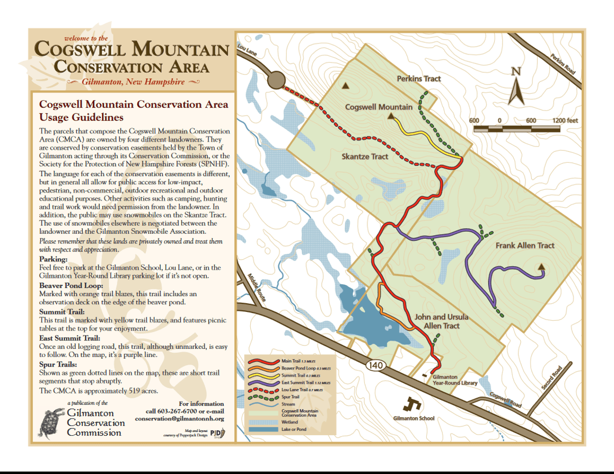
The parcels that compose the Cogswell Mountain Conservation Area (CMCA) are owned by four different landowners. They are conserved by conservation easements held by the Town of Gilmanton acting through its Conservation Commission, or the Society for the Protection of New Hampshire Forests (SPNHF). The language for each of the conservation easements is different, but in general, all allow for public access for low-impact, pedestrian, non-commercial, outdoor recreational, and outdoor educational purposes. Other activities such as camping, hunting, and trail work would need permission from the landowner. In addition, the public may use snowmobiles on the Skantze Tract. The use of snowmobiles elsewhere is negotiated between the landowner and the Gilmanton Snowmobile Association.
Please remember that these lands are privately owned and treat them with respect and appreciation.
Park at the Gilmanton School, Lou Lane, or if it is not open, in the Gilmanton Year-Round Library parking lot.
Notable Trails
Beaver Pond Loop
Marked with orange trail blazes, this trail includes an observation deck on the edge of the beaver pond.
Summit Trail
This trail is marked with yellow trail blazes and features picnic tables at the top.
East Summit Trail
Once an old logging road, this trail, although unmarked, is easy to follow. On the map, it’s a purple line.
Spur Trails
Shown as green dotted lines on the map, these are short trail segments that stop abruptly.
Features
Restrooms on site
Wheelchair accessible trail
Entrance fee
Content from Cogswell Mountain Conservation Area map
Last updated November 6, 2023