Mill Springs Park
Mill Springs Park
Monticello, Kentucky 42633
Official WebsiteLake Cumberland Official Website
Lake Cumberland (US Army Corps of Engineers Nashville District) website
Lake Cumberland (Lakes online) lake level
Tips for Birding
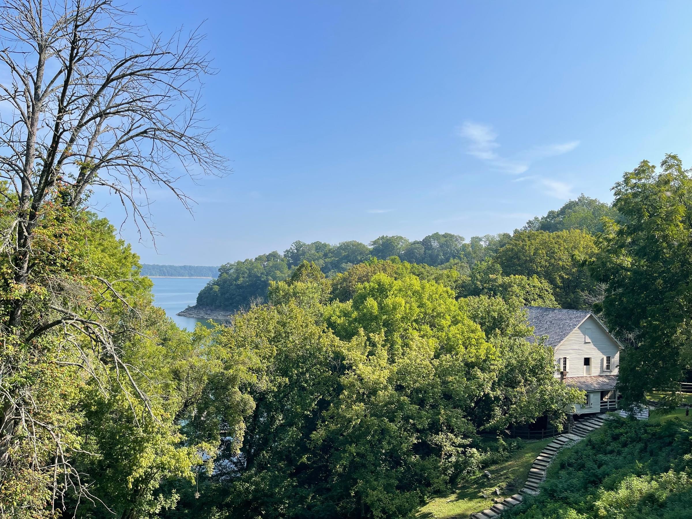
Bird the wooded trail .3 mile out to a point and scope the lake for water birds. The large cedar trees along the trail attracts frugivores during years with a good berry crop. Also, bird down the hill to the old mill and continue down to the water.
About this Location
This park has picnic tables, a wooded trail .3 mile out to a point that overlooks Lake Cumberland. The large cedar trees along the trail attracts frugivores during years with a good berry crop. There’s around 95 steps down the hill to the old mill and lake.
It all began in 1700 when hunters and explorers, called "Long Hunters", found a place "with excellent springs near a waterfall." The settlers were no doubt amazed at the sight of 13 springs flowing from the hillside! Here, Price's Station, one of the first settlements in Kentucky was established and eventually became a fur trading center. In 1774 Daniel Boone and Michael Stoner passed through this area.
The story of Mill Springs Mill began around 1817 when Charles, John and Dr. James Metcalf settled in the area and erected a cereal grinding mill, or a grist mill as they were usually called, for the milling of corn and wheat. The mill was equipped with 48 inch French burrs, millstones for grinding wheat and corn. Flour and cornmeal were custom ground for families who brought their grain by wagon or horseback on milling day.
In 1963 the Monticello Woman's Club and other civic organizations, with aid from the Kentucky Department of Highways, reactivated the mill. In 1973 the mill was designated as a National Historic Site. In 1976, a major restoration to the structure and grounds was completed by the U.S. Army Corps of Engineers. Traditional tools and skills were used to render the Mill as close to the original work as possible. The use of mortar was forgone to make the restorations as close to the original millwrights, Andrew Denney, as possible. Old fashioned cut nails and even the paint colors were carefully duplicated. Mill Springs is now on the National Register of Battlefields and is one of 25 Civil War battlefields that is included on a special Endangered Battlefield list.
About Lake Cumberland
See all hotspots at Lake Cumberland
Lake Cumberland is the second largest lake in the Cumberland River System. The lake provides varied outdoor recreational opportunities for millions of visitors each year.
Lake Cumberland is located in Wayne, Russell, Pulaski, Clinton, McCreary, Laurel, and Whitley counties in Southeastern Kentucky on the Cumberland River. The damsite is at river mile 460.9 or about 10 miles southwest of Jamestown, Kentucky.
The Wolf Creek Project was authorized by the Flood Control Act of 1938 and the Rivers and Harbor Act of 1946. Construction of the project, designed and supervised by the U.S. Army Corps of Engineers, began in August 1941. After a three-year delay caused by World War II, the project was completed for full beneficial use in August 1952.
The dam was completed for flood control operation in 1950. Three of the six hydroelectric generating units were placed in operation in 1951 and the remaining three in 1952. Operation of the lake is for the primary purposes of flood control and the production of hydroelectric power. The cost of the project was approximately $80.4 million.
Features
Restrooms on site
Entrance fee
Roadside viewing
Content from Official Website and Lake Cumberland (Lakes online) lake level
Last updated August 25, 2023
 Lake Cumberland