Lake Somerville SP (Lee Co.) (Nails Crk & Flag Pond)
Lake Somerville SP (Lee Co.) (Nails Crk & Flag Pond)
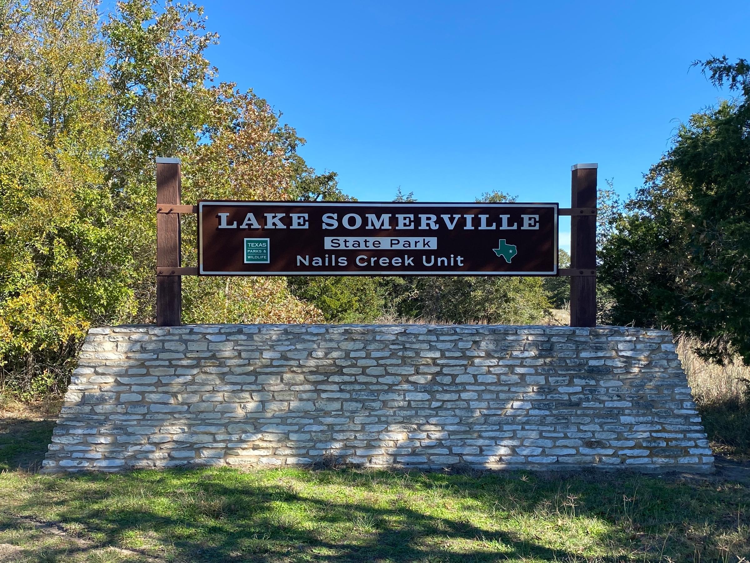
Nails Creek Unit 6280 FM 180 Ledbetter, TX 78946-7036 Latitude: 30.290719 Longitude: -96.667214
Official WebsiteLake Somerville State Park and Trailway Official Website
Tips for Birding
Check in at the main park entrance first to obtain your entrance permit. There is a per-person entrance fee to use the state park.
A state park pass might be a wise investment if multiple people are birding or if you think you will be accessing a Texas State Park multiple times over the next 12 months.
Check here to see if a state parks pass is right for you: https://tpwd.texas.gov/state-parks/park-information/passes/park-passes
After checking in at the headquarters, drive along the park roads very slowly, looking and listening. If it's a weekend or if the park is very busy, this might not be possible.
There are lots of places where the human-bird interface makes for a good birdy spot: by the RV dump station, in the campgrounds, around the horse corrals in the equestrian campgrounds.
Be sure to go to the boat ramp and scope the lake from there.
If the lake is low, it is possible to walk out onto the lake bed taking care to stop before sucking muds makes traveling difficult. In November, 2023, one of the better places to start walking out into the lake (only 60% full as of that date) was off the Rocky Point trail accessed from the Rocky Point day use area.
If you are a county birder, be careful about the boundary lines between Lee (Nails Creek Unit), Burleson (Birch Creek Unit) and Washington counties.
Birds of Interest
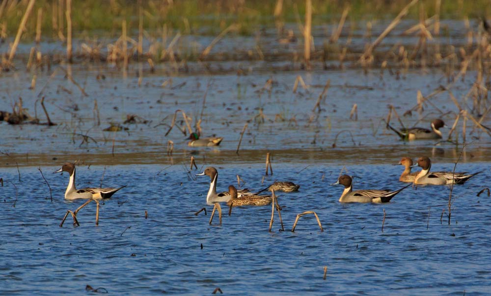
Winter waterfowl for sure. Lots of woodland species also.
Texas's first Snail Kite, found at Flag Pond (separate specific hotspot) in 2022, is mentioned here because this broader hotspot also includes Flag Pond.
If you go to Flag Pond separately from visiting Nails Creek (not walking over there on the trails from Nail's Creek, for example, but going to the separate entrance), please submit a separate checklist from and at the Flag Pond hotspot.
About this Location
Check in at the main park entrance first to obtain your entrance permit. There is a per-person entrance fee to use the state park.
A state park pass might be a wise investment if multiple people are birding or if you think you will be accessing a Texas State Park multiple times over the next 12 months.
Check here to see if a state parks pass is right for you: https://tpwd.texas.gov/state-parks/park-information/passes/park-passes
The Nails Creek unit of Lake Somerville State Park is at the end of Farm-to-Market Road 180
Park Hours
Open daily,
6 a.m. - 10 p.m. for day use
The park often reaches capacity. It is recommended to make reservations for both camping and day use. To guarantee entry, reserve passes online or by calling the customer service center before you visit.
Busy Season
First weekend in March through Fourth of July
About Lake Somerville State Park and Trailway
See all hotspots at Lake Somerville State Park and Trailway
Check in at the main park entrance first to obtain your entrance permit. There is a per-person entrance fee to use the state park.
A state park pass might be a wise investment if multiple people are birding or if you think you will be accessing a Texas State Park multiple times over the next 12 months.
Check here to see if a state parks pass is right for you: https://tpwd.texas.gov/state-parks/park-information/passes/park-passes
Four units make up Lake Somerville State Park. Birch Creek Unit is on the north side of the lake (in Burleson County), while Nails Creek Unit (in Lee County) is on the southwest side. The 13-mile Lake Somerville Trailway connects the two units. Somerville Public Hunting Land is nearby, also on the lake.
Birch Creek and Nails Creek offer access to the lake for fishing, boating, paddling and swimming. On land at either unit, you can camp, picnic, hike, ride mountain bikes, geocache, and go birding. Explore miles of multiuse trails.
The U.S. Army Corps of Engineers began building Lake Somerville in June 1962. Deliberate impoundment of water began in January 1967.
The dam is located on Yegua Creek, 20 miles upstream of where it joins the Brazos River, and about two miles south of Somerville. The lake covers 11,630 acres and has an 85-mile shoreline. Its main purposes are flood control, municipal water supply and recreation.
TPWD leased the complex from the federal government in 1969 and opened it in 1970. TPWD manages the Somerville Public Hunting Land under a license agreement and in cooperation with the U.S. Army Corps of Engineers.
Flag Pond is a 350-acre impoundment in the Yegua Creek watershed along the Trailway. A private hunting club originally developed the pond in 1926.
Enjoy, but do not disturb historical places. If you find an artifact, leave it in place and let park staff know.
Notable Trails
In the Nails Creek Unit
Cedar Creek Loop
(Nails Creek)
2.1 mi.1.5 hrs.
Moderate
Offers great access to fishing and wildlife-viewing.
See map images for a larger version of the trail map PDF to see additional trails at the Nails Creek unit.
Notable Trails throughout the State Park
The Lake Somerville Trailway connects Birch Creek and Nails Creek units via a trail around the west end of Lake Somerville. The Trailway’s 26 miles of interconnected trails and loops let you explore the shoreline.
Those miles of trail cross through yaupon, post oak, hickory, blackjack oak and water oak forests, and pass scenic overlooks and water crossings.
All trails are open to hikers, mountain bikers and horseback riders. Please be courteous to other trail users.
Note: Obtain permits at either unit's headquarters. Equestrian parking for the Trailway is permitted at the access gate on CR 125 and CR 140. Contact the park for the most recent information.
Access the primitive group camping areas along the Trailway. Fires are allowed in established fire rings except when county-wide burn bans are in place. This site does not have potable water. Several chemical toilets (port-a-potties) are along the trails.
Well water for horses (not humans) is at Newman Bottom and Wolf Pond.
Flag Pond
Follow the Trailway about 4 miles from Nails Creek Unit (9 miles from Birch Creek) to Flag Pond, home to birds and other wildlife.
The pond is a 350-acre impoundment in the Yegua Creek watershed. It’s a natural depression which serves as wetland habitat for waterfowl in the winter. A private hunting club originally developed the pond in 1926.
A system of trails and the Flag Pond Observation Center surround the pond today. You can view wildlife and take photographs from all angles.
Features
Restrooms on site
Wheelchair accessible trail
Entrance fee
Roadside viewing
Content from Official Website, Lake Somerville State Park and Trailway Official Website, and kz 11/23/2023
Last updated January 23, 2024
 More detailed image of the Nails Creek Unit trail map
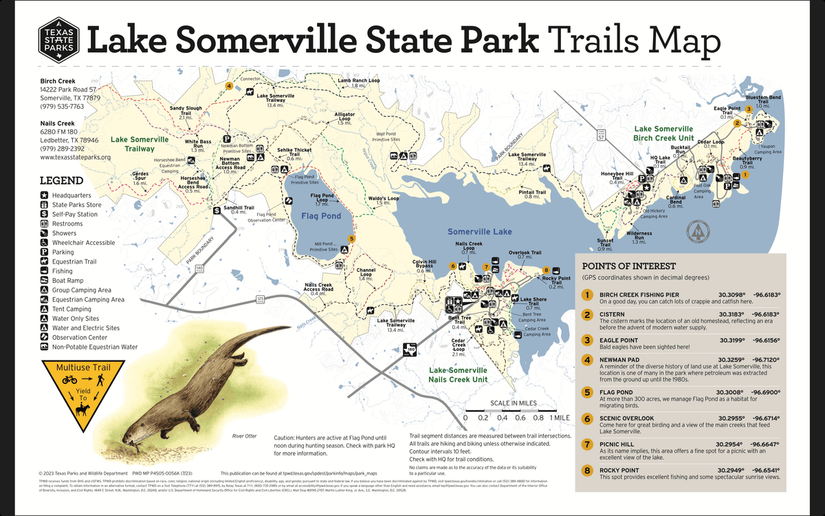 Trails Map
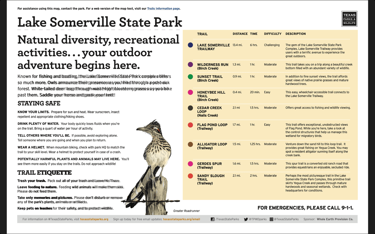 Trails Descriptions