Southern New England Trunkline Trail--Center St. to Lake St., Bellingham
Southern New England Trunkline Trail--Center St. to Lake St., Bellingham
Bellingham, Massachusetts 02019
Official WebsiteSouthern New England Trunkline Trail map
About this Location
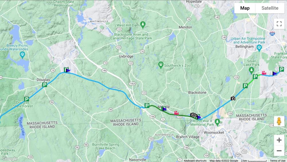
The Southern New England Trunkline Trail (SNETT) is a recreational trail along a former railroad corridor that runs approximately 22 miles from the Franklin State Forest on the east, to the Douglas State Forest on the west. It passes through the towns of Franklin, Bellingham, Blackstone, Millville, Uxbridge, and Douglas; and is one of the longest rail trails in southern Massachusetts. The Massachusetts Department of Conservation and Recreation (DCR) owns the trail corridor. Most of the trail is currently gravel surface and is used by various recreational users. DCR is actively working with towns and other trail stakeholders to maintain and improve the trail surface. A 3.7-mile portion of the SNETT in Blackstone, Millville, and Uxbridge is also currently being developed as a paved multi-use trail as a part of the Blackstone River Greenway.
Features
Wheelchair accessible trail
Restrooms on site
Entrance fee
Content from Official Website
Last updated February 11, 2024