Cibola NF--Bear Trap Canyon Campground
Cibola NF--Bear Trap Canyon Campground
Magdalena, New Mexico 87825
Official WebsiteCibola National Forest Campgrounds map
Cibola National Forest Official Website
Tips for Birding
This is one of 8 hotspots in the northern San Mateo Mountains, and should not be confused with the newer, more southerly hotspot, named simply Bear Trap Canyon.
Birds of Interest
Owing to winter road and campground closures, almost all records for the northern San Mateos are during the 5 months May-September. Species frequently found here include: Common Nighthawk, Common Poorwill, Mexican Whip-poor-will, Broad-tailed Hummingbird, Flammulated Owl, Northern Pygmy Owl, Plumbeous Vireo, Clark’s Nutcracker, Mountain Chickadee, both Ruby-crowned and Golden-crowned Kinglet, Grace’s Warbler, and Red-faced Warbler. American Goshawk has been listed on multiple occasions.
eBird listers will play an important role in documenting species frequency/abundance changes since the Bear Trap Fire of May 2022.
About this Location
Bear Trap Canyon stretches over 13 miles up the pine-and-juniper-covered western slope of the San Mateo Mountains, running roughly northwest from its confluence with Pigeon Canyon in the south. Now a popular destination for hikers, campers, and birdwatchers, the canyon was named for bear traps that were once used by trappers in the area. The canyon is home to a variety of wildlife, including bear, elk, deer, coyote, and a variety of birds.
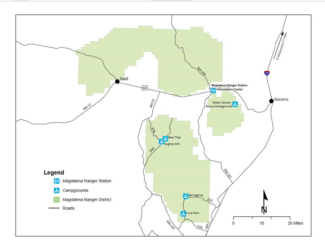
Hiking trails include the Bear Trap Canyon Trail, which is a 2.5-mile loop trail that takes hikers through the canyon and up to the top of Mount Withington; it's a steep climb. The Bear Trap Canyon Campground located in the north of the canyon at 8600 feet above sea level has 4 campsites and a picnic area, but no water.
The best time to visit Bear Trap Canyon is during spring or fall when the weather is mild. Aside from the possibility of snow, monsoon rains make it prudent to check weather conditions before you go.
FR-549, also known as Bear Trap-Withington Road and Old State Highway 52, runs along Bear Trap Canyon and includes two campgrounds, Bear Trap and Hughes Mill, between its intersection with FR-476 and FR-91.
About Cibola National Forest
See all hotspots at Cibola National Forest
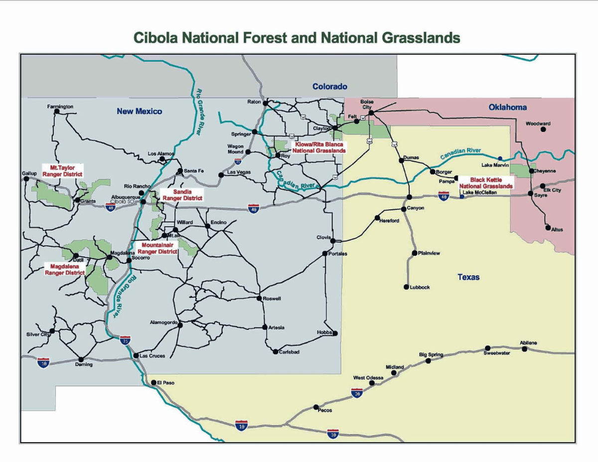
Cibola National Forest covers more than 1.6 million acres and includes mountains, grasslands, wilderness, and forests. The name Cibola comes from the Zuni word for their tribal lands, which the Spanish later translated as "buffalo". The forest is home black bears, cougars, elk, and pronghorn. Cibola National Forest offers many recreational opportunities including hiking, camping, fishing, hunting, and skiing. It also has cultural and historical significance, as it contains ancient Native American sites and historic trails.
The National Forest has four ranger districts: Sandia, Mountainair, Magdalena, and Mount Taylor. In addition, the Cibola has four wilderness areas: Sandia Mountain, Manzano Mountain, Withington, and Apache Kid.
Notable Trails
Forest Service trails in the area include Trail #38 - Potato Canyon, Trail #64 - Chimney Trail, Trail #65 - Hughes Mill Trail, and Trail #91 - Monica Trail.
Features
Restrooms on site
Roadside viewing
Wheelchair accessible trail
Entrance fee
Content from Official Website, Cibola National Forest Official Website, and John Montgomery
Last updated February 10, 2024