Mendon Town Forest
About this Location
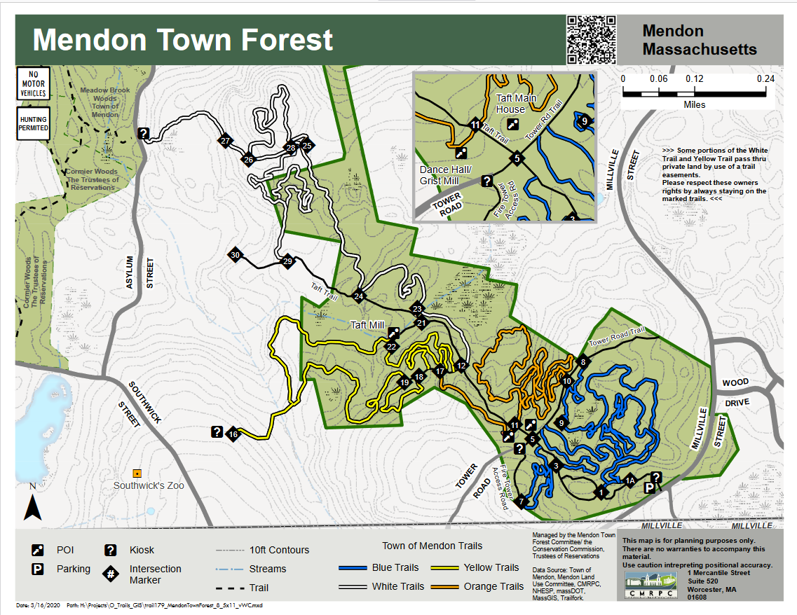
The Mendon Town Forest is accessible to hikers, mountain bikers, equestrians, bird watchers, winter sports enthusiasts, and school groups with a focus on nature, geological study, and 19th-century Agricultural and Early Industrial Period Mendon History.
This 120-acre tract is the second-highest elevation in Worcester County. During the late 1800s and early 1900s, it was not only a center of recreational activity; it was an agricultural and lumber manufacturing community. There are several historical sites within the Forest and the Massachusetts Historical Commission has requested that the Town consider doing an archeological reconnaissance survey of the Town Forest.
The eastern boundary of the Town Forest abuts the Southwick Zoo and the Zoo property abuts the 175 acre Cormier Woods and 90 acre Meadow Brook Woods. Peter Brewer and Justine Southwick Brewer have generously donated legal easements to the Town of Mendon that will connect both tracts of conservation land to the Forest. The Committee’s long-term goals are to create a protected greenway that would connect the Mendon Town Forest with the nearby Quissett Wildlife Management Area, an 800-acre tract of land that straddles the Mendon and Blackstone town line, and the Daniels Farm. In addition, the Mendon Land Use Committee has received a grant that will add 100 acres off Lake Nipmuc that can eventually be connected to the Forest.
Notable Trails
The AllTrails website has descriptions and maps of hikes at Mendon Town Forest.
Features
Restrooms on site
Wheelchair accessible trail
Entrance fee
Content from Official Website
Last updated December 15, 2023