JD Murphree WMA--Salt Bayou Unit--Lost Lake Rookery
JD Murphree WMA--Salt Bayou Unit--Lost Lake Rookery
Wildlife Management Areas of the Texas Official WebsitePublic Hunting Lands Map booklet
J.D. Murphree Wildlife Management Area Official Website
About this location
About Wildlife Management Areas of the Texas
See all hotspots at Wildlife Management Areas of the Texas
Many Texas Wildlife Management Areas are open for activities such as biking, primitive camping, birding, fishing, hiking, equestrian activities, driving tours, and wildlife viewing.
Many times you need minimally a Texas Limited Public Use Permit (LPU - #175). You can purchase a Limited Public Use Permit or Annual Public Hunting Permit at any location that sells hunting licenses or at the Texas License Connection. If purchased online a representation of receipt is acceptable until official printer version has been mailed to you. In some cases it's not obvious when you need a permit for a Texas Wildlife Management Area so it might be better to be safe, because Texas game wardens do check for such permits.
About J.D. Murphree Wildlife Management Area
See all hotspots at J.D. Murphree Wildlife Management Area
In 1963, the Wildlife Management Area (WMA) was named in honor of John David Murphree, a Texas Game Warden who was murdered by a duck poacher in Jasper County.
The original 8,200 acres of land for the wildlife management area was purchased in 1957 from the William Perry Herring McFaddin heirs. The McFaddin family owned thousands of acres of land of which some was received for service in the Texas army during the Texas Revolution. William M. McFaddin, his son William Perry Herring McFaddin and family were pioneer settlers in the Beaumont area who were involved in ranching, rice farming, commercial, fur trapping, and searching for oil.
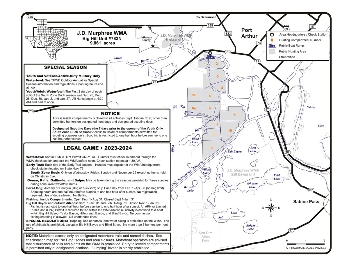
The J. D. Murphree WMA is a 25,852-acre tract of fresh, intermediate and brackish water coastal marsh on the upper coast of Texas. These wetlands are part of the Texas Chenier Plain, the westernmost geologic delta of the Mississippi River. The original 8,312 acres of the Big Hill Unit were acquired in 1958 using funds generated by waterfowl stamp and hunting license sales. The Lost Lake Unit was acquired in 1983 through mitigation. In August 1997, 11,231.23-acre tract was added to the Area in a trade of Sheldon WMA lands for lands in Sea Rim State Park. This acreage was added to the Lost Lake Unit and re-designated as the Salt Bayou Unit (15,595 acres). In 2019, an additional 1,280 acres of freshwater marsh was added to the Big Hill Unit. The Area represents the coastal marshes of the Texas Chenier Plain and is managed as wetland habitat with a special emphasis on migratory waterfowl habitat. The Hillebrandt Unit (591 acres) was added to the Area as mitigation in 1987.
The WMA headquarters is on the south side of Highway 73 near the intersection of Jade Avenue in Port Arthur.
Content from Wildlife Management Areas of the Texas Official Website, Public Hunting Lands Map booklet, Dell Little, and Dell Little
 Dell Little
 Dell Little