Lowell Woods
About this Location
Stretching from one end of Gay Street, behind the Hanlon School to High Street behind Farm Lane to the end of the Sandy Valley Road extension, this area contains some of the newest conservation land in Westwood. The contiguous Conservation Commission sites of Lowell, Mulvehill, Grimm, and Sandy Valley combined with town-owned Shuttleworth and Wheeler Pond parcels offer over 290 acres of scenic beauty, and historic and natural wonderment.
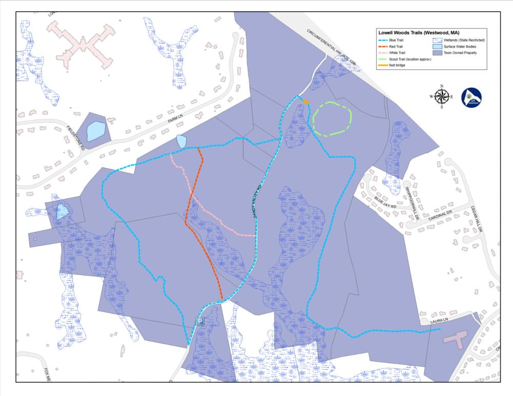
The Lowell Woods has miles of marked trails and varied terrain and woodlands. There is a picnic area, a small pond, and several wetland areas to enjoy. A picturesque bridge crossing Purgatory Brook is a favorite stopping point for many hikers. Some of the fun names of the trail system indulge the active imagination of many visitors. Antler Alley, Dead Swamp Road, Purgatory Pass, and Rocky Ridge, to name a few, provide habitat for deer, coyotes, hawks, owls, small woodland creatures, and dozens of birds. The wide variety of wildlife, woodlands, wetlands, and rock outcroppings and the feeling of great expanse make an outing to this area worthwhile. Passive recreational activities abound with hiking, birding, biking, snowshoeing, and cross-country skiing.
One of the parcels, Mulvehill, acquired in 1969, was once one of the earlier dairy farms in the area long owned by the Mulvehill family, a well-known name in the early history of Westwood. The headwaters of the Purgatory Brook, which is a groundwater supply system for Westwood and an important tributary of the Neponset River, make this parcel an important environmental resource.
Access to this area is from two Trailheads, behind the Hanlon School on Gay Street and at the end of the Sandy Valley Road extension.
Features
Restrooms on site
Wheelchair accessible trail
Entrance fee
Content from Westwood Open Space brochure
Last updated February 8, 2024