Lake Somerville SP- Birch Creek Unit (PPW-W 005) (Burleson Co.)

Lake Somerville SP- Birch Creek Unit (PPW-W 005) (Burleson Co.)
Birch Creek Unit 14222 Park Road 57 Somerville, TX 77879-9713 Latitude: 30.308582 Longitude: -96.634692 (979) 535-7763
Official WebsiteBirch Creek Unit Park map
Lake Somerville State Park and Trailway Official Website
About this Location
Hours
Open daily,
6 a.m. - 10 p.m.
The park often reaches capacity. It is recommended to make reservations for both camping and day use. To guarantee entry, reserve passes online or by calling the customer service center before you visit.
Busy Season
First weekend in March through Fourth of July
About Lake Somerville State Park and Trailway
See all hotspots at Lake Somerville State Park and Trailway
Check in at the main park entrance first to obtain your entrance permit. There is a per-person entrance fee to use the state park.
A state park pass might be a wise investment if multiple people are birding or if you think you will be accessing a Texas State Park multiple times over the next 12 months.
Check here to see if a state parks pass is right for you: https://tpwd.texas.gov/state-parks/park-information/passes/park-passes
Four units make up Lake Somerville State Park. Birch Creek Unit is on the north side of the lake (in Burleson County), while Nails Creek Unit (in Lee County) is on the southwest side. The 13-mile Lake Somerville Trailway connects the two units. Somerville Public Hunting Land is nearby, also on the lake.
Birch Creek and Nails Creek offer access to the lake for fishing, boating, paddling and swimming. On land at either unit, you can camp, picnic, hike, ride mountain bikes, geocache, and go birding. Explore miles of multiuse trails.
The U.S. Army Corps of Engineers began building Lake Somerville in June 1962. Deliberate impoundment of water began in January 1967.
The dam is located on Yegua Creek, 20 miles upstream of where it joins the Brazos River, and about two miles south of Somerville. The lake covers 11,630 acres and has an 85-mile shoreline. Its main purposes are flood control, municipal water supply and recreation.
TPWD leased the complex from the federal government in 1969 and opened it in 1970. TPWD manages the Somerville Public Hunting Land under a license agreement and in cooperation with the U.S. Army Corps of Engineers.
Flag Pond is a 350-acre impoundment in the Yegua Creek watershed along the Trailway. A private hunting club originally developed the pond in 1926.
Enjoy, but do not disturb historical places. If you find an artifact, leave it in place and let park staff know.
Features
Restrooms on site
Wheelchair accessible trail
Entrance fee
Roadside viewing
Content from Official Website, Birch Creek Unit Park map, Lake Somerville State Park and Trailway Official Website, and kz 11/23/2023
Last updated January 23, 2024
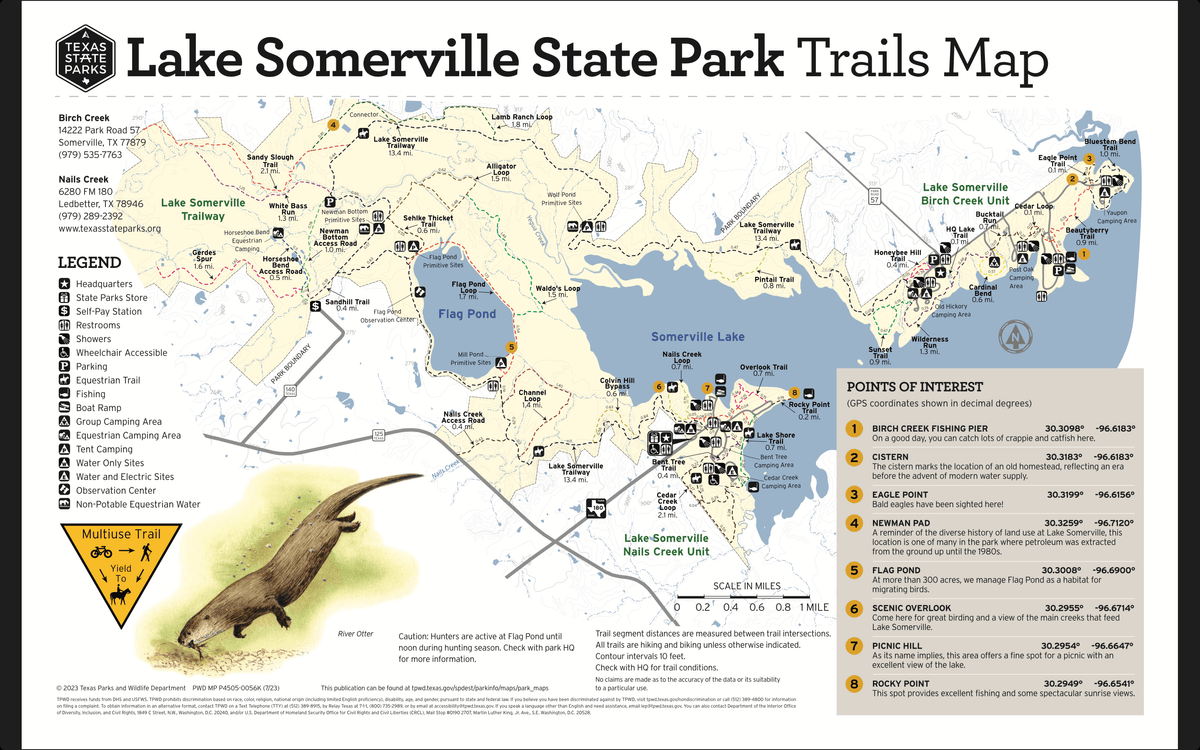 Trails Map
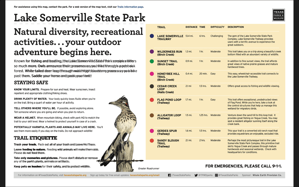 Trails Descriptions