Weathersfield Town Forest
Weathersfield Town Forest
Weathersfield, Vermont 05156
Official WebsiteWeathersfield Town Forest master plan with maps
About this Location
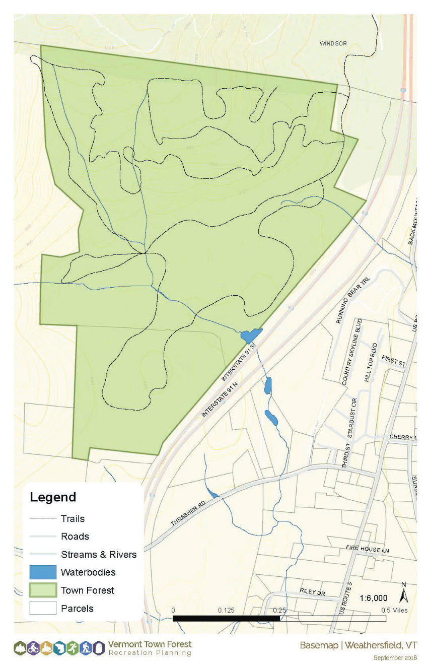
Weathersfield Town Forest borders Interstate 91 and Mount Ascutney State Park. There is currently no public road access to the forest. As a result, the forest sees minimal use. The property contains an old logging road network, a cabin, a network of former private trails, and VAST trails. The town has not constructed any new trails or other infrastructure since acquiring the land in 2010. Recently, the town obtained access for public parking and is now planning for an increase in users with improved access. The forest is part of the town’s economic development plan, which includes a regional plan to create trail connections between area villages, mountains, and recreation areas.
Weathersfield (population 2794) has a 310-acre forest that is an integral part of the town’s economic development plan, which calls for an integrated trail system connecting villages, hamlets, and recreational areas throughout the town. Weatherfield is interested in developing a trail plan that provides a solid foundation of the multi-recreational trail system, conservation of wildlife habitat, and a stronger community connection to the town forest.
Features
Restrooms on site
Wheelchair accessible trail
Entrance fee
Content from Official Website
Last updated October 8, 2023