Inks Lake SP--Inks Lake Bird Blind (separate gated entrance)
Inks Lake SP--Inks Lake Bird Blind (separate gated entrance)
Burnet, Texas 78611
Inks Lake State Park Official WebsiteInks Lake State Park campground map
Inks Lake State Park interactive trail map
Tips for Birding
Check-in at the main park entrance first to obtain your entrance permit. There is a per-person entrance fee to use the state park. A state park pass might be a wise investment if multiple people are birding or if you think you will be accessing a Texas State Park multiple times over the next 12 months (which is highly likely if you are birding in the valley for several days).
Check here to see if a state parks pass is right for you: https://tpwd.texas.gov/state-parks/park-information/passes/park-passes
The bird blind is a large structure built by the Highland Lakes Master Naturalists chapter. It is maintained by volunteers and the refilling of bird feeders is somewhat sporadic. Unfortunately, a lot of the birds at the blind itself seem to be what most birders would consider trash birds—cowbirds, grackles, starlings, blackbirds, and house sparrows. There is a water feature at the blind which is helpful, especially in dry periods. The blind can be hot in the warm months despite the ceiling fan and some netting/mesh used for walls to try to allow for air circulation.
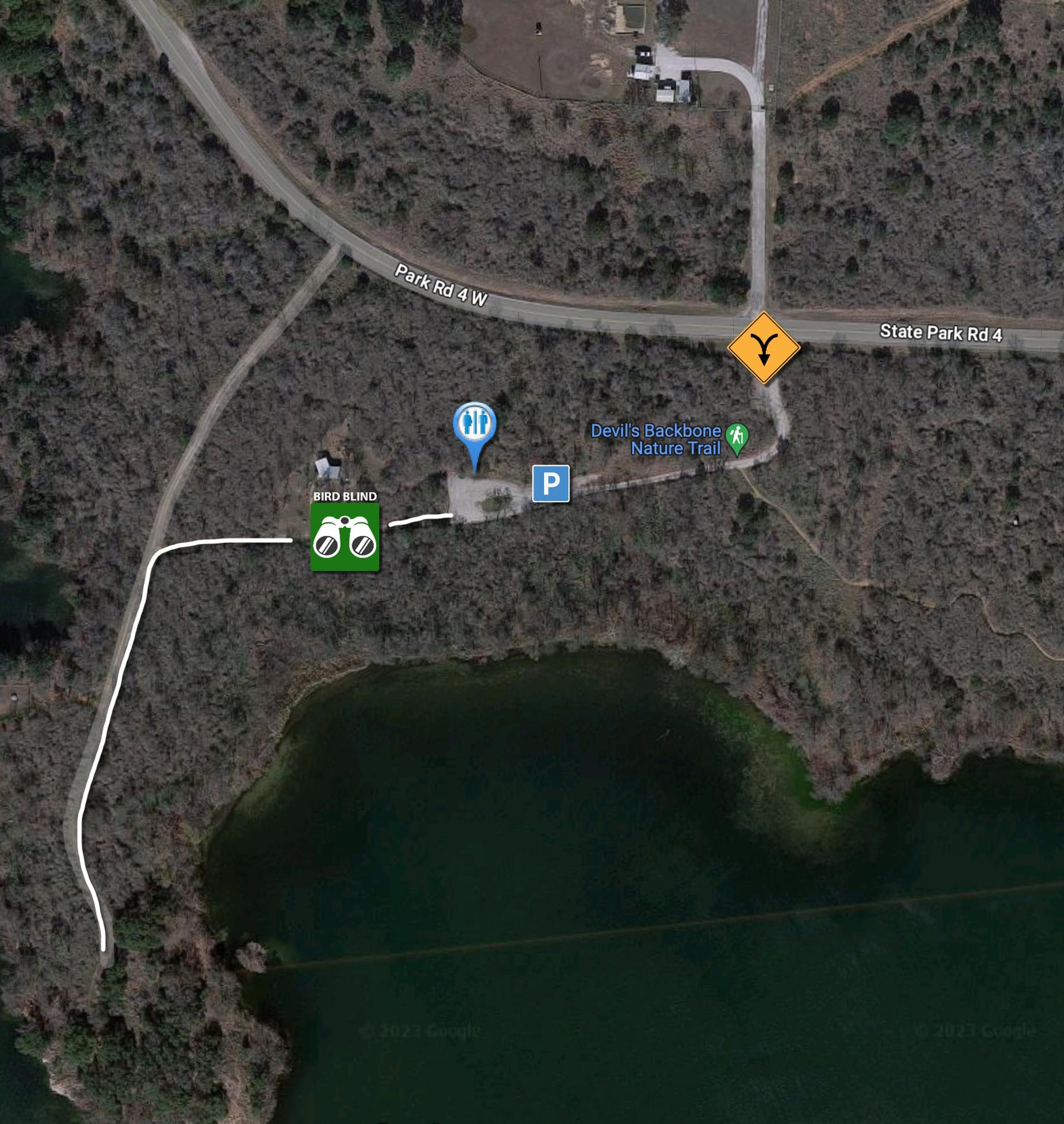
After checking out the blind, continue west from the blind (leading away from the parking area from which you have just come). When you hit a “T" intersection, turn left heading south. You will be running along a peninsula which extends out into Inks Lake so you will be surrounded by water on three sides. You can see little bits and pieces of the lake. Waterfowl can be found in an inlet cove on the west side just south of the “T” intersection and just before arriving at the water plant. This is a great place to walk quietly and maybe pish a little bit to see what you can pull up out of the dense woods and thickets. There is also a Wood Duck box on the west side of the trail just before the water plant.
You can continue past the water plant if you are willing to bushwhack on an un-maintained path. At the end of the peninsula, it is possible to walk out onto granite outcroppings which overlook the lake from where you can scope for more waterfowl.
Birds of Interest
Black-capped Vireo (BCVI) would be the main bird of interest here but has only been reported two times. Dates for Black-capped Vireos generally are mid to late April through early July. One would be more likely to hear a BCVI rather than see it, so 1) be sure to know the sound of a BCVI, 2) have your Merlin Bird ID Sound ID app up to date with the Texas-Oklahoma bird pack downloaded and 3) count yourself extremely lucky, fortunate and blessed if you get to see—not just year—a BCVI.
Painted Buntings are fairly prevalent from late April to mid-August. Orange-crowned and Yellow-rumped Warblers, Spotted Towhees, and other sparrows such as White-crowned, Chipping and Lincoln’s can be found here in the winter.
About this Location
Check-in at the main park entrance first to obtain your entrance permit. There is a per-person entrance fee to use the state park. A state park pass might be a wise investment if multiple people are birding or if you think you will be accessing a Texas State Park multiple times over the next 12 months (which is highly likely if you are birding in the valley for several days).
Check here to see if a state parks pass is right for you: https://tpwd.texas.gov/state-parks/park-information/passes/park-passes
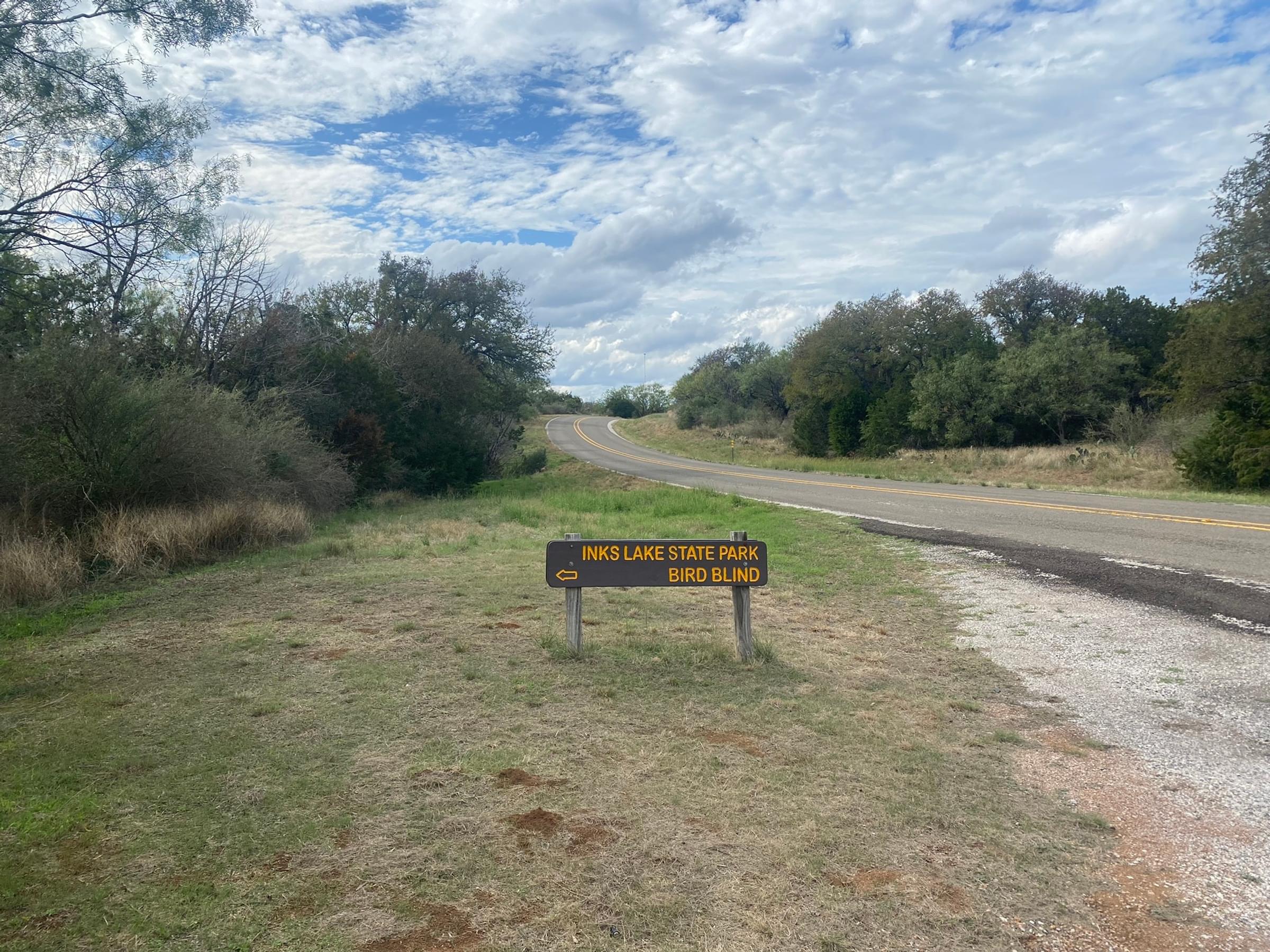
After checking in at the main entrance (and using the toilet facilities if you wish to use a flush toilet), drive 2.25 miles north on Park Road 4 to the “Inks Lake State Park Bird Blind” entrance. If the new entrance station is open (estimated completion in late 2023 or early 2024), the distance to the bird blind gate will be 1.8 miles north of the new main park entrance.
Once you enter the gate at the bird blind, drive all the way to the end of the gravel road (past the right-angle turn in the road). Park and use the wheelchair-accessible Port-a-Potty if you wish. Then walk or wheel towards the locked gate. There is a “walk around” spot just to the right of the gate.
There is "roadside" viewing driving on Park Road 4 to the entrance gate for the bird blind (though do watch for traffic which is fairly light on this stretch of the road) and also along the drive to the blind itself.
About Inks Lake State Park
See all hotspots at Inks Lake State Park
Inks Lake
About 8,000 years ago, prehistoric peoples lived and worked here along the banks of the Colorado River. Later, Spanish and Anglo settlers built communities in the area. A dependable water source, abundant fish and game, and the area’s natural beauty combined to make this an inviting location. Those same features bring people to the shores of Inks Lake today.
For early Hill Country residents, the river proved as much a danger as a blessing. The Colorado River, the largest river entirely within the state of Texas, has a 900-mile course, through which almost 600 billion gallons of water flow in a typical year. Steep slopes and thin, rocky soils channeled runoff into the river, causing frequent, devastating floods.
Created as a means of flood control, Inks Lake is the second in a series of six lakes that make up the “Highland Lakes Chain.” Two dams form the boundaries of Inks Lake—Buchanan Dam to the north, and Inks Dam to the south. Built by the Lower Colorado River Authority (LCRA) at the height of the Great Depression, the construction not only improved flood control but employed as many as 1,500 people.
The Texas State Parks Board originally acquired much of the acreage from the LCRA in 1940. The decision to gift the State Parks Board with the property was part of a larger plan, endorsed by local business leaders, to aid the development of the Colorado River. The flood control project on the Colorado River was a signature issue of U.S. Rep. (and future President) Lyndon B. Johnson, who once stated, “Of all the endeavors on which I have worked in public life, I am proudest of the accomplishments in developing the Colorado River.
Gneiss Islands and Vernal Pools
At Inks Lake, the pink rock outcrops jutting up through the surrounding limestone are Valley Spring Gneiss (pronounced “nice”), a pinkish granite-like metamorphic rock formed from recrystallized sedimentary rocks.
These gneiss “islands” support unique, localized, and ecologically significant microhabitats. Over many hundreds of years, larger rocks are broken down into gravels and soil by the plants that grow in crevices and at the base of these formations. Outcrops support a wide array of wildflowers, grasses, forbs, mosses, lichens, and ferns. Most of these plants are small, requiring a keen eye to see tiny flowers, interesting shapes, and colors; well worth the search!
Shallow temporary rainwater basins called vernal pools form on rock outcrops. The thin layer of sand and organic material on the bottom of the pools sustains a great variety of aquatic plants which become dormant when the water dries up in summer. All that’s visible by mid-summer is a thin crust in a dry basin which regenerates with the next spring rain.
Some of these plants, such as rock quillwort and basin corn salad, are found only in this area of Texas, and nowhere else in the world. Dry, gravelly areas, shaded crevices, and the outcrop base may support wild onions, carpets of spike mosses, sedges, native grasses, spiderworts, and several arid land fern species.
Bare rock outcrops offer outdoor laboratories for the study of plant succession, soil development, interesting microhabitats, and their plant communities. Many of these outcrops are quarried or developed throughout Central Texas. Inks Lake State Park protects a valuable representative of this special natural community.
Creating Parks
With the onset of the Great Depression in the 1930s, the nation suffered from debilitating unemployment levels. With more than half the young men under 25 years of age out of work, President Franklin Roosevelt created the Civilian Conservation Corps (CCC) to provide employment. The program put young men to work developing state and national parks, as well as rehabilitating forests and controlling soil erosion.
Between 1934 and 1942, the young men of CCC Company 854 labored to create two new state parks here. At Longhorn Cavern, they removed debris from the cavern, and built trails, an administration building, an observation tower, and a lighting system. The beginning of World War II cut short plans for Inks Lake State Park. Despite this, the CCC constructed a boat house and road system with dozens of stone culverts.
The men of CCC Company 854 cleared 30,000 cubic yards of mud and debris from Longhorn Cavern by hand. That’s equal to about 3,000 dump truckloads.
Notable Trails
None at the bird blind itself. The Devil’s Backbone Nature Trail accesses the bird blind from the Devil’s Waterhole trailhead which is at the end of the far northern part of the north camping loop (around campsite No. 250). This trail is 1.7 miles one way and is rated moderate (it has a good bit of elevation gain and is somewhat narrow and rocky) so there’s no reason to use this trail to access the bird blind if your goal is to go to the bird blind.
Wheelchair accessibility: Generally the gravel path from the parking area to the bird blind is flat and level. There is some uphill grade to get from the main path to and into the blind itself. After leaving the bird blind and continuing west towards the road to the water plant, the path narrows significantly and is less wheelchair friendly. The path past the water plant is not wheelchair accessible.
Unfortunately, the door into the bird blind may not be wide enough for most wheelchairs. Without measuring, it appears to be about 30 inches wide or less. If one is willing and able, it might be possible to wheel from the pathway to the split rail fence to view the water feature and feeding stations.
Features
Restrooms on site
Wheelchair accessible trail
Entrance fee
Roadside viewing
Content from Inks Lake State Park Official Website, Inks Lake State Park campground map, Inks Lake State Park interactive trail map, and kz 1/21/2024
Last updated January 22, 2024
 Fay Ratta