Santuit Pond
About this Location
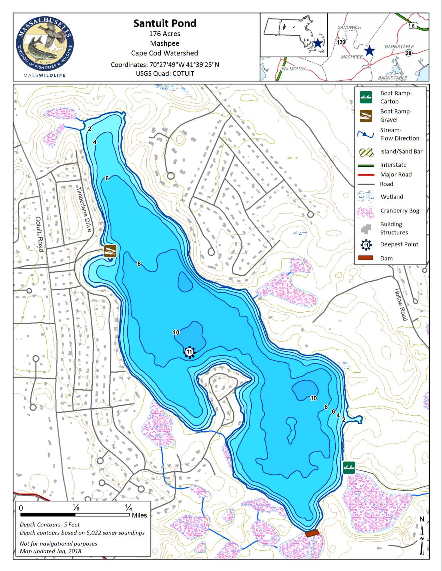
Santuit Pond is a shallow, fertile, 176-acre enlarged Great Pond with a maximum depth of 11 feet and an average depth of 6.5 feet. The pond is groundwater-fed and forms the headwaters of the Santuit River (also known as the Cotuit River). The 3.6 miles of shoreline are moderately developed with homes and cranberry bogs and is generally steep and wooded.
Access is provided by a town-managed gravel ramp suitable for cartop boats, canoes, and light trailered boats off of Timberlane Drive in the northwest section of the pond. There is parking for approximately six vehicles. During the summer months, parking is limited to town residents with stickers only but boats can be launched and nearby roadside parking can be found. Public hiking access is also available through the Santuit Pond Preserve on the southern end of the pond. The primary access to the Santuit Pond Preserve is in Barnstable where a small access area is available off Santuit-Newtown Road just to the north and west of the Lovells Pond Boat Ramp. A new access to the preserve lands has been created in Mashpee off MA-130.
Features
Restrooms on site
Wheelchair accessible trail
Entrance fee
Content from Santuit Pond information page and map
Last updated March 18, 2024