Fort Stanton-Snowy River Cave NCA
Fort Stanton-Snowy River Cave NCA
Fort Stanton-Snowy River Cave National Conservation Area Ruidoso, New Mexico 88338
Official WebsiteFort Stanton-Snowy River Cave map
About this Location
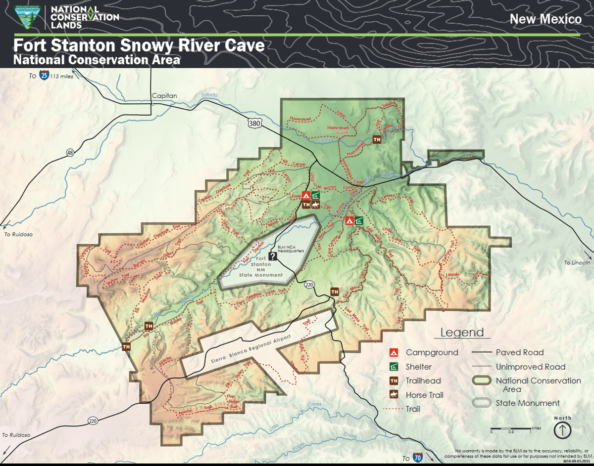
The Fort Stanton-Snowy River Cave National Conservation Area (NCA) was established in 2009 to protect, conserve, and enhance the unique and nationally important historic, cultural, scientific, archaeological, natural, and educational subterranean cave resources of the Fort Stanton-Snowy River Cave system. The NCA was once known as the Fort Stanton Military Reservation. In 1855, the U.S. Army established Fort Stanton as an Infantry and Cavalry post in the east-central New Mexico Territory to protect settlers in the region. Within the NCA is Fort Stanton Cave, at over 31 miles, it is the second longest cave in New Mexico, the 14th longest cave in the U.S., the 62nd longest in the world, and the largest cave managed by the Bureau of Land Management. Snowy River is a significant passage within Fort Stanton Cave and is the longest cave formation in the world.
This unique NCA has many opportunities for hiking, caving, horseback riding, mountain biking, camping, visiting cultural and historic sites, picnicking, hunting, wildlife viewing, nature study, and photography. There is drinking water and toilets at the Rob Jaggers Camping Area and at the Cave Campgrounds.
Notable Trails
Fort Stanton NCA has 73 miles of sustainable horseback, mountain biking, and hiking trails that wind through open meadows and canyons. Trails are marked with flexible fiberglass markers with the trail name or an arrow attached to the marker. Cross-country horse and foot travel is allowed. Mountain bikes are strongly encouraged to stay on established trails to protect the rider as well as the landscape. The trails offer great views of the surrounding Sacramento and Capitan Mountains. The majority of the trails start at the Rob Jaggers Camping Area on NM-220 where you will find hitching rails, water for your animals, and a vault toilet.
Hike the Petroglyph Trail along the Rio Bonito and glimpse into the past. At the midpoint of the Trail, in the river bed, is Petroglyph Rock. Etched on this rock are depictions of an ancient people known as the Jornada Mogollon who have long since left the area. Very little evidence has stood the test of time, but here on the Petroglyph Trail remains a link to the culture and lifestyle of these ancient people.
The Trail can be reached from NM-220, west of the Sierra Blanca Regional Airport. Follow the highway signs stating “Upper Rio Bonito” to the bottom of the hill and turn right for approximately 250 feet then take the next left until you reach the trailhead (high-clearance vehicles are recommended). Petroglyph Rock is a short 450-foot walk from the parking area. The loop trail is approximately 2.1 miles in total length and is easy-to-moderate hiking with a few hills and areas with loose footing. Plan to spend approximately one hour on the Trail.
Features
Restrooms on site
Last updated August 11, 2023