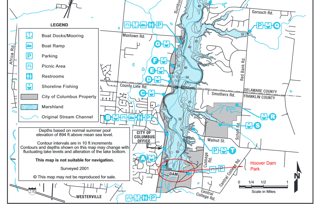
Hoover Reservoir--Hoover Dam Park

Hoover Reservoir--Hoover Dam Park
Sunbury Road Westerville, Ohio 43081
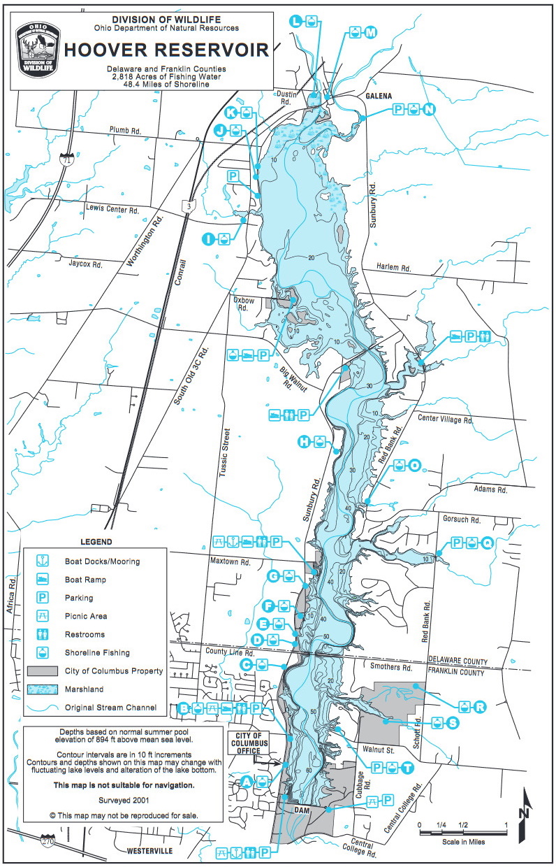
Hoover Reservoir mapAlso, see all the hotspots at:
Big Walnut Important Bird Area
Hoover Reservoir Birding Drive
About this Location
Below the dam is an open field that is edged with a riparian corridor along Big Walnut Creek, brushy wetland, mature forest and conifer forest. Access is made by the driveway at the southern end of the dam parking lot. During the winter a walk around the field edge can produce numerous species.
About Hoover Reservoir
See all hotspots at Hoover Reservoir
Hoover Reservoir consists of 5,026 total acres. This is made up of 3,843 Water acres at normal water levels and 1,183 Land acres that include The Hoover Nature Preserve that is just over 925 acres. There are areas of open water, wetland swamp, wetland forest, riparian corridors, deciduous forest, pine stands, prairie remnants, and seasonal mudflats. The main roads around Hoover Reservoir are Sunbury Road, Big Walnut Road, Tussic Street, and South Old 3C Highway on the West; Sunbury Road on the North; Sunbury Road, Red Bank Road and Schott Road on the East; and Central College Road on the South. Smothers Road crosses the reservoir along the Franklin-Delaware County line.
Features
Restrooms on site
Content from Ohio Ornithological Society