Danville CA
About this Location
Directions: If driving east, from I-70 exit 170 (Danville), take the south outer road east 2 miles, then Rt. RB south 2 miles to the entrance. If driving west, take I-70 exit 174, then continue west on the south outer road to Rt. RB.
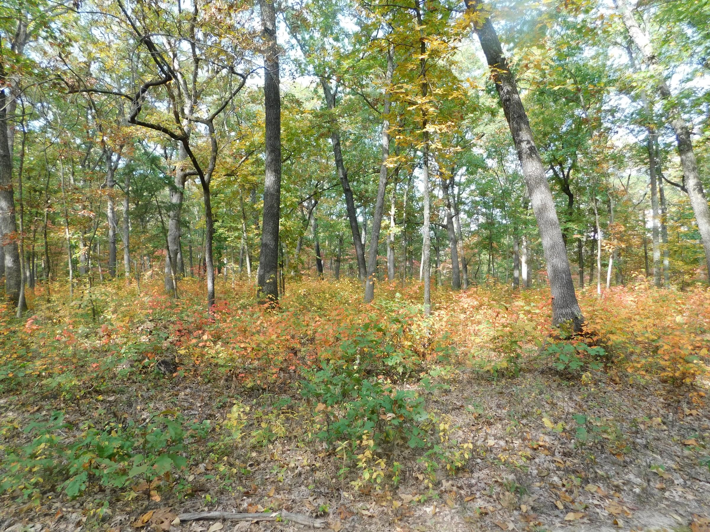
The roads pass brush/tree lines and grassland. Turkey Ridge Rd. to the east goes through a ridge top camping area and then descends through woods to give good views into riparian habitat. Staying straight from Rt. RB, the road goes through an area being cleared of trees and brush in 2016. To the west on Turkey Ridge Rd., more clearing is underway. An active management program of controlled burns, cedar removal and pond improvements will bring some major changes.
Danville Glades Natural Area is in two sections. The 313-acre east section is accessible along the moderately rated 3-mile loop Danville Glades Trail with a trailhead at the parking lot at the east end of Turkey Ridge Rd., 1.4 miles from the entrance. Take the trail with a narrow, shallow (usually can be crossed with dry feet) creek just beyond the lot. The trail is an elongated loop, going clockwise. It comes back to the road about 250 yards from the trailhead lot.
The first section of the trail generally follows a creek that looks ideal for Winter Wren, Hermit Thrush and Louisiana Waterthrush. There’s an outcropping of blue clay in the creek bank as you come to the first of two points where the trail crosses the utility right-of-way about halfway up the left half of the loop. There are old clay pits on the far side of the trail loop.
The trail diverges from the creek and goes upslope with woods and open areas along the way. At the point the trail nears the power lines again there is a fork. The left fork leads to the north boundary and a field/food crop area. There are some woods that might be productive in migration, but no unusual habitat along the way. The right fork is the continuation of the loop trail.
Unless you are looking especially for grass-loving sparrows, are in the correct season for glade-preferring species, or really like to hike, you may optimize your time and birdfinding potential by backtracking at this point and giving the creek side portion a second look, rather than completing the loop. From this second crossing of the utility right-of-way, the trail follows the ridge top through old-field grassland for a long way before beginning the descent to the road.
The last section of the trail starts downhill through a bit of glade and woods to stream level again. There is a good look at a large glade to the right that begs to be explored. A fork goes left just before reaching the road. It’s good for checking for birds along the creek bottom. You must turn around to rejoin the main trail. Staying right at the fork will return you to the road (and another crossing of the shallow creek) with some good woodland and brushy areas along the way. Walking this part of the trail counterclockwise (the lowland and the ascent from this east side) beginning at the road, then backtracking, may be more productive, birdwise/timewise, than reaching it by walking the full loop.
The 48-acre west section of the Danville Glades Natural Area is across Turkey Ridge Rd. from the west most parking lot. Go through the cable/gate at the road and continue through the old pasture and through a second (open) gate. The graveled road/trail makes a right curve soon after reaching the tree line at the far end of this pasture. The trail here gives a very good treetop view of the narrow valley below. Migrating warblers, vireos, etc., will be at eye level for a birder making this short hike. The full trail is 1.5 miles one way (not a loop).
Features
Restrooms on site
Roadside viewing
Wheelchair accessible trail
Entrance fee
Content from A Birders' Guide to Danville CA
Last updated September 14, 2023
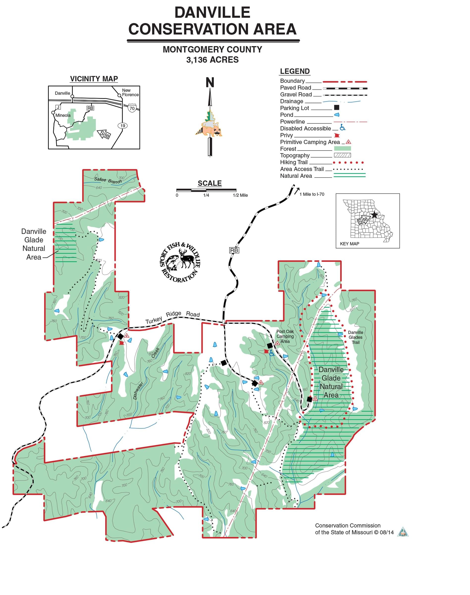 Danville CA Map
Missouri Dept. of Conservation