Saguaro NP--West--Hugh Norris Trail
Saguaro NP--West--Hugh Norris Trail
Tucson Mountain District (West) 2700 North Kinney Road Tucson, Arizona 85743
Saguaro National Park websiteSaguaro National Park maps
Saguaro National Park - West Hiking Guide
About this Location
4.9 miles, one way. The Hugh Norris Trail is the longest trail in the Tucson Mountain District.
About Saguaro NP West - Tucson Mountain District
See all hotspots at Saguaro NP West - Tucson Mountain District
Saguaro National Park is composed of two distinct districts: The Rincon Mountain District and the Tucson Mountain District. The Tucson Mountain District lies on the west side of Tucson, Arizona, while the Rincon Mountain District lies on the east side of Tucson. Both districts were formed to protect and exhibit forests of their namesake plant: the Saguaro Cactus.
Most people think of Saguaro National Park as being a desert park. True, the lower elevations of the park encompass Sonoran Desert Vegetation, but there is much more to Saguaro National Park than just cacti.
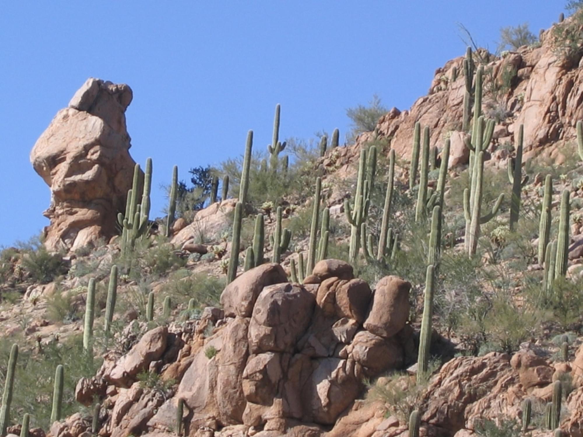
The Tucson Mountain District of Saguaro National Park ranges from an elevation of 2,180 ft to 4,687 ft and contains 2 biotic communities, desert scrub, and desert grassland. The average annual precipitation is approximately 10.27 in. Common wildlife includes the coyote, Gambel’s quail, and desert tortoise.
Notable Trails
The Hugh Norris Trail begins off the Bajada Loop Drive, 2.5 miles north of the Red Hills Visitor Center. The trail was named after a former Chief of the Tohono O’odham Indian Police. The trail begins with a series of switchbacks that climb to a ridge overlooking the cactus forest. From there, the trail follows the ridge-top through areas with splendid views and unique rock formations until it reaches Amole Peak, approximately 4.1 miles from the trailhead. The next 0.8 miles go up a final series of switchbacks and a gradual climb that leads to the top of Wasson Peak. Livestock is prohibited on this trail.
Content from Tucson Mountain District Trails brochure with map and Saguaro National Park webpage
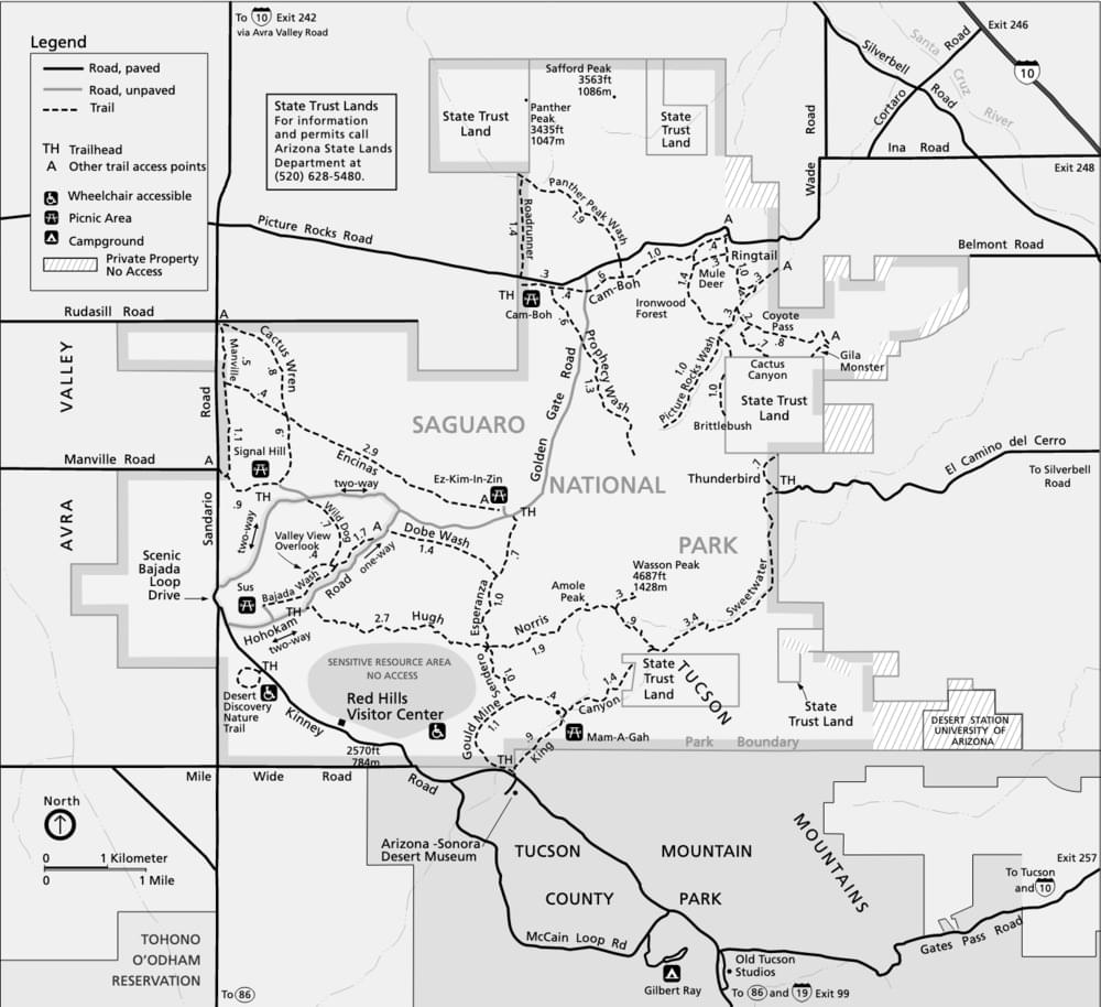 Saguaro National Park - West Trail Map