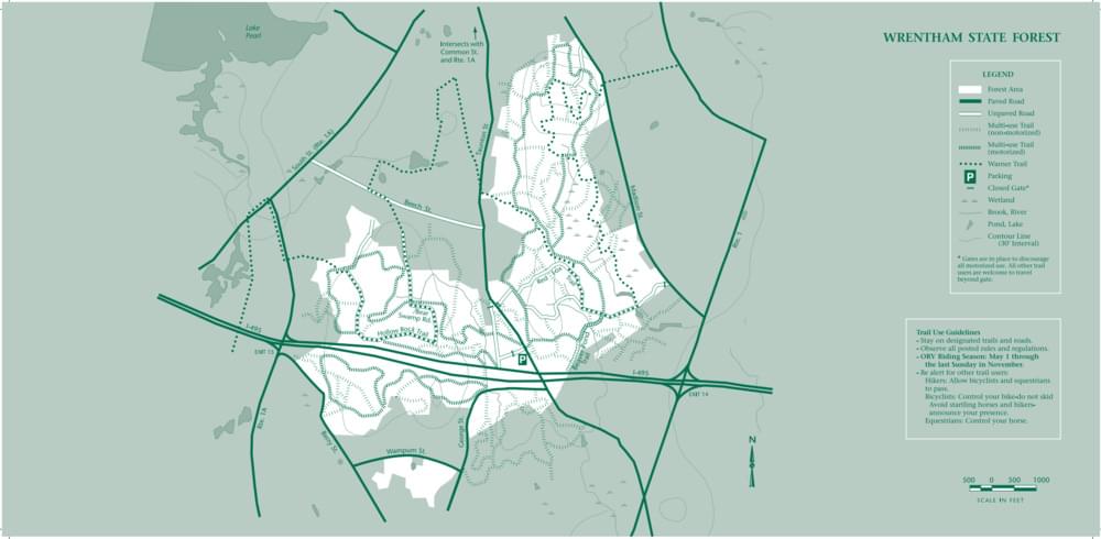
Wrentham State Forest
About this Location
Covering over 1,000 acres, Wrentham State Forest is a minimally developed area. The gravel parking area on Taunton Street leads to miles of weaving trails and dirt roads. Trails are open for hiking, mountain biking, and cross-country skiing. Additionally, there is a designated loop trail for off-roading. Motorized use in this forest is restricted to Motorcycles only. The park also offers access to the Warner Trail, a 30-mile hiking trail that travels through Norfolk County down to Rhode Island.
Notable Trails
The AllTrails website has descriptions and maps of hikes at Wrentham State Forest.
Features
Roadside viewing
Restrooms on site
Wheelchair accessible trail
Entrance fee
Content from Official Website
Last updated February 16, 2024
