Piney Creek Road and/or Camps
Piney Creek Road and/or Camps
off Carmel Valley Road in the Arroyo Seco watershed
Tips for Birding
For birders, access to creeks in the arid Arroyo Seco watershed is difficult to reach and are usually on private property. Within this Hotspot, Piney Creek and Paloma Creek can be accessed more easily (before they run dry in hot summers) with high clearance vehicles and an adventurous attitude. Be sure you carry water in this remote and rugged location, and be very aware of rattlesnakes in any hot weather at any date. It is often cold and rainy here in winter, so most locals visit in spring and fall. If one has an interest in butterflies, dragonflies, and plants, the serpentine rock habitat in the vicinity has unique species for Monterey County.
Birds of Interest
In spring and summer, Piney Creek and Paloma Creek, which join just a few miles downstream from this Hotspot, have small populations of Black-chinned Hummingbird, Phainopepla, and Yellow-breasted Chat in the creekside riparian of sycamore and willows. This is hot, arid country, and an occasional Costa's Hummingbird may be encountered. The rocky chaparral hillsides have, in spring and summer, Ash-throated Flycatcher and Blue-gray Gnatcatcher, and resident populations of Rufous-crowned and Bell's Sparrow (both shy and skittish, but in song in spring). California Quail are ubiquitous along the creeks but in the thick chaparral on the lower slopes of the Santa Lucia Mountains, Mountain Quail can be heard down to 1500' elevation (but those quail are exceeding shy and difficult to see).
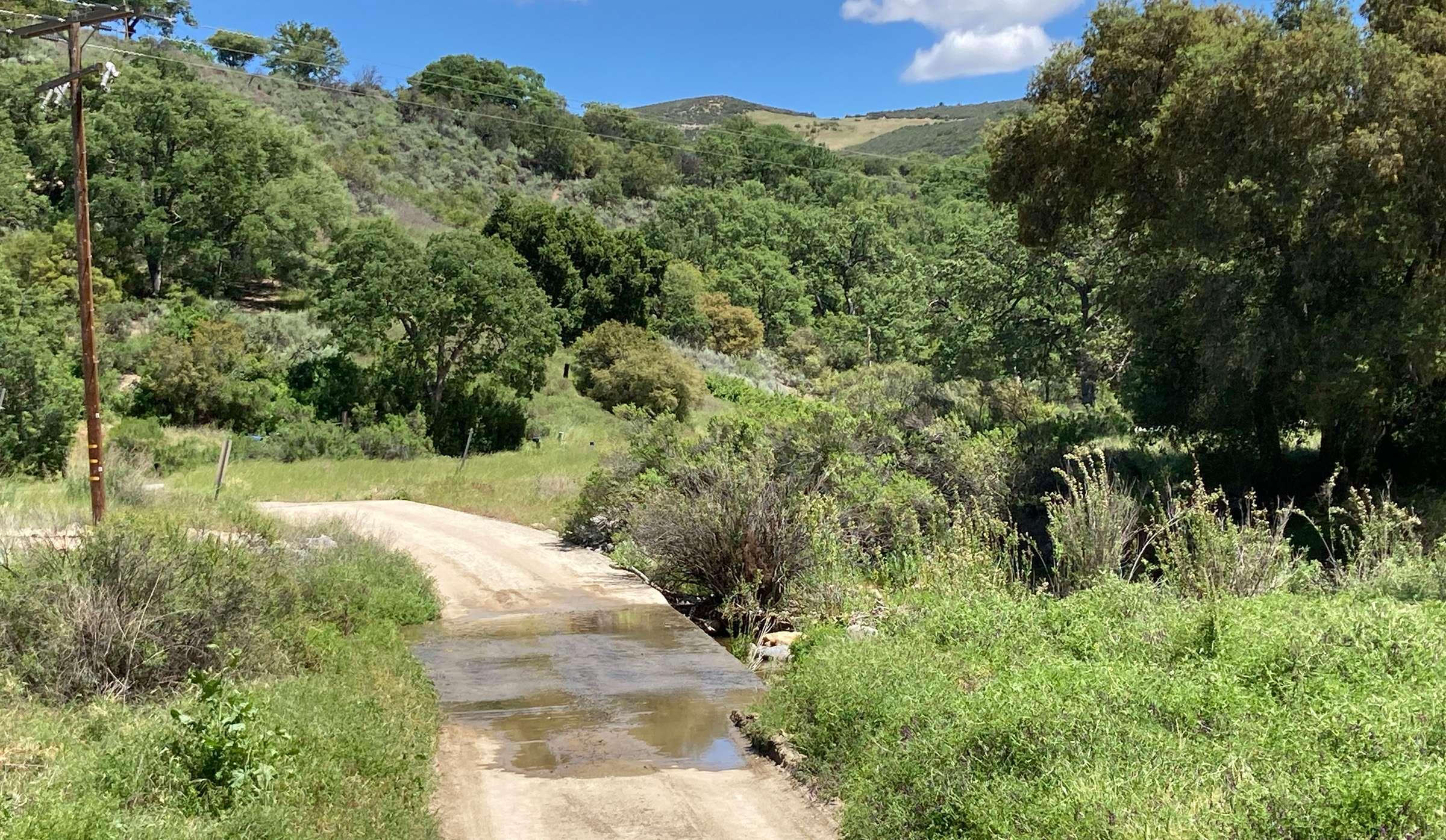
About this Location
Piney Creek Road is a National Forest Service gravel/dirt road on the eastern slopes of the Santa Lucia Mountains, within the Arroyo Seco River watershed. It is accessed from Carmel Valley Road just north of milepost 35.5, which is only about 5 miles north of the intersection of Carmel Valley Road and Arroyo Seco Road. The sandy road is not sign-posted as it leaves Carmel Valley Road and heads west, almost immediately crosses Paloma Creek (often dry but running in spring some years), and then has a sharp left-hand (south) turn and goes steeply uphill (if you went straight ahead there is a closed gate to private property). At the sharp left turn, there is a signpost at the base of the rutted and rather rugged road stating it is 2.5 miles to Lower Piney Creek Campground, 3 miles to Upper Piney Creek Campground, and 5 miles to the "end of the road." to a Forest Service heavy-duty gate. If you are walking from here, park here, on the road edges. Very shortly uphill there is a heavy-duty Forest Service gate. [At least in 2023 and early 2024, this gate was locked]. When the gate is open, the road, at least in dry weather, might be driven by a high-clearance vehicle, but 4-wheel-drive would be useful. [The road is not recommended for ordinary cars as there a spots with rocky and rutted terrain that requires high clearance.] One can walk or use a bicycle on the road even when the gate is locked.
The entrance to the road, and Lower Piney Campground, are at about 1100' elevation, in mixed oak woodland and riparian vegetation along the creek. The road goes uphill for 1.2 mile to ridgeline, and by then the habitat is rocky chaparral with patches of grassland. The road winds upwards through chaparral and down to the creek again (there are semi-abandoned side roads that look confusing on the map).
Features
Restrooms on site
Wheelchair accessible trail
Entrance fee
Roadside viewing
Content from Don Roberson & Rita Carratello
Last updated May 1, 2024