Funk Bottoms Wildlife Area (Ashland Co.)
Funk Bottoms Wildlife Area (Ashland Co.)
Lake Fork, Ohio 44840
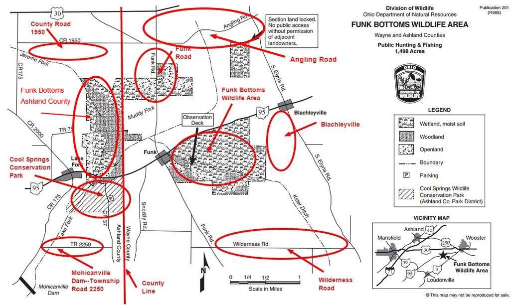
Funk Bottoms Wildlife Area Official WebsiteFunk Bottoms Wildlife Area map
Tips for Birding
If you carefully keep your bird records by county, be sure to use the specific hotspots in this wildlife area so that the birds will be assigned to the proper county.
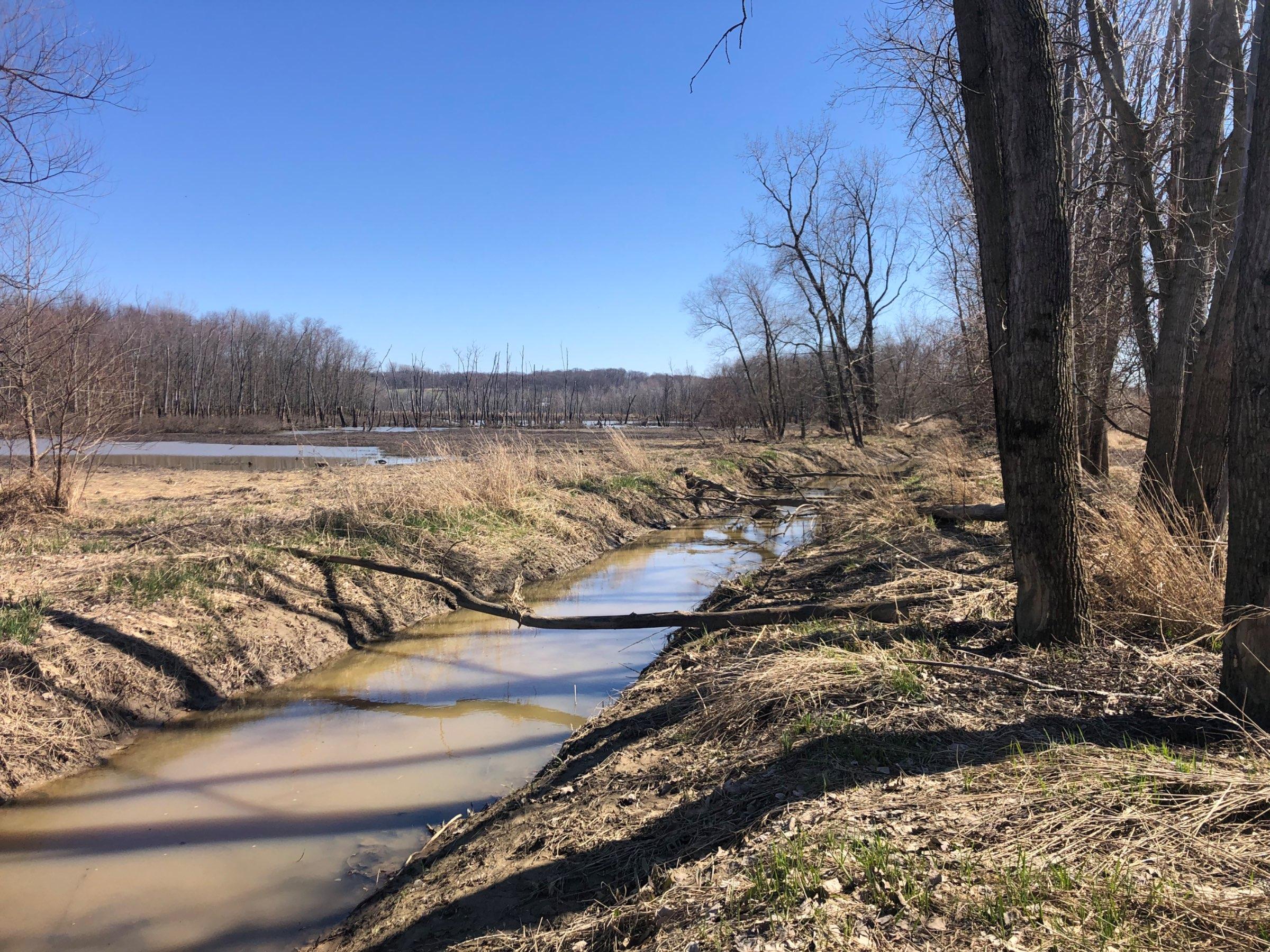
Parking is unmarked for a few cars (dicey if wet and muddy) on the north side of OH-95 just east of Lake Fork. From there walk east until you hit Jerome Fork. Follow the anglers's trail north along the fork until you come to a ditch flowing into Jerome Fork from the west. Turn left and head west along the south edge of this smaller ditch. You will be in open woods with wetlands both to your north and south. Go slow and quiet as ducks and a few shorebirds can be all around you and not real easy to see until you flush them if you're not careful. Keep working slowly west. You will need to cross 2 or 3 smaller ditches that make muck boots and maybe a walking stick helpful. Eventually, the loose trees you are in give way to a completely wide open muddy, wet area (in the photos) that today was chock full of ducks and shorebirds. A scope will be helpful.
About Funk Bottoms Wildlife Area
See all hotspots at Funk Bottoms Wildlife Area
This 1,498-acre wildlife area in northeastern Ohio is in portions of Wayne and Ashland counties. OH-95, running east-west, goes through the middle of the area, from Blachleyville (east), through Funk and Lake Fork (west). The area lies in the glaciated central hills region of Ohio, with flat to moderately rolling topography. The vast majority of the wildlife area consists of seasonally flooded moist soil meadows and bottomland hardwoods.
Purchase of land for Funk Bottoms Wildlife Area began in 1991. Additional land is being acquired as funds become available, and as landowners are willing to sell. The present acquisition plan is limited to property within the Muskingum Watershed Conservancy District (MWCD) flood easement. The Mohicanville “Dry” Dam was built in 1936, primarily for flood control. All land behind the dam, below an elevation of 963 feet, is under flood easement to the U.S. Army Corps of Engineers. This totals over 8,800 acres. The Division of Wildlife is acquiring land in this area because of the quality wetland habitat and associated wildlife species that are found here. This wildlife area is managed as a public use facility and features moist soil and shallow water habitat. The land is allowed to return to its natural wetland condition, with the approval of the appropriate agencies.
The creeks and permanent marshes on the area support mainly rough fish with small numbers of panfish.
Mallard, wood duck, muskrat, raccoon, and cottontail rabbit are the principal game and furbearer species. Deer, pheasant, woodchuck, fox squirrel, Canada goose, and other furbearers are common.
A great variety of nesting and migrant birds occur in the area. Of particular interest is the spring migration of waterfowl (23 species, including Tundra swans) and shorebirds (28 species). Several species of raptors can be found during migrations and overwintering. Bald eagles have been observed on the wildlife area.
Nesting of the state endangered Sandhill Crane on the purchase unit was confirmed in 1988; this was the first recorded Ohio nesting of this species in more than 60 years. Sandhill nests have been confirmed here several times since. Sandhill cranes are a wetland-dependent species.
Features
Restrooms on site
Wheelchair accessible trail
Entrance fee
Content from Funk Bottoms Wildlife Area Official Website, Kent Miller, and Ohio Ornithological Society
Last updated April 4, 2024