Garland Ranch Regional Park
Garland Ranch Regional Park
700 West Carmel Valley Road Carmel Valley, California 93924
Garland Ranch Regional ParkTips for Birding
This is the "general" Hotspot for Garland Ranch Regional Park, and can be used by visiting birders and brief forays into the park, and by others who prefer a "general" hotspot when hiking. The main entrance at 700 West Carmel Valley Road has a very large parking lot with a walk to a Visitor Center and restroom facilities.
The park property has over 3400 acres and has a variety of habitats including riparian, meadow, mixed oak woodland, and redwood canyon. There are a variety of entrances to the park and many eBird Hotspots. If you are a regular visitor, you may wish to use one of various eBird sub-locations that generally feature specific trails, ridges, or redwood groves.
Birds of Interest
The wide variety of habitats provides resources for many birds of the forest, meadow, and chaparral. Sycamore, cottonwood, maples, live oak, buckeye, eucalyptus, and more grow along the extensive valley floor. You will find a variety of hawks, woodpeckers, songbirds, and flycatchers. Spring and summer months yield many nesting birds.
About this Location
Near the Visitor Center is a native plant garden with picnic benches. The Visitor Center is occasionally staffed with volunteers. Restrooms are adjacent to the Visitor Center.
Birdability: none of the trails are rated ADA. The trails in the valley are wide and mostly level but may be sandy with embedded pebbles and roots.
About Garland Ranch Regional Park
See all hotspots at Garland Ranch Regional Park
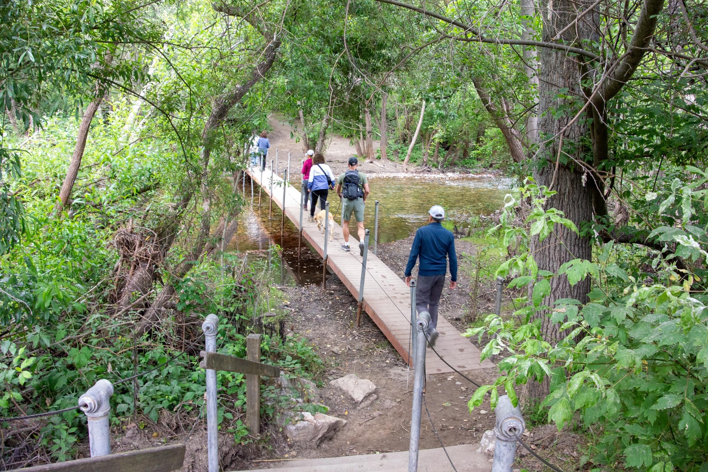
Garland Ranch Regional Park contains over 3400 acres that were formerly a ranch. The park is now owned and administered by the Monterey Peninsula Regional Park District. The main entrance at 700 West Carmel Valley Road has a very large parking lot with a walk to a Visitor Center and restroom facilities. A vehicle bridge (for official vehicles only) crosses the Carmel River and is available to pedestrians and cyclists year-round. A small footbridge crosses the river during the summer and fall when the water level is low. The park has a variety of habitats including riparian, meadow, mixed oak woodland, and redwood canyon. The park is multi-use: birders will share the trails with hikers, equestrians, and is dog-friendly (defined as "on leash or within direct voice control;" some park users will stretch this definition). Bicycling is only allowed in a small portion of the park.
The main units of Garland Ranch Regional Park are open dawn to dusk. There are a variety of entrances and various eBird Hotspots, including a "general" Hotspot and a variety of sub-locations that generally feature specific trails. [The is also a stand-alone Hotspot for the newly-acquired, permit-only Kahn Ranch unit.] Elevations with the primary Garland Ranch Regional Park vary from 200 to 2000 feet [60--600m] elevation. The park stretches from the banks of the Carmel River southwards into the Santa Lucia Mountains foothills. Garzas Creek bisects the Park, often flowing through densely wooded habitats.
Notable Trails
Garland Trail map: https://www.mprpd.org/files/2540014cf/GRRP_2010.pdf
You can string together a nice easy loop on the valley floor with the Lupine Loop and the Rancho loop which have some varying habitats. Leave the valley floor via the narrow Buckeye Trail which is a wildflower wonderland in the spring, and cool during hot summer days. For a more strenuous hike, link together the Maple Canyon to Sage and Sky trails to reach Snivelys Ridge for a 360 degree view of Carmel Valley and Robinson Canyon area. The Mesa Trail will lead to the Mesa Pond; return via the poorly-named and mostly dry Waterfall Trail.
Features
Restrooms on site
Wheelchair accessible trail
Entrance fee
Roadside viewing
Content from Garland Ranch Regional Park and Carol Greenstreet
Last updated June 13, 2023